Click to visit the main New York Public Library Homepage
The New York Public Library
Digital Collections
About Digital Collections
Browse
Search only public domain materials
Items
Collections
Divisions
Home
Search
Browse
About
Search only public domain materials
Items
Collections
Divisions
Digital Collections
Using Images
Using Data
Search
Filtered keyword search
Show filters
Hide filters
Show Only Public Domain
topic
Nautical charts
2
Coasts
1
History
1
Indians of North America
1
name
Anderson, H
1
Blunt, Edmund M. (Edmund March), 1770-1862
1
Bowles, John, 1701-1779
1
Bowles, Thomas, -1767
1
France. Dépôt des cartes et plans de la marine
1
More
Less
collection
Maps of North America
4
Lawrence H. Slaughter Collection of English maps, charts, globes, books and atlases
1
place
x
Florida
Cuba
3
Bahamas
2
Louisiana
2
United States
2
More
Less
genre
Maps
5
Nautical charts
1
publisher
Dépôt general de la Marine
1
Johann Wechel
1
John L. Narstin
1
Printed for Thos. Bowles & John Bowles
1
Published for & sold by Wm. Hooker, 202 Water Street
1
division
Map Division
5
type
x
cartographic
Date Range
to
5 results found for:
x
Cuba
Filtering on:
x
Place
: Florida
x
Type
: cartographic
Sort by:
Relevance
Title
Date created
Date digitized
Sequence
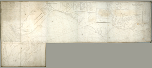
A map of Mexico, Louisiana, a…
Floridae Americae provinciae …
abstract:
… Caroline,
Cuba
, rivers
Carte réduite des côtes et de…
abstract:
… of
Cuba
and the Bahamas
Florida, called by ye French …
abstract:
… and the very top of
Cuba
. Map
To the members of the Nautica…
note:
…, northern part of
Cuba