Click to visit the main New York Public Library Homepage
The New York Public Library
Digital Collections
About Digital Collections
Browse
Search only public domain materials
Items
Collections
Divisions
Home
Search
Browse
About
Search only public domain materials
Items
Collections
Divisions
Digital Collections
Using Images
Using Data
Search
Filtered keyword search
Show filters
Hide filters
Show Only Public Domain
topic
History
24
Roads
19
Guidebooks
15
Guidebooks, 1802
15
Boundaries
10
More
Less
name
Carey, Mathew, 1760-1839
15
Jones, T. W
15
Moore, S. S
15
United States. Army. Corps of Topographical Engineers
11
Barclay, Anthony, 1792-1877
5
More
Less
collection
Maps of North America
76
Lawrence H. Slaughter Collection of English maps, charts, globes, books and atlases
16
Maps of New York City and State
2
place
x
United States
Middle Atlantic States
15
Middle Atlantic States Guidebooks
15
Philadelphia
15
Philadelphia (Pa.)
15
More
Less
genre
Maps
94
Nautical charts
4
Manuscript maps
3
Bathymetric maps
2
Military maps
2
More
Less
publisher
M. Carey
15
Corps of Topographical Engineers
5
U.S. Light-House Board
5
publisher not identified
5
M. Carey,
4
More
Less
division
Map Division
94
type
x
cartographic
still image
2
Date Range
to
94 results found for:
x
S. W
Filtering on:
x
Place
: United States
x
Type
: cartographic
Sort by:
Relevance
Title
Date created
Date digitized
Sequence
Map of the United States of A…
note:
… desig'd. & eng'd. by
W
.
S
m
Map of the United States of A…
note:
… desig'd. & eng'd. by
W
.
S
Map of Port-Lawrence & Vistul…
note:
… feet to the inch (
W
83°32ʹ42ʺ--
W
83°31ʹ09ʺ/N
m
Mitchell's new national map e…
note:
engraved by
W
. Williams, map engraver
Map of the U.
S
. and Territories…North Central.
note:
… of the Hon. Silas
W
. Lamoreux
Map of the U.
S
. and Territories…North East.
note:
… of the Hon. Silas
W
. Lamoreux
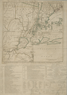
Road from Philadela. to New Y…
Road from Philadela. to New Y…
Road from Philadelphia to New…
Road from Philadelphia to New…
Road from Philadelphia to New…
Road from Philadelphia to New…
Road from Philada. to New Yor…
Road from Philadelphia to Was…
Road from Philadela. to Washi…
Road from Philadela. to Washi…
Road from Philadela. to Washi…
Map illustrating the plan of …
note:
…, U.
S
.T.E., by
W
. Hood.
Washington city
m
Johnson's new illustrated & e…
note:
Scale approximately 1:3,072,000 (
W
127°35ʹ00ʺ--
W
Philadelphia and the commence…
Carte reduite des costes de l…
note:
Scale approximately 1:2,500,000 (
W
97°19ʹ--
W
77°59
Road from Philadela. to New Y…
Road from Philadelphia to Was…
Map of the United States of A…
note:
… desig'd. & eng'd. by
W.S
m
Map of the United States of A…
note:
… desig'd. & eng'd. by
W.S
Mt. Washington and vicinity: …
note:
… by
W
.H. Lovell and Robert
Map and profile of the Tejon …
note:
…. R.
S
. Williamson, Topl
A.R. Roessler's latest map of…
note:
… 1:1,267,200 (
W
107°45ʹ--
W
m
Map of the river Sainte Mary …
note:
… to the commissioners ; George
W
. Whistler, U.
S
. Artillery
United States of America
note:
…"Title cartouche engraved by J.
W
. Steel."…
Map of the City of Richmond, …
note:
… Library by Edward
W
. West
No. 3, map of Isle Royale in …
note:
… to the commissioners ; George
W
. Whistler, U.
S
. Artillery
m
United States of America, 1834
note:
Title cartouche engraved by J.
W
. Steel.
Map of Richmond, Virginia and…
note:
…
W
. West, [Cato
Map showing the principal rai…
note:
Scale approximately 1:12,000,000 (
W
129°--
W
63°/N
A new map of the United State…
note:
compiled, drawn & engraved by
W
. Williams
The United States according t…
note:
Scale [ca. 1:3,200,000] (
W
95°--
W
59°/N
Position de l'armée Américain…
note:
Scale approximately 1:70,000 (
W
73°53ʹ29ʺ--
W
m
Dakota Territory
note:
… ... by
W
.H. Wood, 1872."…
To accompany Willard's histor…
note:
Scale not given (
W
83°05ʹ--
W
78°14ʹ/N 36°07
The Country twenty five miles…
Sketch exhibiting the positio…
note:
Scale approximately 1:60,000 (
W
76°33ʹ00ʺ--
W
Battle of Rappahannock Statio…
note:
Not drawn to scale (
W
77°28ʹ46ʺ--
W
77°27
Map of the Black Hills : from…
note:
… in. = 3 miles (
W
104°51ʹ--
W
103°05ʹ/N
m
Outline map showing a new rou…
note:
… of Engineers, U.
S
.A. ; compiled & drawn by Chas.
W
Map of the battle field of Ge…
note:
Scale approximately 1:63,360 (
W
77°15ʹ50ʺ--
W
Frederick County Maryland: pr…
note:
Scale not given (
W
77°40ʹ38ʺ--
W
77°06ʹ24ʺ/N
m
Lay's map of the United States
note:
Scale [ca. 1:2,000,000] (
W
97⁰--
W
67⁰/N
m
Map of the United States with…
note:
Scale [ca. 1:3,900,000] (
W
134⁰--
W
53⁰/N