Click to visit the main New York Public Library Homepage
The New York Public Library
Digital Collections
About Digital Collections
Browse
Search only public domain materials
Items
Collections
Divisions
Home
Search
Browse
About
Search only public domain materials
Items
Collections
Divisions
Digital Collections
Using Images
Using Data
Search
Filtered keyword search
Show filters
Hide filters
Show Only Public Domain
topic
Real property
115
Landowners
74
Railroads
58
Administrative and political divisions
51
History
48
More
Less
name
Heliotype Printing Co
7
Gavit, John E., 1817-1874
6
Hayward, George, approximately 1800-
6
Pease, Richard H., 1813-1869
6
Ackerman Lithr
5
More
Less
collection
Maps of North America
332
Maps of New York City and State
118
Maps of Europe
1
Maps of North and South America
1
place
New York (State)
98
Massachusetts
64
New York
30
United States
28
Boston
25
More
Less
genre
Maps
452
Cadastral maps
98
Geological maps
16
Facsimiles
10
Early maps
9
More
Less
publisher
x
publisher not identified
Lith of R.H. Pease
2
AM. Photo-Lith. Co. N.Y. (Osborne's Pro.)
1
D. McLellan, lithographer
1
Engraved & Printed by J. E.Gavit
1
More
Less
division
Map Division
452
type
cartographic
452
text
8
still image
7
Date Range
to
Looking for one of these collections?
Maps of North America
3,345 items
Maps of New York City and State
2,059 items
452 results found for:
x
map
Filtering on:
x
Publisher
: publisher not identified
x
Rights
: Public Domain
Sort by:
Relevance
Title
Date created
Date digitized
Sequence
11th ward showing its 28 elec…
note:
NYPL
Map
Div. copy has accession no
A bird's-eye view of the city…
note:
Mapping
the Nation (NEH grant, 2015-2018)…
A compleat
map
of North-Carolina from
note:
… this
map
is most humbly
A correct
map
of Connecticut
note:
Mapping
the Nation (NEH grant, 2015-2018)…
m
A correct
map
of the state of Vermont, from
note:
NYPL
Map
Div. copy
A geological and topographical sketch
map
note:
Mapping
the Nation (NEH grant, 2015-2018)…
A geological
map
of a part of Massachusetts
note:
Mapping
the Nation (NEH grant, 2015-2018)…
A geological
map
of Massachusetts
note:
Mapping
the Nation (NEH grant, 2015-2018)…
A
map
of a tract of land in the State
note:
Mapping
the Nation (NEH grant, 2015-2018)…
A
map
of Kentucky from actual survey …
note:
Mapping
the Nation (NEH grant, 2015-2018)…
A
map
of part of Alabama & Florida
note:
Map
of southern Alabama and part
A
map
of part of Alabama & Florida, …
note:
See also
Map
Div. 15-5378 [Filed
A
map
of part of the land in the Royal Grant
note:
…"Reduced one fifth from the original
map
."…
A
map
of part of the Province of Pennsylvania
note:
…
map
.
A
map
of the colonies of Connecticut
note:
Mapping
the Nation (NEH grant, 2015-2018)…
A
map
of the countrey of the Five
note:
Mapping
the Nation (NEH grant, 2015-2018)…
A
map
of the country between Crown
note:
Mapping
the Nation (NEH grant, 2015-2018)…
A
map
of the county of Worcester
note:
Facsimile of
map
taken from:The history
A
map
of the new governments of East & West
note:
NYPL
Map
Div. copy is pasted on sheet 31 x 36
A
map
of the state of Virginia …
note:
Mapping
the Nation (NEH grant, 2015-2018)…
A
map
of the Virginia Central Railroad
note:
Mapping
the Nation (NEH grant, 2015-2018)…
A mappe of Colonel Römers voy…
note:
Mapping
the Nation (NEH grant, 2015-2018)…
A mappe of Colonel Römers voy…
note:
Mapping
the Nation (NEH grant, 2015-2018)…
A new and accurate
map
of east and west
note:
NYPL
Map
Div. copy is pasted on sheet 31 x 36
A new and accurate
map
of the province
note:
Mapping
the Nation (NEH grant, 2015-2018)…
A new and accurate plan of th…
note:
City
map
shows the "Powder House" pictorially.
A plan of Charles town
note:
Mapping
the Nation (NEH grant, 2015-2018
A plan of Charles Town, the c…
note:
Mapping
the Nation (NEH grant, 2015-2018)…
A plan of Greenville, Norwich…
note:
Mapping
the Nation (NEH grant, 2015-2018)…
A plan of New York Island, pa…
note:
Mapping
the Nation (NEH grant, 2015-2018)…
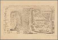
A Plan of the action at Bunke…
note:
Mapping
the Nation (NEH grant, 2015-2018)…
A plan of the battle, on Bunk…
note:
Mapping
the Nation (NEH grant, 2015-2018)…
A plan of the Manor of Philip…
note:
Mapping
the Nation (NEH grant, 2015-2018)…
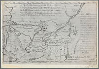
A plan of the operations of t…
note:
… similar
map
that appears
A plan of the salt marsh and …
note:
Mapping
the Nation (NEH grant, 2015-2018)…
A Plan of the Straits of St. …
note:
Library of Congress.
Maps
and charts
A plan of the town of Pittsfo…
note:
Mapping
the Nation (NEH grant, 2015-2018)…
A prospective view of the bat…
note:
Mapping
the Nation (NEH grant, 2015-2018)…
A prospective view of the bat…
note:
… Library."-- Bottom of
map
.
A sketch of the Cherakee boun…
note:
Mapping
the Nation (NEH grant, 2015-2018)…
A topographical
map
of the state of New Hampshire
note:
Mapping
the Nation (NEH grant, 2015-2018)…
Aboriginal America east of th…
note:
… another version of
map
Alaska and adjoining region
note:
NYPL
Map
Div. copy has accession no
Albany Rural Cemetery, 1884: …
note:
Mapping
the Nation (NEH grant, 2015-2018)…
Americae septentrionalis pars…
note:
Mapping
the Nation (NEH grant, 2015-2018)…
An exact
map
of New Jersey, Pensylvania [sic
note:
Mapping
the Nation (NEH grant, 2015-2018)…
Antietam
note:
Mapping
the Nation (NEH grant, 2015-2018)…
Approach of the Union Armies …
note:
Mapping
the Nation (NEH grant, 2015-2018)…
Atherton, St. Lawrence County…
note:
Mapping
the Nation (NEH grant, 2015-2018)…
Attack of the rebels upon For…
note:
Mapping
the Nation (NEH grant, 2015-2018)…
1
2
Previous
Next
1
2
Previous
Next