Click to visit the main New York Public Library Homepage
The New York Public Library
Digital Collections
About Digital Collections
Browse
Search only public domain materials
Items
Collections
Divisions
Home
Search
Browse
About
Search only public domain materials
Items
Collections
Divisions
Digital Collections
Using Images
Using Data
Search
Filtered keyword search
Show filters
Hide filters
Show Only Public Domain
topic
Real property
115
Landowners
74
Railroads
58
Administrative and political divisions
51
History
48
More
Less
name
Heliotype Printing Co
7
Gavit, John E., 1817-1874
6
Hayward, George, approximately 1800-
6
Pease, Richard H., 1813-1869
6
Ackerman Lithr
5
More
Less
collection
Maps of North America
332
Maps of New York City and State
118
Maps of Europe
1
Maps of North and South America
1
place
New York (State)
98
Massachusetts
64
New York
30
United States
28
Boston
25
More
Less
genre
Maps
452
Cadastral maps
98
Geological maps
16
Facsimiles
10
Early maps
9
More
Less
publisher
x
publisher not identified
Lith of R.H. Pease
2
AM. Photo-Lith. Co. N.Y. (Osborne's Pro.)
1
D. McLellan, lithographer
1
Engraved & Printed by J. E.Gavit
1
More
Less
division
Map Division
452
type
cartographic
452
text
8
still image
7
Date Range
to
Looking for one of these collections?
Maps of North America
3,345 items
Maps of New York City and State
2,059 items
452 results found for:
x
map
Filtering on:
x
Publisher
: publisher not identified
x
Rights
: Public Domain
Sort by:
Relevance
Title
Date created
Date digitized
Sequence
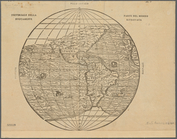
Universale della parte del mo…
note:
Mapping
the Nation (NEH grant, 2015-2018)…
Americae septentrionalis pars…
note:
Mapping
the Nation (NEH grant, 2015-2018)…
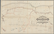
Map
of the rail roads of the state
note:
Map
within decorative border.
Map
of the rail roads of the State
note:
Mapping
the Nation (NEH grant, 2015-2018)…
Engineers
map
of the state of New York
note:
Map
within decorative border.
Nieu Nederlandt
note:
Map
signed "The Hague, 27th July, 1841
Map
of New Netherland which was annexed
note:
Map
signed by "The Hague, 27th July, 1841
m
Niev Nederlandt
note:
… the original
map
deposited
Map
of New Netherland
note:
… the original
map
deposited by M
A mappe of Colonel Römers voy…
note:
Mapping
the Nation (NEH grant, 2015-2018)…
A mappe of Colonel Römers voy…
note:
Mapping
the Nation (NEH grant, 2015-2018)…
m
To his excellency William Try…
note:
…"Copied from the original manuscript
map
A
map
of the countrey of the Five
note:
Mapping
the Nation (NEH grant, 2015-2018)…
Map
of New York, New England
note:
Photocopy of a manuscript
map
, hand colored.
NE sheet of
map
of North America
note:
Mapping
the Nation (NEH grant, 2015-2018)…
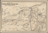
Map
of the Fitchburg, Cheshire
note:
Mapping
the Nation (NEH grant, 2015-2018)…
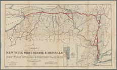
Map
of the New York West Shore & Buffalo
note:
Mapping
the Nation (NEH grant, 2015-2018)…
Map
showing route of the New York, Ontario
note:
Map
also shows lakes, rivers.
Map
of the great pleasure route to Saratoga
note:
Mapping
the Nation (NEH grant, 2015-2018)…
m
The New York wilderness: Hami…
note:
Map
shows lot numbers, lakes, railroads
Map
of the head waters of the rivers
note:
Reduced version of the
map
lithographed
Map
showing the only all rail route
note:
Mapping
the Nation (NEH grant, 2015-2018)…
A
map
of a tract of land in the State
note:
Mapping
the Nation (NEH grant, 2015-2018)…
A prospective view of the bat…
note:
Mapping
the Nation (NEH grant, 2015-2018)…
A prospective view of the bat…
note:
… Library."-- Bottom of
map
.
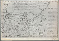
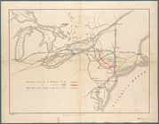
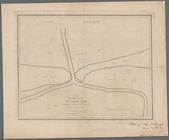
Map
of the mouth of big Sandy Creek
note:
Mapping
the Nation (NEH grant, 2015-2018)…
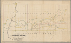
Map
of Tonawanda Swamp in the counties
note:
Mapping
the Nation (NEH grant, 2015-2018)…
A
map
of part of the land in the Royal Grant
note:
…"Reduced one fifth from the original
map
."…
Map
of Dobbs Ferry and Hastings
note:
Map
also shows street names, roads
A
map
of the country between Crown
note:
Mapping
the Nation (NEH grant, 2015-2018)…
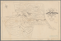
Map
of the Albany Rural Cemetery
note:
Mapping
the Nation (NEH grant, 2015-2018)…
Map
& profile of the Lake Ontario & Hudson
note:
… insets: "
Map
of French
Plan of West Point
note:
History of
map
in upper right conner
Western Division of the Erie Canal :
map
note:
Mapping
the Nation (NEH grant, 2015-2018)…
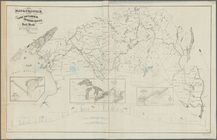
Map
of the United States showing
note:
Includes inset
map
: Alaska
United States: comparative ti…
note:
Mapping
the Nation (NEH grant, 2015-2018)…
Territory covered by the prin…
note:
Mapping
the Nation (NEH grant, 2015-2018)…
Skeleton
map
of the overland mail route
note:
Mapping
the Nation (NEH grant, 2015-2018)…
Aboriginal America east of th…
note:
… another version of
map
Profiles of the canals and ra…
note:
Mapping
the Nation (NEH grant, 2015-2018)…
Map
showing the proposed Tennessee, Alabama
note:
Mapping
the Nation (NEH grant, 2015-2018)…
Carta particolare della nuoua…
note:
Mapping
the Nation (NEH grant, 2015-2018)…
General
map
accompanying the report
note:
Mapping
the Nation (NEH grant, 2015-2018)…
Railroad
map
of New England
note:
Mapping
the Nation (NEH grant, 2015-2018)…
m
Map
of Maine, New Hampshire, Vermont
note:
Mapping
the Nation (NEH grant, 2015-2018)…
Southern New England
note:
Mapping
the Nation (NEH grant, 2015-2018)…
Massachusetts, Connecticut an…
note:
Mapping
the Nation (NEH grant, 2015-2018)…
Southern New England and New …
note:
Mapping
the Nation (NEH grant, 2015-2018)…
Enlarged
map
of the coast from New York
note:
Mapping
the Nation (NEH grant, 2015-2018)…
Map
illustrating the plan of the defences
note:
Mapping
the Nation (NEH grant, 2015-2018)…
1
2
Previous
Next
1
2
Previous
Next