Click to visit the main New York Public Library Homepage
The New York Public Library
Digital Collections
About Digital Collections
Browse
Search only public domain materials
Items
Collections
Divisions
Home
Search
Browse
About
Search only public domain materials
Items
Collections
Divisions
Digital Collections
Using Images
Using Data
Search
Filtered keyword search
Show filters
Hide filters
Show Only Public Domain
topic
Harbors
6
Mortality
6
Communicable diseases
4
Indians of North America
4
Canyons
3
More
Less
name
United States. Government Printing Office
23
Norris Peters Co
7
Donaldson, Thomas, 1843-1898
6
United States. Army. Corps of Topographical Engineers
4
Baird, Spencer Fullerton, 1823-1887
3
More
Less
collection
Maps of North America
30
Report upon the Colorado River of the West : explored in 1857 and 1858 by Lieutenant Joseph C. Ives, Corps of Topographical Engineers
3
Maps of New York City and State
2
place
Washington (D.C.)
9
Arizona
4
Illinois
4
Southwest, New
4
Colorado River (Colo.-Mexico)
3
More
Less
genre
Maps
32
Nautical charts
3
Views
3
Geological cross-sections
2
Geological maps
2
More
Less
publisher
x
Government Printing Office
Norris Peters Co., photo-litho
1
division
Map Division
32
Rare Book Division
3
type
cartographic
32
still image
3
Date Range
to
35 results found for:
x
United States. Government Printing Office
Filtering on:
x
Publisher
: Government Printing Office
Sort by:
Relevance
Title
Date created
Date digitized
Sequence
Map of the city of Washington…
use:
Can be sold through 3rd party
print
Map of the South Western dist…
use:
Can be sold through 3rd party
print
Map of the city of Washington…
use:
Can be sold through 3rd party
print
Map of the city of Washington…
use:
Can be sold through 3rd party
print
Map of the city of Washington…
use:
Can be sold through 3rd party
print
Sketch of West Pier, Oswego H…
use:
Can be sold through 3rd party
print
Map of Louisiana : representi…
use:
Can be sold through 3rd party
print
Map of the city of Washington…
use:
Can be sold through 3rd party
print
Map of the city of Washington…
use:
Can be sold through 3rd party
print
Sketch of the Pontchartrain H…
use:
Can be sold through 3rd party
print
Map of the city of Washington…
use:
Can be sold through 3rd party
print
Transportation lines tributar…
use:
Can be sold through 3rd party
print
Judith Basin
use:
Can be sold through 3rd party
print
Map of the city of Washington…
use:
Can be sold through 3rd party
print
Map of the city of Washington…
use:
Can be sold through 3rd party
print
Harbor of Dubuque : [Iowa]
use:
Can be sold through 3rd party
print
Map of the
State
of Indiana …
use:
Can be sold through 3rd party
print
Chicago harbor
use:
Can be sold through 3rd party
print
Harbor of Michigan City, Indi…
use:
Can be sold through 3rd party
print
Map of the territory of New M…
use:
Can be sold through 3rd party
print
Geological chart of part of I…
use:
Can be sold through 3rd party
print
Map showing different routes …
use:
Can be sold through 3rd party
print
Geological section from the m…
use:
Can be sold through 3rd party
print
… of the
United
States
use:
Can be sold through 3rd party
print
Indian Territory, 1883
use:
Can be sold through 3rd party
print
… reservations in the
United
States
west of the 84th
use:
Can be sold through 3rd party
print
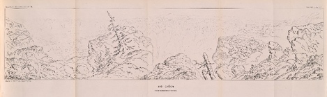
Colorado Expedition - Panoram…
use:
Can be sold through 3rd party
print
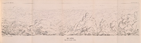
Colorado Expedition - Panoram…
use:
Can be sold through 3rd party
print
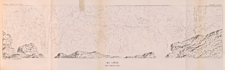
Colorado Expedition - Panoram…
use:
Can be sold through 3rd party
print
Diagram B, Township no. 6 Nor…
use:
Can be sold through 3rd party
print
Map showing the public domain…
use:
Can be sold through 3rd party
print
Precious metal regions of the…
use:
Can be sold through 3rd party
print
A diagram of the
State
of Alabama
use:
Can be sold through 3rd party
print
Map showing private land clai…
use:
Can be sold through 3rd party
print
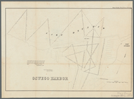
Oswego Harbor, 33d Congress, …
use:
Can be sold through 3rd party
print
End of results
|
Top