Click to visit the main New York Public Library Homepage
The New York Public Library
Digital Collections
About Digital Collections
Browse
Search only public domain materials
Items
Collections
Divisions
Home
Search
Browse
About
Search only public domain materials
Items
Collections
Divisions
Digital Collections
Using Images
Using Data
Search
Filtered keyword search
Show filters
Hide filters
Show Only Public Domain
topic
Guidebooks
15
Guidebooks, 1802
15
Roads
15
Nautical charts
7
Atlases
1
More
Less
name
Carey, Mathew, 1760-1839
15
Jones, T. W
15
Moore, S. S
15
Norie, J. W. (John William), 1772-1843
3
Shallus, Francis
3
More
Less
collection
x
Lawrence H. Slaughter Collection of English maps, charts, globes, books and atlases
place
United States
16
Middle Atlantic States
15
Middle Atlantic States Guidebooks
15
Philadelphia
15
Philadelphia (Pa.)
15
More
Less
genre
Maps
30
publisher
M. Carey
15
M. Carey,
4
s.n
3
E.S. Grant?,
1
Heather and Williams
1
More
Less
division
Map Division
30
type
x
cartographic
Date Range
to
30 results found for:
x
S. W
Filtering on:
x
Collection
: Lawrence H. Slaughter Collection of English maps, charts, globes, books and atlases
x
Type
: cartographic
For more collection details, visit the
Lawrence H. Slaughter Collection of English maps, charts, globes, books and atlases collection page
.
Sort by:
Relevance
Title
Date created
Date digitized
Sequence
A New generall chart for the …
note:
… and
S
100.
The Earth's Western planisphe…
Road from Philadela. to New Y…
Road from Philadela. to New Y…
Road from Philadelphia to New…
Road from Philadelphia to New…
Road from Philadelphia to New…
Road from Philadelphia to New…
Road from Philada. to New Yor…
Road from Philadelphia to Was…
Road from Philadela. to Washi…
Road from Philadela. to Washi…
Road from Philadela. to Washi…
Washington city
Philadelphia and the commence…
Road from Philadela. to New Y…
Road from Philadelphia to Was…
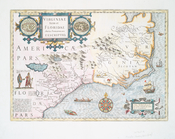
Virginiae item et Floridae Am…
note:
Variant of Cumming,
W
. P. Southeast
Audience de Guadalajara, Nouv…
note:
Scale [ca. 1:17,500,000] (
W
125°--
W
97°/N
To the independent mariners o…
note:
…,
W
. Heather
A new chart of America with t…
note:
drawn from the latest authorities by
W
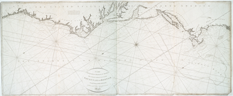
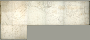
A chart of the coast of New Y…
…., long. 72º15{167}
W
note:
Covers Atlantic Coast of U.
S
. from New
Delaware
note:
drawn by F. Lucas, Jr. ; engraved by G.
W
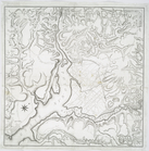
A chart of the bar of Sandy H…
note:
Scale [ca. 1:30,000] (
W
74⁰00ʹ/N 40⁰27ʹ)…
America.
A chart of the coast of Ameri…
note:
… 1837, by J.
W
. Norie
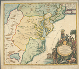
Virginia, Marylandia et Carol…
note:
Cumming,
W
.P. Southeast in early maps, 156
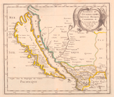
A Map of Carolana and of the …
note:
Cumming,
W
.P. Southeast in early maps, 190
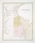
Territory of Columbia
note:
drawn by And'
w
Ellicott.
End of results
|
Top