Click to visit the main New York Public Library Homepage
The New York Public Library
Digital Collections
About Digital Collections
Browse
Search only public domain materials
Items
Collections
Divisions
Home
Search
Browse
About
Search only public domain materials
Items
Collections
Divisions
Digital Collections
Using Images
Using Data
Search
Filtered keyword search
Show filters
Hide filters
Show Only Public Domain
topic
Nautical charts
68
Coasts
12
Harbors
5
Pilot guides
5
Atlases
2
More
Less
name
Blunt, Edmund M. (Edmund March), 1770-1862
7
Hooker, William
7
Fisher, Joshua, 1707-1783
6
Blunt, G. W. (George William), 1802-1878
5
Des Barres, Joseph F. W. (Joseph Frederick Wallet), 1729-1824
5
More
Less
collection
x
Lawrence H. Slaughter Collection of English maps, charts, globes, books and atlases
place
New York (N.Y.)
16
New Jersey
14
Atlantic Coast (North America)
13
Atlantic Ocean
13
Maps
12
More
Less
genre
Maps
71
Nautical charts
1
publisher
Pub. by E.M. Blunt for W. Hooker
5
By Pieter Goos, op de Texelse Kay, naest de Rams-koy, in de Zee-Spiegel
3
And are to be sold at his shopps in Wapping at the Hermitage and in Exchange-Alley near the Royall-Exchange ..
2
Printed for Robt. Sayer & John Bennett, sea chart & map-sellers ..
2
Publish'd ... by I.F.W. Des Barres Esqr.,
2
More
Less
division
Map Division
71
type
cartographic
71
Date Range
to
71 results found for:
x
Nautical charts
Filtering on:
x
Collection
: Lawrence H. Slaughter Collection of English maps, charts, globes, books and atlases
For more collection details, visit the
Lawrence H. Slaughter Collection of English maps, charts, globes, books and atlases collection page
.
Sort by:
Relevance
Title
Date created
Date digitized
Sequence
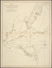
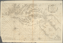
Chart
of the entrance of Hudson's River
topic:
Nautical
charts
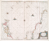
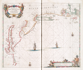
Pas kaart van de zee kusten v…
topic:
Nautical
charts
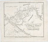
A
chart
of Delaware Bay and River
note:
Nautical
charts
, with depths shown by soundings
Pascaerte vande Vlaemsche, So…
topic:
Nautical
charts
…
chart
for the West
topic:
Nautical
charts
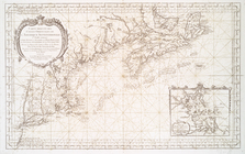
A
Chart
of ye coast of New England, New York
topic:
Nautical
charts
The bay and river of Delaware
topic:
Nautical
charts
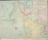
A draught of New York and Per…
topic:
Nautical
charts
A Generall
chart
topic:
Nautical
charts
A draught of New York from th…
topic:
Nautical
charts
Pas caerte van Nieu Nederland…
topic:
Nautical
charts
…
chart
for the West
topic:
Nautical
charts
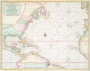
Ocean Atlantique, ou, Mer du …
topic:
Nautical
charts
Carte de la baye et riviere d…
topic:
Nautical
charts
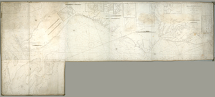
… of the
Nautical
Institution
note:
… to form L-shaped
chart
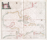
Pascaerte van Westindien : de…
topic:
Nautical
charts
A
chart
of New York Harbour : with the banks
topic:
Nautical
charts
Ocean Atlantique, ou, Mer du …
topic:
Nautical
charts
A
chart
of the Atlantick Ocean from Buttons
topic:
Nautical
charts
Entrance to New York Bay from…
note:
… with "
Chart
and quadrant store
The Bay and river of Delaware
note:
… with "
Chart
and quadrant store
Pas kaart van West Indien : b…
topic:
Nautical
charts
Carte reduite des costes orie…
topic:
Nautical
charts
m
The provinces of New York, an…
note:
Insets: A
chart
of the mouth of Hudson's River
Bowles's new pocket map of th…
topic:
Nautical
charts
A
chart
of Delaware Bay and River
note:
taken from the original
chart
published
Baye de la Delaware avec les …
topic:
Nautical
charts
A
chart
of Delaware Bay and River
note:
taken from the original
chart
published
Virginia, Maryland, Pennsilva…
note:
Nautical
chart
of the coast from New York Bay
…
chart
for the West
topic:
Nautical
charts
A
chart
of the coast of America : from
note:
Nautical
chart
.
A
chart
of Delaware Bay and River
note:
taken from the original
chart
published
Pas-Kaart vande zee kusten va…
topic:
Nautical
charts
A
chart
of Delaware Bay and River
topic:
Nautical
charts
Nautical
chart
of Little Egg Harbour, New
note:
… with "
Chart
and quadrant store
A general
chart
of the West India's [sic]
topic:
Nautical
charts
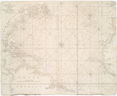
A Generall
chart
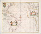
of the Western Ocean.
topic:
Nautical
charts
The Western Ocean.
note:
Chart
of the Atlantic Ocean with rhumb
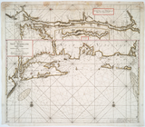
A
chart
of the coast of New York, New
topic:
Nautical
charts
A new and accurate
chart
of the vast
topic:
Nautical
charts
Chart
of the entrance of Hudson's River
topic:
Nautical
charts
A
chart
of Delawar
topic:
Nautical
charts
Virginia, Maryland, Pennsilva…
note:
Nautical
chart
of the coast from New York Bay
A
chart
of the Atlantic Ocean. I sheet.
topic:
Nautical
charts
Chart
of Long Island Sound, 1822
note:
… with "
Chart
and quadrant store
Chart
of the entrance to Chesapeake Bay
note:
… with "
Chart
and quadrant store
A
chart
of the West Indies from Cape Cod
topic:
Nautical
charts
Long Island Sound from New Yo…
note:
Nautical
chart
.
A New and correct
chart
of the Atlantick
topic:
Nautical
charts
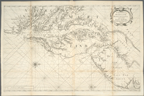
A
chart
of the sea coast of New Foundland
topic:
Nautical
charts