Click to visit the main New York Public Library Homepage
The New York Public Library
Digital Collections
About Digital Collections
Browse
Search only public domain materials
Items
Collections
Divisions
Home
Search
Browse
About
Search only public domain materials
Items
Collections
Divisions
Digital Collections
Using Images
Using Data
Search
Filtered keyword search
Show filters
Hide filters
Show Only Public Domain
topic
Nautical charts
32
Administrative and political divisions
24
Railroads
22
History
18
Real property
18
More
Less
name
United States Coast Survey
32
Bache, A. D. (Alexander Dallas), 1806-1867
28
Moll, Herman, -1732
9
American Civil War (1861-1865)
7
Bowles, John, 1701-1779
7
More
Less
collection
Maps of North America
174
Lawrence H. Slaughter Collection of English maps, charts, globes, books and atlases
35
John H. Levine Collection
6
Atlases of the United States
4
Atlases, gazetteers, guidebooks and other books
3
More
Less
place
Florida
107
United States
47
North America
20
Southern States
20
South Carolina
16
More
Less
genre
Maps
229
Nautical charts
25
Bathymetric maps
19
Cadastral maps
8
land surveys
7
More
Less
publisher
U.S. Coast Survey
26
publisher not identified
16
Surveyor General's Office
5
Post Office Department
4
General Land Office
3
More
Less
division
Map Division
225
Rare Book Division
3
Wallach Division: Print Collection
2
type
x
cartographic
text
3
still image
1
Date Range
to
230 results found for:
x
Florida
Filtering on:
x
Type
: cartographic
Sort by:
Relevance
Title
Date created
Date digitized
Sequence
A map of Carolina,
Florida
and the Bahama
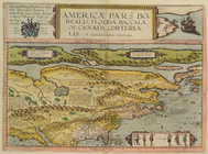
Americae Pars Borealis,
Florida
Map of the American Coast, fr…
collection:
… &
Florida
.
Phelps's national map of the …
note:
… of
Florida
-- Map of Oregon
A general chart of all the co…
Key West Harbor and its appro…
collection:
Florida
A map of St. Augustine & vici…
collection:
…,
Florida
Chart of the coast of Georgia
collection:
Georgia coast : from East
Florida
m
Post route map of the State of
Florida
m
… of
Florida
…
note:
…"
Florida
service on this diagram brought up to date
m
Copy of map of state of
Florida
…
Map of the state of
Florida
…
… in the state of
Florida
…
A map of part of Alabama &
Florida
, …
abstract:
… of western
Florida
showing
Post route map of the States …
Le Nouveau Mexique et la Flor…
abstract:
… Mexico, Spanish
Florida
Floridae
Americae provinciae recens
abstract:
Shows
Florida
Atlantic coast lists
abstract:
…: [North
Florida
]. Shows
m
…,
Florida
, …
Carte reduite des costes de l…
A plan of the harbour of St. …
collection:
Florida
…,
Florida
…
… of
Florida
, 1848-54 …
note:
… of Tortugas Island,
Florida
… and approaches,
Florida
…
Johnson's Georgia and Alabama
note:
… of
Florida
and South Carolina.
A draught of West
Florida
…
note:
… of West
Florida
Sketch of the Atlantic coast …
note:
… of
Florida
from St. Johns
Map of Clay County,
Florida
…
Pictorial map of the seat of …
abstract:
…,
Florida
.
… Counties,
Florida
… on the
Florida
reefs …
Preliminary chart of Waccasassa Bay,
Florida
…
Sketch F No. 2 : showing the …
collection:
Survey of the
Florida
reefs 1849-1854
Ocilla River,
Florida
…
Sketch G : showing the progre…
note:
… of
Florida
.
Preliminary survey of Turtle …
collection:
Florida
Reconnaissance of Coffin's Pa…
collection:
Florida
Reefs
Plan of Amelia Island in East
Florida
…
abstract:
…
Florida
. Maps show the new
Putnam County
Florida
Fortifications of Charleston …
m
Post route map of the states …
Carolina
note:
…
Florida
.
Strategic war points of the U…
m
A New description of Carolina
abstract:
… of
Florida
" p. 50 and "The
m
A new description of Carolina
abstract:
… of
Florida
" p. 50 and "The
Map of the seat of war in
Florida
Correct map of
Florida
…
note:
Inset : Map of western part of
Florida
… of
Florida
…
abstract:
… and Improvement Company of
Florida
Carte réduite des côtes et de…
abstract:
Covers from the Dry Tortugas and the
Florida
… of
Florida
…
abstract:
… of
Florida
. 24 p. ; 14 cm