Click to visit the main New York Public Library Homepage
The New York Public Library
Digital Collections
About Digital Collections
Browse
Search only public domain materials
Items
Collections
Divisions
Home
Search
Browse
About
Search only public domain materials
Items
Collections
Divisions
Digital Collections
Using Images
Using Data
Search
Filtered keyword search
Show filters
Hide filters
Show Only Public Domain
topic
Real property
286
Nautical charts
139
Railroads
85
Administrative and political divisions
81
History
45
More
Less
name
G.W. Bromley & Co
221
Bromley, George Washington
196
Bromley, Walter Scott
196
United States Coast Survey
116
Bache, A. D. (Alexander Dallas), 1806-1867
100
More
Less
collection
Maps of North America
523
Atlases of the United States
282
Atlases of New York City
151
Maps of New York City and State
108
Lawrence H. Slaughter Collection of English maps, charts, globes, books and atlases
30
More
Less
place
New York (State)
346
Westchester County
136
Westchester County (N.Y.)
136
Staten Island (New York, N.Y.)
94
United States
94
More
Less
genre
Maps
1121
Atlases
282
Nautical charts
108
Bathymetric maps
56
Topographic maps
34
More
Less
publisher
G.W. Bromley & Co
216
G.W. Bromley and Co.,
69
U.S. Coast Survey
56
publisher not identified
43
U.S. Coast Survey Office
35
More
Less
division
Map Division
1125
Schomburg Jean Blackwell Hutson Research and Reference Division
3
Rare Book Division
2
Manuscripts and Archives Division
1
Wallach Division: Print Collection
1
type
x
cartographic
text
16
still image
14
Date Range
to
1,132 results found for:
x
S. W
Filtering on:
x
Type
: cartographic
Sort by:
Relevance
Title
Date created
Date digitized
Sequence
m
Nuevo mapa topográfico de la …
note:
Scale approximately 1:190,000 (
W
68°06ʹ--
W
65°06
m
… of the U.
S
. Grinnell
note:
Scale not given (
W
85°02ʹ--
W
50°08ʹ/N 82°30
m
A chart of the discoveries of H.M.
S
. Hecla
note:
Scale not given (
W
116°11ʹ--
W
77°00ʹ/N 76°32
Rand, McNally & Co.'
s
new automobile
note:
Scale approximately 1:93,000 (
W
74°41ʹ33ʺ--
W
Rail terminal facilities in G…
note:
Scale approximately 1:100,000 (
W
74°17ʹ45ʺ--
W
m
Flushing Bay, Long Island, N.…
note:
Scale approximately 1:2,680 (
W
73°50ʹ58ʺ--
W
m
Rand, McNally & Co.'
s
complete map
note:
Scale approximately 1:25,000 (
W
74°02ʹ43ʺ--
W
East River Heights, first war…
m
Hammond's complete map of New…
note:
Scale approximately 1:18,000 (
W
74°01ʹ32ʺ--
W
m
Hammond's complete map of Bro…
note:
Scale approximately 1:36,500 (
W
73°57ʹ08ʺ/N
Track map of the trolley line…
note:
… inches = 1 mile (
W
74°12ʹ09ʺ--
W
74°02ʹ39ʺ/N
Relief map of New York and vi…
note:
… inch = 3 miles (
W
74°30ʹ--
W
73°41ʹ/N 41°00ʹ--N
m
The Wanamaker diary map of Ne…
note:
Scale approximately 1:34,000 (
W
74°01ʹ22ʺ--
W
New York City and environs : …
note:
Scale 1:200,000 (
W
74°19ʹ03ʺ--
W
73°48ʹ24ʺ/N
m
New guide map of New York Cit…
note:
Scale approximately 1:18,500 (
W
74°02ʹ50ʺ--
W
Hammond's new guide map of Ma…
note:
Scale approximately 1:33,500 (
W
74°04ʹ10ʺ--
W
m
Hammond's new guide map of Ma…
note:
Scale approximately 1:36,000. (
W
74°01ʹ22ʺ--
W
m
Taunton new guide map and dir…
note:
Scale [ca. 1:18,400]. (
W
74°01ʹ13ʺ--
W
73°57
m
Map of the city of Brooklyn
note:
Scale approximately 1:21,250 (
W
74°01ʹ40ʺ--
W
Watson's new map of the city …
note:
engraved by
W.S
. Barnard.
Map of the city of Brooklyn
note:
Scale not given (
W
74°01ʹ--
W
73°53ʹ/N 40°44
m
Map of the consolidated City …
note:
Scale [ca. 1:22,352] (
W
74°01ʹ--
W
73°53ʹ/N
m
Rand McNally & Co.'
s
road map
note:
Scale approximately 1:94,000. (
W
74°15ʹ32ʺ--
W
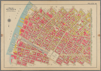
Map of New York City : showin…
note:
Scale approximately 1:45,000. (
W
74°04ʹ42ʺ--
W
Freight terminal map of the P…
note:
Scale 1:55,000 (
W
74°17ʹ24ʺ--
W
73°40ʹ54ʺ/N
m
Watson's new map of New York …
note:
Scale approximately 1:18,000. (
W
74°04ʹ09ʺ--
W
m
Street guide of Manhattan and…
note:
Scale approximately 1:30,000 (
W
74°01ʹ19ʺ--
W
… Wood Harmon & Co.'
s
note:
Scale not given (
W
74°03ʹ21ʺ--
W
73°50ʹ54ʺ/N
m
H.M.
S
. Aeolus and H.M.
S
. Norwich
abstract:
… the H.M.
S
. Aeolus under
Preliminary geologic map of A…
note:
… inch = 1 mile (
W
74°15ʹ--
W
73°40ʹ/N 42°49ʹ--N
Map of the rail-roads of the …
note:
Scale not given (
W
80°12ʹ--
W
71°47ʹ/N 45°44
Map of the rail roads of the …
note:
Scale approximately 1:1,000,000 (
W
80°20ʹ--
W
71°20
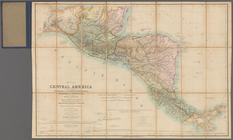
Map of Central America includ…
note:
Scale [ca. 1:2,100,000] (
W
96⁰--
W
79⁰/N
m
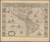
Americae nova tabula
note:
… 1:45,000,000 (
W
171°54ʹ00ʺ--
W
5°37ʹ00ʺ/N 77°01ʹ00ʺ--
S
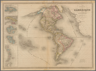
Carte de l'Amerique
note:
… 178°55ʹ00ʺ--
W
13°14ʹ00ʺ/N 72°41ʹ00ʺ--
S
65°35ʹ00ʺ)…
m
Map of the hydrographical bas…
note:
… by the War Department ;
W
Map of the Great Salt Lake an…
note:
Scale 1:240,000 (
W
113°40ʹ--
W
111°36ʹ/N
m
Rand, McNally & Co.'
s
Minnesota
note:
Scale approximately 1:1,000,000 (
W
97°15ʹ--
W
89°30
Plan of the city of Philadelp…
note:
Drawn and engraved by
W
.H. Gamble.
Rand, McNally & Co.'
s
Illinois …
note:
Scale approximately 1:950,000 (
W
91°50ʹ--
W
87°01
Map of the battlefield of Fre…
note:
… (
W
77°33ʹ--
W
77°23ʹ/N
Washington and vicinity, Mary…
note:
Scale 1:62,500 (
W
77°15ʹ--
W
76°45ʹ/N 39°00
A preliminary geological map …
note:
… mile to the inch (
W
74°30ʹ--
W
73°57ʹ/N 40°30
Progress map of the state of …
note:
… miles to 1 inch (
W
75°40ʹ--
W
73°50ʹ/N 41°20ʹ--N
Map of the boundary lines bet…
note:
…. Engineers and
W
.M.C. Fairfax
To accompany Willard's histor…
note:
Scale not given (
W
83°05ʹ--
W
78°14ʹ/N 36°07
… of Genl.
W
.T. Sherman from
note:
…. Gen.
W
.T. Sherman."…
… Court,
W
. 3rd Street, Avenue R.,
W
. 5th Street
…., Roebling St., Union Ave.,
S
. Second St., Hooper St.,
S
Bounded by
S
. 11th Street, Berry Street,
S
1
2
3
4
5
Previous
Next
1
2
3
4
5
Previous
Next