Click to visit the main New York Public Library Homepage
The New York Public Library
Digital Collections
About Digital Collections
Browse
Search only public domain materials
Items
Collections
Divisions
Home
Search
Browse
About
Search only public domain materials
Items
Collections
Divisions
Digital Collections
Using Images
Using Data
Search
Filtered keyword search
Show filters
Hide filters
Show Only Public Domain
topic
Real property
730
Geography
406
Administrative and political divisions
228
Nautical charts
178
Atlases
170
More
Less
name
Robinson, E. (Elisha)
391
Pidgeon, R. H. (Roger H.)
364
E. Robinson Co
345
Burr, David H., 1803-1875
195
A.H. Mueller (Publisher)
162
More
Less
collection
Lawrence H. Slaughter Collection of English maps, charts, globes, books and atlases
1101
Maps of North America
811
Atlases of the United States
687
Atlases of New York City
343
Maps of New York City and State
293
More
Less
place
New York (State)
828
New York (N.Y.)
415
New York
286
United States
271
Great Britain
235
More
Less
genre
Maps
3480
Atlases
676
Cadastral maps
157
Nautical charts
87
Bathymetric maps
48
More
Less
publisher
E. Robinson Co
297
A.H. Mueller
162
Printed for Ieames Shawe, and are to be solde at his shoppe nigh Ludgate,
123
Chapman and Hall
109
Reading Publishing House
72
More
Less
division
Map Division
3352
Pforzheimer Collection
38
Schomburg Jean Blackwell Hutson Research and Reference Division
30
Milstein Division
29
Rare Book Division
20
More
Less
type
x
cartographic
text
80
still image
41
Date Range
to
Looking for this collection?
Lawrence H. Slaughter Collection of English maps, charts, globes, books and atlases
1,252 items
3,513 results found for:
x
H. H
Filtering on:
x
Type
: cartographic
Sort by:
Relevance
Title
Date created
Date digitized
Sequence
Results 1751 - 1800
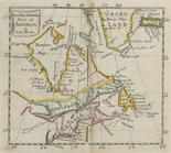
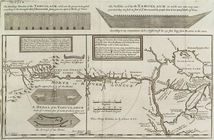
The north west part of America
note:
Lawrence
H
. Slaughter Collection ; 335.
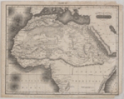
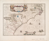
Northern and Central Africa
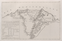
Carte de l'Egypte inferieure
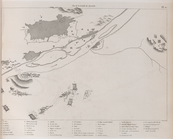
Plan de la bataille des Pyram…
Insula S. Thomae [West Africa]
note:
Stokes Foreign Views, 1645-
H
-6A
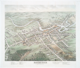
Bird's eye view of Rochester …
note:
John
H
. Levine Collection
Pacific Ocean showing part of…
collection:
John
H
. Levine Collection
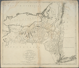
The state of New York, compil…
collection:
Lawrence
H
. Slaughter Collection
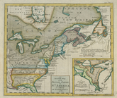
An accurate map of the Britis…
collection:
Lawrence
H
. Slaughter Collection
Bowles's new pocket map of th…
collection:
Lawrence
H
. Slaughter Collection
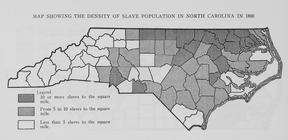
Map showing the density of sl…
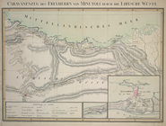
Caravanenzug des Freyherrn vo…
collection:
… Beilagen begleitet von E.
H
Plate
H
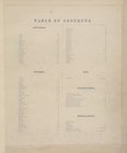
Table of Contents.
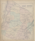
Red Hook [Township]
Rhinebeck [Township]
Rhinebeck [Village]
Milan [Township]
Clinton [Township]
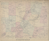
Stanford [Township]
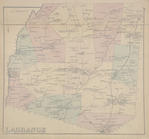
Lagrange [Township]
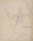
Dover Plains [Village]
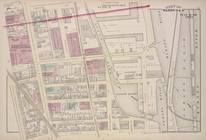
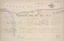
Parts of Wards 5, 10. & 13. [Plate
H
.]
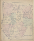
Map of Unionvale Township.
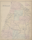
Beekman [Township]
Pawling [Township]
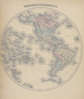
Western Hemisphere
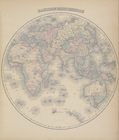
Eastern Hemisphere
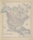
North America
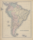
South America
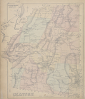
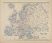
General Description - Europe.
Europe
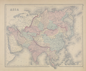
Asia
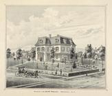
Ervin
H
. Ewell. ; Residence of J. C. Greene, M
…. ; Residence of
H
. D. Kirkover
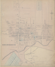
Part of Ward 3 & 5 [Plate
H
]
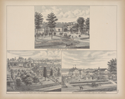
Residence of Dr. Jas.
H
. Holly, Warwick
The dwelling houses of the Ta…
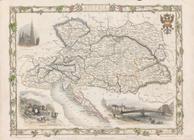
Austria
Plan of the city and fortific…
Preliminary chart of Gloucest…
note:
…. ; topography by
H
.L. Whiting
Map of the state of Montana
note:
… by R.
H
. Morton
Carte de la Virginie et du Ma…
note:
Lawrence
H
. Slaughter Collection ; 63.
Virginiae partis australis, e…
note:
Lawrence
H
. Slaughter Collection ; 356.
Bowles's new pocket map of th…
note:
Lawrence
H
. Slaughter Collection ; 228.
Carte de la Louisiane et du c…
note:
Lawrence
H
. Slaughter Collection ; 453
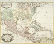
Carte du Mexique et de la Flo…
note:
Lawrence
H
. Slaughter Collection ; 457.
A new chart of America with t…
note:
Lawrence
H
. Slaughter Collection ; 547.
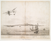
[A chart of New York Island &…
note:
Lawrence
H
. Slaughter Collection ; 830.
Mappa geographica Provinciae …
note:
Lawrence
H
. Slaughter Collection ; 843.
1
2
…
5
6
7
8
9
10
11
12
…
14
15
Previous
Next
1
2
…
5
6
7
8
9
10
11
12
…
14
15
Previous
Next