Click to visit the main New York Public Library Homepage
The New York Public Library
Digital Collections
About Digital Collections
Browse
Search only public domain materials
Items
Collections
Divisions
Home
Search
Browse
About
Search only public domain materials
Items
Collections
Divisions
Digital Collections
Using Images
Using Data
Search
Filtered keyword search
Show filters
Hide filters
Show Only Public Domain
topic
Administrative and political divisions
663
Railroads
559
Real property
395
Landowners
316
Roads
120
More
Less
name
Rand McNally and Company
105
United States. General Land Office
74
Bien, Julius, 1826-1909
71
Julius Bien & Co
71
G.W. & C.B. Colton & Co
67
More
Less
collection
Maps of North America
1589
Maps of New York City and State
707
Atlases of the United States
83
Lawrence H. Slaughter Collection of English maps, charts, globes, books and atlases
21
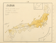
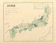
Maps of Asia
10
More
Less
place
New York (State)
664
New York (N.Y.)
276
New York
262
United States
216
Massachusetts
172
More
Less
genre
Maps
2450
Cadastral maps
280
Topographic maps
96
Geological maps
92
Manuscript maps
90
More
Less
publisher
publisher not identified
169
G.W. & C.B. Colton & Co
49
G.M. Hopkins (Firm)
42
Rand, McNally & Co
40
General Land Office
38
More
Less
division
Map Division
2429
Wallach Division: Print Collection
6
Manuscripts and Archives Division
5
Rare Book Division
5
Wallach Division: Photography Collection
5
More
Less
type
x
cartographic
still image
71
text
42
three dimensional object
1
Date Range
to
2,455 results found for:
x
Colors
Filtering on:
x
Type
: cartographic
Sort by:
Relevance
Title
Date created
Date digitized
Sequence
Adirondack survey, Sketch in
colors
showing
Geological map of Potter Coun…
abstract:
…, and available in
color
. At head
… in
colors
, from light
… in
colors
, from light
… of production in
colors
, from
… in
colors
, from light
… in
colors
, from light
Map of Chicago and its wester…
note:
Colors
indicate wards within the city
Map of the railroads of Conne…
note:
… in distinguishing
colors
.
Map of Garret Nostrand's farm…
note:
…, with additional
colors
.
… represented in
colors
)…
Map of the railroads of Conne…
abstract:
…
colors
.
Map of the United States of N…
note:
… by hachures. Two
colors
Map of southern Butler County…
abstract:
… available in
color
. At head
m
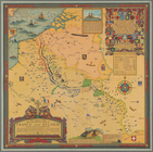
The Virginia Company chart
note:
Manuscript map, drawn in gold and
colors
Plan of Boston proper, showin…
note:
… and layout by
colored
Map of Boston for 1874: publi…
note:
Shows in various
colors
the lands
Preliminary geological map of…
abstract:
… of
colors
. "Pl. V"--Upper
Geological map of Fayette Cou…
abstract:
… in
color
. At head
m
Map of Long Island and adjace…
note:
… in different
colors
.
Geological map of Potter Coun…
abstract:
… in
color
, and available
Geological map of Alabama
note:
Includes "explanation" key to
colors
Geological map of Allegheny C…
abstract:
… available in
color
. At head
Map of North Allegheny, showi…
abstract:
… available in
color
. At head
Geological map of the route e…
note:
Includes index of
colors
as a key
m
Mapah derekh emet : Mapa Dere…
note:
Includes key with explanation of
colors
.
Map of Beaver County showing …
abstract:
… available in
color
. At head
The Louisiana State Universit…
Geological map of the environ…
note:
… available in
color
. At head
Triassic formation: including…
note:
Includes a table of
colors
and 6 sections.
m
Official map of south-west po…
note:
…"
Colored
by E. M. Sleator, 529 Shotwell St
Plan of the city of Philadelp…
note:
Fill
color
by hand
Substances minérales utiles d…
note:
color
Map of New York City above 11…
note:
…
coloring
. The grand
Map of the City of Wilmington…
Bayfield & Ashland Counties i…
note:
…
coloring
of selected
m
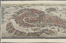
Venetia
note:
Hand-
colored
m
Rand, McNally & Co.'s new ind…
note:
… 1]
colored
in orange & brown; [copy 2]
colored
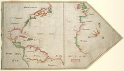
Map of New York, New England,…
note:
Photocopy of a manuscript map, hand
colored
.
The great war map of battle l…
note:
Colored
. Printed on cloth
Map of Georgia
abstract:
…, D.C. Includes
color
A map of Carolina, Florida an…
note:
Hand-
colored
New Hampshire & Vermont
note:
Outline
color
Map of Massachusetts, Connect…
note:
Colored
by county; borders of states in red.
Topographical plan showing po…
abstract:
…. The
color
is a pale pink
m
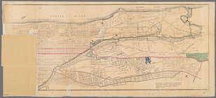
1907 Library map of Manhattan…
abstract:
…, hand
colored
Driving chart of Hartford and…
note:
… hand
colored
.
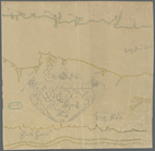
Map showing lands of the Iron…
note:
Ink and
colored
crayon drawing
m
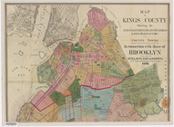
Map of Kings County: showing …
note:
… in
colored
lead.
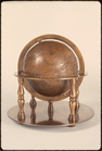
Full view of globe with stand in
color
1
2
3
4
5
6
7
8
9
10
Previous
Next
1
2
3
4
5
6
7
8
9
10
Previous
Next