Click to visit the main New York Public Library Homepage
The New York Public Library
Digital Collections
About Digital Collections
Browse
Search only public domain materials
Items
Collections
Divisions
Home
Search
Browse
About
Search only public domain materials
Items
Collections
Divisions
Digital Collections
Using Images
Using Data
Search
Filtered keyword search
Show filters
Hide filters
Show Only Public Domain
topic
Administrative and political divisions
481
Real property
369
Landowners
304
Railroads
289
History
94
More
Less
name
Burr, David H., 1803-1875
124
Rawdon, Clark & Co
81
Rawdon, Wright & Co
79
De Witt, Simeon, 1756-1834
60
New York (State). Surveyor General
48
More
Less
collection
Maps of North America
1169
Maps of New York City and State
482
Lawrence H. Slaughter Collection of English maps, charts, globes, books and atlases
279
Atlases of the United States
122
John H. Levine Collection
51
More
Less
place
New York (State)
456
New York (N.Y.)
249
United States
224
North America
164
New Jersey
138
More
Less
genre
Maps
2186
Cadastral maps
213
Atlases
122
Geological maps
32
Topographic maps
19
More
Less
publisher
publisher not identified
117
s.n
49
G.M. Hopkins (Firm)
42
... Sold ... by Tho. Bowles, print and map-seller in St. Paul's-Churchyard
30
G.W. & C.B. Colton & Co
27
More
Less
division
Map Division
2169
Schomburg Jean Blackwell Hutson Research and Reference Division
6
Wallach Division: Print Collection
6
Manuscripts and Archives Division
4
Rare Book Division
3
More
Less
type
x
cartographic
still image
38
text
31
Date Range
to
2,190 results found for:
x
Hands
Filtering on:
x
Type
: cartographic
Sort by:
Relevance
Title
Date created
Date digitized
Sequence
….,
Hands
Path]
Sketch of the action on the h…
note:
… in the
hands
of J. Cist Esq
Sketch of the action on the h…
note:
… in the
hands
of J. Cist Esq
m
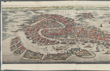
Venetia
note:
Hand
-colored
America
note:
…'s
Hand
-Atlas, No. 41."…
Map of New York, New England,…
note:
Photocopy of a manuscript map,
hand
colored.
Plan of the city of Philadelp…
note:
Fill color by
hand
Centennial map of Concord, 17…
note:
Hand
-colored
A map of Carolina, Florida an…
note:
Hand
-colored
Driving chart of Hartford and…
note:
…
hand
colored.
Carte de la Virginie et du Ma…
note:
NYPL copy
hand
col.
Hand
-drawn map
abstract:
Hand
-drawn map, in ink
Map of the city of St. Louis,…
note:
NYPL copy
hand
col. at later date.
m
Map of the City of New York n…
note:
Hand
colored.
Neueste Karte von New York : …
note:
From Meyer's
Hand
-Atlas.
Skeleton map showing the rail…
note:
Railroad lines
hand
col. in red ink.
Vereinigte Staaten in Nord Am…
note:
…
Hand
-Atlas, Ausg. 1824.
Novi Belgii Novaeque Angliae …
note:
Hand
col. …
Verein-Staaten von Nord-Ameri…
note:
…'s
Hand
-Atlas (No. 46b).
Bay and harbor of New York
note:
… and beacon
hand
col.
Vereinigte Staaten von Amerik…
note:
…"Stieler's
Hand
-Atlas, No. 83."…
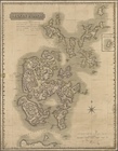
Orkney Islands
note:
Hand
coloured boundaries.
m
Map of the City of New York n…
note:
Hand
colored.
Amerika ĕst nor Ashkharhagrak…
note:
Hand
colored.
m
Cameron, Agnes Deans
note:
File includes a
hand
-drawn map of Cameron
Map showing locations of Dela…
note:
… in upper-left
hand
corner.
m
Map of the City of New York, …
note:
Hand
colored.
Map of New York and vicinity …
note:
… right
hand
corner.
m
Map of Monroe County, New York
note:
Hand
colored to emphasize town (township
Map of Warren County, Pennsyl…
abstract:
…, and tract acreages.
Hand
Agricultural and geological m…
note:
Hand
coloring to distinguish geological
Vereinigte Staaten von Amerik…
note:
…"Stieler's
Hand
-Atlas, No. 88."…
m
Geological map of the State o…
note:
Hand
colored to distinguish geological
A new map of North America fr…
Colton's railroad & township …
abstract:
… and provinces.
Hand
colored
m
Preliminary post route map of…
note:
… to be added by
hand
.
m
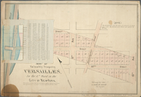
Map of valuable property at V…
note:
NYPL copy has block numbers
hand
Map of property of the Bloomi…
abstract:
…, as well as
hand
Lloyd's map of the Canadas, N…
note:
Includes
hand
colored illustrations
m
Map of the Clutter farm in Capote's
hand
Carte generale de l'Amerique …
A map of the State of New York
A new & correct map of Negrol…
Carta delle Isole Antille
m
Sanitary & topographical map …
note:
Hand
colored.
m
The Wyoming Coal Field and it…
note:
…. 1 map :
hand
colored
Skeleton map showing the rail…
note:
Railroad lines
hand
col. in red and green
Le Canada, ou Nouvelle France…
abstract:
….
Hand
-colored in outline. Relief
Skeleton map showing the rail…
note:
Railroad lines
hand
col. in red ink.
A plan of Fort Montgomery & F…
note:
…].
Hand
col. ; 45 x 30 cm
1
2
3
4
5
6
7
8
9
Previous
Next
1
2
3
4
5
6
7
8
9
Previous
Next