Click to visit the main New York Public Library Homepage
The New York Public Library
Digital Collections
About Digital Collections
Browse
Search only public domain materials
Items
Collections
Divisions
Home
Search
Browse
About
Search only public domain materials
Items
Collections
Divisions
Digital Collections
Using Images
Using Data
Collections
Charting America: Maps from the Lawrence H. Slaughter Collection and Others
Charting America: Maps from the Lawrence H. Slaughter Collection and Others
Navigation
Filters
Charting America: Maps from the Lawrence H. Slaughter Collection and Others
Previous
The south part of Virginia, now the north part of Carolina
0
Atlases, gazetteers, guidebooks and other books
377
Maps of the World
16
Maps of the Oceans
24
Maps of North and South America
23
Maps of North America.
551
Maps of New York City and State
1340
Lawrence H. Slaughter Collection of English maps, charts, globes, books and atlases
1020
John H. Levine Collection
60
More
Show filters
Hide filters
Show Only Public Domain
topic
Road maps
53
Geography
33
History
30
Nautical charts
22
Harbors
16
More
Less
name
Colles, Christopher, 1738-1816
54
Tiebout, Cornelius, 1777-1832
54
Mitchell, S. Augustus (Samuel Augustus), 1792-1868
28
Morse, Jedidiah, 1761-1826
27
Stockdale, John, 1749?-1814
27
More
Less
collection
Lawrence H. Slaughter Collection of English maps, charts, globes, books and atlases
177
Maps of New York City and State
106
Atlases, gazetteers, guidebooks and other books
36
John H. Levine Collection
8
Maps of North and South America
3
More
Less
place
United States
184
Middle Atlantic States
72
New York (State)
72
New York (N.Y.)
31
North America
20
More
Less
genre
Maps
307
Registers (Lists)
23
Nautical charts
10
Facsimiles
5
Bathymetric maps
4
More
Less
publisher
S. A. Mitchell, jr
28
Printed for J. Stockdale
26
M. Carey
17
Printed by H. Sweitzer, for M. Carey,
7
The Survey
6
More
Less
division
Map Division
330
Manuscripts and Archives Division
1
type
cartographic
304
text
27
still image
1
Date Range
to
332 results found for:
United States?tab=filter
Sort by:
Relevance
Title
Date created
Date digitized
Sequence
Staten Island, N.Y., ed. of F…
topic:
New York (
State
)…
Paterson, N.J. - N.Y., ed. of…
collection:
Maps of New York City and
State
Santanoni, ed. of Mar. 1904, …
topic:
New York (
State
)…
…
United
Association. List
m
Military map of Cuba
Mt. Marcy, ed. of June 1902, …
topic:
New York (
State
)…
m
Panoramic view of New York Ci…
collection:
Maps of New York City and
State
m
The
United
Electric Light and Power Company
m
… by order of the
United
State
Mortgage and Trust
m
Map[s] to accompany report "T…
collection:
Maps of New York City and
State
… routes between the
United
States
and other American
A topographical map of the no…
collection:
Maps of New York City and
State
Hydrographic map of the Ocono…
collection:
United
States
(except New York)…
Trade of the
United
States
with American
m
Map of the Harlem River and S…
collection:
Maps of New York City and
State
m
Niagara 1819
note:
… the
United
States
The second section of the sur…
note:
… the
United
States
Pierhead and bulkhead lines f…
collection:
Maps of New York City and
State
Map of the Rome, Watertown an…
note:
…
states
of the
United
States
and part of Canada.
Map of the boundary line between the
states
note:
… of their respective
states
on December
1889, Larchmont Harbor, N.Y.:…
collection:
Maps of New York City and
State
m
Maps of the picturesque Catsk…
collection:
Maps of New York City and
State
New map of New York City: fro…
note:
On bottom left corner: "
United
States
Elevated railway map of New Y…
note:
… for
United
States
Life
Plan of West Point
collection:
Maps of New York City and
State
Position de l'armée Américain…
collection:
Maps of New York City and
State
Colton's New York City : Broo…
note:
… of the
United
States
Plan of the Battle of Long Is…
collection:
Maps of New York City and
State
Map of New York City and of M…
collection:
Maps of New York City and
State
New York to New Rochelle: fro…
note:
… of the roads of the
United
States
of America
Niagara Falls: from surveys e…
collection:
Maps of New York City and
State
m
Post route map of the
State
of New York
note:
… Department,
United
States
Asher & Adams' map of the bay…
collection:
Maps of New York City and
State
m
United
States
--east coast, New York--New
note:
… and Geodetic Survey.|t
United
States
--east coast, New
Northern coast of Long Island…
collection:
Maps of New York City and
State
m
Map of the City of New York :…
note:
… Court of the
United
States
for the Southern
m
New map of the
state
of New York
note:
… of the
United
States
Colton's Map of the New York …
note:
… of the
United
States
Map of the county of Kings, s…
collection:
Maps of New York City and
State
m
Asher & Adams' new topographical map of the
state
note:
… of the
United
States
m
Map of the upper part of the …
note:
… Court of the
United
States
for the Southern
Johnson's New York and Brookl…
note:
… Court of the
United
States
for the Southern
G. Woolworth Colton's new map…
note:
… Court of the
United
States
for the Southern
G. Woolworth Colton's new map…
note:
… Court of the
United
States
for the Southern
m
Map showing the survey of lan…
collection:
Maps of New York City and
State
m
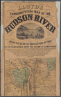
Lloyd's topographical map of …
collection:
Maps of New York City and
State
m
Lloyd's Topographical map of …
collection:
Maps of New York City and
State
A sketch of the operations of…
collection:
Maps of New York City and
State
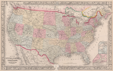
Map of the
United
States
, and territories
… of the
United
States
of America.
1
2
Previous
Next
1
2
Previous
Next