Click to visit the main New York Public Library Homepage
The New York Public Library
Digital Collections
About Digital Collections
Browse
Search only public domain materials
Items
Collections
Divisions
Home
Search
Browse
About
Search only public domain materials
Items
Collections
Divisions
Digital Collections
Using Images
Using Data
Collections
Charting America: Maps from the Lawrence H. Slaughter Collection and Others
Charting America: Maps from the Lawrence H. Slaughter Collection and Others
Navigation
Filters
Charting America: Maps from the Lawrence H. Slaughter Collection and Others
Previous
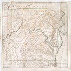
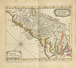
The south part of Virginia, now the north part of Carolina
0
Atlases, gazetteers, guidebooks and other books
377
Maps of the World
16
Maps of the Oceans
24
Maps of North and South America
23
Maps of North America.
551
Maps of New York City and State
1340
Lawrence H. Slaughter Collection of English maps, charts, globes, books and atlases
1020
John H. Levine Collection
60
More
Show filters
Hide filters
Show Only Public Domain
topic
Administrative and political divisions
340
Railroads
316
Real property
301
Landowners
215
City planning
124
More
Less
name
New York (N.Y.). Common Council
98
Moll, Herman, -1732
79
Colles, Christopher, 1738-1816
54
Tiebout, Cornelius, 1777-1832
54
Valentine, D. T. (David Thomas), 1801-1869
49
More
Less
collection
Maps of New York City and State
1999
Lawrence H. Slaughter Collection of English maps, charts, globes, books and atlases
379
Atlases, gazetteers, guidebooks and other books
67
John H. Levine Collection
28
Maps of North and South America
7
More
Less
place
New York (State)
1292
New York (N.Y.)
624
New York
523
Manhattan (New York, N.Y.)
339
Brooklyn (New York, N.Y.)
266
More
Less
genre
x
Maps
Cadastral maps
183
Manuscript maps
71
Aerial views
30
Topographic maps
29
More
Less
publisher
publisher not identified
118
Printed for Robert Sayer, No. 53, Fleet-Street
44
Printed for Timothy Childe at the White Hart at the West-end of St. Paul's Church-yard
44
s.n
41
G.W. & C.B. Colton & Co
33
More
Less
division
Map Division
2486
Manuscripts and Archives Division
2
type
cartographic
2475
still image
27
text
24
Date Range
to
2,488 results found for:
x
New York (State)?tab=filter
Filtering on:
x
Genre
: Maps
Sort by:
Relevance
Title
Date created
Date digitized
Sequence
… and
states
: also
use:
… partner (e.g.,
New
York
New
York
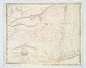
province. Map of the country
use:
… partner (e.g.,
New
York
Novae insvlae XXVI nova tabvla
use:
… partner (e.g.,
New
York
Province de
New
-
York
: en 4 feuilles
use:
… partner (e.g.,
New
York
A
new
and accurat map of the world
use:
… partner (e.g.,
New
York
… of
New
-
York
in North
use:
… partner (e.g.,
New
York
m
… of
New
-
York
in North
use:
… partner (e.g.,
New
York
State
of
New
-
York
for Spafford's gazetteer
use:
… partner (e.g.,
New
York
A map of the
State
of
New
York
use:
… partner (e.g.,
New
York
Die Neüwen Inseln so hinder H…
use:
… partner (e.g.,
New
York
Isothermal chart, or, View of…
use:
… partner (e.g.,
New
York
A map of the
State
of
New
York
use:
… partner (e.g.,
New
York
Nouvelle carte de la Pensylva…
use:
… partner (e.g.,
New
York
Nouvelle carte de la Caroline
use:
… partner (e.g.,
New
York
A map of the
state
of
New
York
: compiled
use:
… partner (e.g.,
New
York
Moral and political chart of …
use:
… partner (e.g.,
New
York
… of the United
States
of America
use:
… partner (e.g.,
New
York
A map of the
state
of
New
York
: exhibiting
use:
… partner (e.g.,
New
York
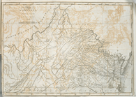
The
state
of Virginia : from the best
use:
… partner (e.g.,
New
York
America
use:
… partner (e.g.,
New
York
A map of the
State
of
New
York
: exhibiting
use:
… partner (e.g.,
New
York
… for the report of the
New
York
use:
… partner (e.g.,
New
York
An Accurate map of
New
York
in North
use:
… partner (e.g.,
New
York
The
state
of Virginia : from the best
use:
… partner (e.g.,
New
York
… of the
state
of
New
York
use:
… partner (e.g.,
New
York
m
Map of
New
York
exhibiting the post offices
use:
… partner (e.g.,
New
York
Map of
New
-
York
: on the improved plan of Sidney E
use:
… partner (e.g.,
New
York
… : including part of
New
Jersey,
New
York
, Staten
use:
… partner (e.g.,
New
York
Map of the
State
of
New
York
use:
… partner (e.g.,
New
York
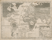
The world, on Mercator's proj…
use:
… partner (e.g.,
New
York
D'Engelze volkplanting in Vir…
use:
… partner (e.g.,
New
York
Map of the
State
of
New
York
use:
… partner (e.g.,
New
York
Map of the
State
of
New
York
use:
… partner (e.g.,
New
York
Map of the meetings constituting
New
York
Yearly
use:
… partner (e.g.,
New
York
m
Map of the route of the proposed
New
York
& Erie
use:
… partner (e.g.,
New
York
m
Map of the
state
of
New
York
use:
… partner (e.g.,
New
York
Carte de la Nouvelle
York
: y-compris
use:
… partner (e.g.,
New
York
Map of the
state
of
New
York
use:
… partner (e.g.,
New
York
Map of the
state
of
New
York
: compiled
use:
… partner (e.g.,
New
York
Map of the
state
of
New
York
: compiled
use:
… partner (e.g.,
New
York
Map of the
state
of
New
York
: compiled
use:
… partner (e.g.,
New
York
Map of the
state
of
New
York
: compiled
use:
… partner (e.g.,
New
York
Newengland and
New
York
.
use:
… partner (e.g.,
New
York
Map of the
state
of
New
York
: compiled
use:
… partner (e.g.,
New
York
A
new
map of
New
England and
New
York
use:
… partner (e.g.,
New
York
Map of the
state
of
New
York
: showing
use:
… partner (e.g.,
New
York
Carolina newly discribed
use:
… partner (e.g.,
New
York
New
England and
New
York
use:
… partner (e.g.,
New
York
Map of the
state
of
New
York
: showing
use:
… partner (e.g.,
New
York
Part of North America: compre…
use:
… partner (e.g.,
New
York
1
2
3
4
5
6
7
8
9
10
Previous
Next
1
2
3
4
5
6
7
8
9
10
Previous
Next