+ o - ^
previous next

A map of the country between Albemarle Sound and Lake Erie : comprehending the whole of Virginia, Maryland, Delaware and Pennsylvania, with parts of several other of the United States of America

More Details Cite This Item

View this item elsewhere:

Title
A map of the country between Albemarle Sound and Lake Erie : comprehending the whole of Virginia, Maryland, Delaware and Pennsylvania, with parts of several other of the United States of America
Names
Jefferson, Thomas, 1743-1826 (Author)
Neele, Samuel John, 1758-1824 (Engraver)
Collection

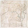
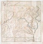
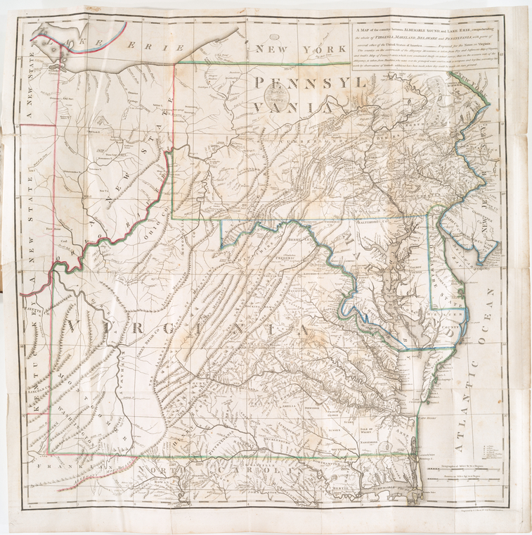
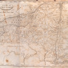
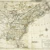
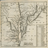
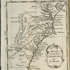
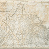
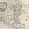
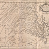
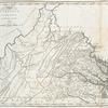
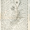
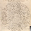
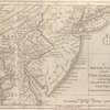
Lawrence H. Slaughter Collection of English maps, charts, globes, books and atlases

Atlases

Notes on the state of Virginia; written in the year 1781, somewhat corrected and enlarged in the winter of 1782, for the use of a foreigner of distinction, in answer to certain queries proposed by him ...

Dates / Origin
Date Issued: 1785
Place: [Paris]
Library locations
Lionel Pincus and Princess Firyal Map Division
Shelf locator: Map Div. 97-6327 [LHS 99; atlas cases]
Shelf locator: Map Div. 97-6327 (Folded plate at end) [In LHS 99]
Topics
Middle Atlantic States -- Maps -- Early works to 1800
Virginia
Delaware
Maryland
Pennsylvania
Genres
Maps
Notes
Content: The country on the eastern side of the Alleganey Mountains, is taken from Fry and Jefferson's Map of Virginia and Scull's Map of Pennsylvania ... that on the western side of the Alleganey, is taken from Hutchins ... additions have been made, where they could be made on sure ground.
Content: "Engraved for the Notes on Virginia."
Content: Lawrence H. Slaughter Collection ; 220.
Content: National Endowment for the Humanities Grant for Access to Early Maps of the Middle Atlantic Seaboard.
Content: Prime meridian: Philadelphia.
Content: Relief shown pictorially.
Content: Shows boundaries.
Statement of responsibility: engraved by S. J. Neele, No. 352 Strand, London.
Physical Description
Extent: 1 map : hand col. ; 59 x 59 cm., folded to 19 x 11 cm.
Type of Resource
Cartographic
Identifiers
RLIN/OCLC: 42266960
NYPL catalog ID (B-number): b14293655
RLIN/OCLC: 48136330
NYPL catalog ID (B-number): b15253458
Universal Unique Identifier (UUID): 72d8e770-c5d3-012f-6b8b-58d385a7bc34
Rights Statement
The New York Public Library believes that this item is in the public domain under the laws of the United States, but did not make a determination as to its copyright status under the copyright laws of other countries. This item may not be in the public domain under the laws of other countries. Though not required, if you want to credit us as the source, please use the following statement, "From The New York Public Library," and provide a link back to the item on our Digital Collections site. Doing so helps us track how our collection is used and helps justify freely releasing even more content in the future.

Item timeline of events

  • 1743: Creator Born
  • 1785: Issued
  • 1826: Creator Died
  • 2015: Digitized
  • 2024: Found by you!
  • 2025

MLA Format

Lionel Pincus and Princess Firyal Map Division, The New York Public Library. "A map of the country between Albemarle Sound and Lake Erie : comprehending the whole of Virginia, Maryland, Delaware and Pennsylvania, with parts of several other of the United States of America" The New York Public Library Digital Collections. 1785. https://digitalcollections.nypl.org/items/510d47da-f2d0-a3d9-e040-e00a18064a99

Chicago/Turabian Format

Lionel Pincus and Princess Firyal Map Division, The New York Public Library. "A map of the country between Albemarle Sound and Lake Erie : comprehending the whole of Virginia, Maryland, Delaware and Pennsylvania, with parts of several other of the United States of America" New York Public Library Digital Collections. Accessed March 19, 2024. https://digitalcollections.nypl.org/items/510d47da-f2d0-a3d9-e040-e00a18064a99

APA Format

Lionel Pincus and Princess Firyal Map Division, The New York Public Library. (1785). A map of the country between Albemarle Sound and Lake Erie : comprehending the whole of Virginia, Maryland, Delaware and Pennsylvania, with parts of several other of the United States of America Retrieved from https://digitalcollections.nypl.org/items/510d47da-f2d0-a3d9-e040-e00a18064a99

Wikipedia Citation

<ref name=NYPL>{{cite web | url=https://digitalcollections.nypl.org/items/510d47da-f2d0-a3d9-e040-e00a18064a99 | title= (cartographic) A map of the country between Albemarle Sound and Lake Erie : comprehending the whole of Virginia, Maryland, Delaware and Pennsylvania, with parts of several other of the United States of America, (1785) |author=Digital Collections, The New York Public Library |accessdate=March 19, 2024 |publisher=The New York Public Library, Astor, Lenox, and Tilden Foundations}}</ref>

A map of the country between Albemarle Sound and Lake Erie : comprehending the whole of Virginia, Maryland, Delaware and Pennsylvania, with parts of several other of the United States of America