Click to visit the main New York Public Library Homepage
The New York Public Library
Digital Collections
About Digital Collections
Browse
Search only public domain materials
Items
Collections
Divisions
Home
Search
Browse
About
Search only public domain materials
Items
Collections
Divisions
Digital Collections
Using Images
Using Data
Collections
Charting America: Maps from the Lawrence H. Slaughter Collection and Others
Charting America: Maps from the Lawrence H. Slaughter Collection and Others
Navigation
Filters
Charting America: Maps from the Lawrence H. Slaughter Collection and Others
Previous
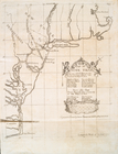
The south part of Virginia, now the north part of Carolina
0
Atlases, gazetteers, guidebooks and other books
377
Maps of the World
16
Maps of the Oceans
24
Maps of North and South America
23
Maps of North America.
551
Maps of New York City and State
1340
Lawrence H. Slaughter Collection of English maps, charts, globes, books and atlases
1020
John H. Levine Collection
60
More
Show filters
Hide filters
Show Only Public Domain
topic
Nautical charts
14
History
3
Indian land transfers
3
Land grants
3
Pilot guides
3
More
Less
name
Fisher, Joshua, 1707-1783
5
Blunt, Edmund M. (Edmund March), 1770-1862
4
Alexander, James, 1691-1756
3
Blunt, G. W. (George William), 1802-1878
3
Bond, Benjamin
3
More
Less
collection
x
Lawrence H. Slaughter Collection of English maps, charts, globes, books and atlases
place
x
New Jersey
New York (N.Y.)
15
Delaware
10
Delaware Bay (Del. and N.J.)
8
Delaware River (N.Y.-Del. and N.J.)
6
More
Less
genre
Maps
27
publisher
Printed by James Parker, and a few Copies are to be Sold by him, and Benjamin Franklin, in Philadelphia;
3
Pub. by E.M. Blunt for W. Hooker
3
Published ... by Andrew Dury, Duke's Court, St. Martins Lane
2
... Sold ... by Tho. Bowles, print and map-seller in St. Paul's-Churchyard
1
Chéz Le Rouge, rue des grands Augustins
1
More
Less
division
Map Division
27
type
cartographic
26
text
1
Date Range
to
27 results found for:
x
New York (N.Y.)?tab=filter
Filtering on:
x
Place
: New Jersey
x
Collection
: 6a373d50-c5d3-012f-a6fb-58d385a7bc34
Sort by:
Relevance
Title
Date created
Date digitized
Sequence
Nova Svecia
use:
… partner (e.g.,
New
York
… : including part of
New
Jersey,
New
York
, Staten
use:
… partner (e.g.,
New
York
New
Iarsey
use:
… partner (e.g.,
New
York
m
…
York
,
New
Jersey
use:
… partner (e.g.,
New
York
A map of
New
Jersey …
use:
… partner (e.g.,
New
York
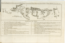
Plan de la Bataille de Montmo…
use:
… partner (e.g.,
New
York
A map of
New
England,
New
York
,
New
use:
… partner (e.g.,
New
York
…. occident seu West
N
. Iersey
use:
… partner (e.g.,
New
York
Entrance to
New
York
Bay from Sandy
use:
… partner (e.g.,
New
York
Nautical chart of Little Egg Harbour,
New
use:
… partner (e.g.,
New
York
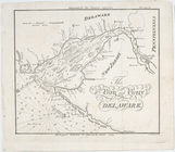
The Bay and river of Delaware
use:
… partner (e.g.,
New
York
… in the chancery of
New
Jersey
use:
… partner (e.g.,
New
York
… in the chancery of
New
Jersey
use:
… partner (e.g.,
New
York
… in the chancery of
New
-Jersey
use:
… partner (e.g.,
New
York
Bowles's
new
pocket
use:
… partner (e.g.,
New
York
A mapp of
New
Jersey in America.
use:
… partner (e.g.,
New
York
A chart of Delaware Bay and R…
use:
… partner (e.g.,
New
York
A chart of Delaware Bay and R…
use:
… partner (e.g.,
New
York
A chart of Delaware Bay and R…
use:
… partner (e.g.,
New
York
A chart of Delaware Bay and R…
use:
… partner (e.g.,
New
York
Baye de la Delaware avec les …
use:
… partner (e.g.,
New
York
A chart of Delawar River from…
use:
… partner (e.g.,
New
York
The bay and river of Delaware
use:
… partner (e.g.,
New
York
… England,
New
York
,
New
use:
… partner (e.g.,
New
York
A draught of
New
York
and Perthamboy
use:
… partner (e.g.,
New
York
A chart of
New
York
Harbour : with the banks
use:
… partner (e.g.,
New
York
… in the Province of
New
Jersey
use:
… partner (e.g.,
New
York
End of results
|
Top