Click to visit the main New York Public Library Homepage
The New York Public Library
Digital Collections
About Digital Collections
Browse
Search only public domain materials
Items
Collections
Divisions
Home
Search
Browse
About
Search only public domain materials
Items
Collections
Divisions
Digital Collections
Using Images
Using Data
Collections
Charting America: Maps from the Lawrence H. Slaughter Collection and Others
Charting America: Maps from the Lawrence H. Slaughter Collection and Others
Navigation
Filters
Charting America: Maps from the Lawrence H. Slaughter Collection and Others
Previous
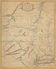
The south part of Virginia, now the north part of Carolina
0
Atlases, gazetteers, guidebooks and other books
377
Maps of the World
16
Maps of the Oceans
24
Maps of North and South America
23
Maps of North America.
551
Maps of New York City and State
1340
Lawrence H. Slaughter Collection of English maps, charts, globes, books and atlases
1020
John H. Levine Collection
60
More
Show filters
Hide filters
Show Only Public Domain
topic
Administrative and political divisions
282
Railroads
264
Real property
249
Landowners
182
City planning
105
More
Less
name
New York (N.Y.). Common Council
87
Mitchell, S. Augustus (Samuel Augustus), 1792-1868
49
Moll, Herman, -1732
41
Wells, Edward, 1667-1727
41
Dripps, M. (Matthew)
39
More
Less
collection
Maps of New York City and State
1385
Lawrence H. Slaughter Collection of English maps, charts, globes, books and atlases
262
Atlases, gazetteers, guidebooks and other books
85
John H. Levine Collection
13
Maps of the World
5
More
Less
place
New York (State)
930
New York (N.Y.)
464
New York
362
Manhattan (New York, N.Y.)
252
Brooklyn (New York, N.Y.)
206
More
Less
genre
Maps
1744
Cadastral maps
151
Manuscript maps
52
Topographic maps
24
Road maps
23
More
Less
publisher
publisher not identified
72
S. A. Mitchell, jr
42
Printed at the Theater,
38
G.W. & C.B. Colton & Co
33
s.n
30
More
Less
division
Map Division
1755
Manuscripts and Archives Division
2
type
cartographic
1736
text
26
still image
14
Date Range
to
1,758 results found for:
North Hempstead (N.Y. : Town) -- Maps?tab=filter
Sort by:
Relevance
Title
Date created
Date digitized
Sequence
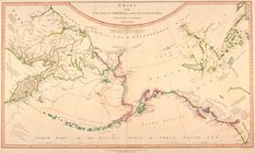
Chart of the
N
.W
collection:
Chart of the
N
Pacific Ocean showing part of
North
note:
… coast of
North
America as far
north
Newfoundland.
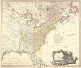
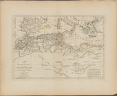
The United States of
North
America
note:
… to Early
Maps
of the Middle
…, Ludovicianae,
N
. Angliae
m
Johnson's Physical
Map
…
Ethnographic
map
of the world showing
Map
showing locations of Delafield
note:
Missing small section of
map
…
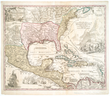
map
of the British colonies in
North
America
note:
… to Early
Maps
of the Middle
A compleat
map
of the West Indies, containing
A new
map
of the United States of
North
note:
London, Printed for Rob[er]t Sayer,
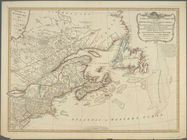
Map
& Sea
North
America, with the West Indies, wherein
America
North
and South and the West
A
map
of Barbary, containing the Kingdoms
A
map
of Abyssinia and Nubia
A
map
of the countries and places
Part IId. of the compleat
map
of the Holy
A compleat
map
of the Holy Land ; adapted
A
map
of Chinese Tartary, with Corea
A complete
map
of the East Indies, exhibiting
A
map
of independent Tartary
A
map
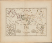
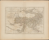
of Turkey in Asia, containing
note:
… of Jan[uar]
y
1788.
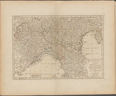
The
North
part of Italy ...
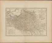
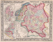
A new
map
of the Kingdom of Poland with all
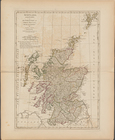
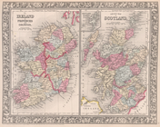
Scotland, and its islands ; or the
north
A new and compendious
map
of England
A
map
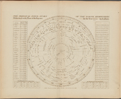
exhibiting the dark shadow of the moon
The principal fixed stars of the
North
The contents of the
maps
in cosmography
An Accurate
map
of New York in
North
note:
… to Early
Maps
of the Middle
… States. [W, X,
Y
, Z]
… States. [
N
, O]
… States. [M,
N
]
Map
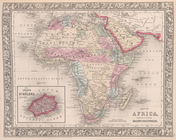
of Africa, showing its most recent
Map
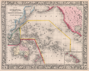
of Oceanica
Map
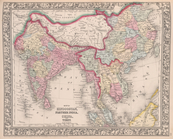
of Hindoostan, Farther India, China
Map
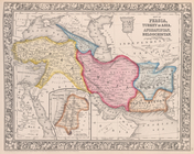
of Persia, Turkey in Asia
Map
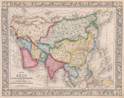
of Asia, showing gt. political
Map
of the Austrian Empire, Italian States
County
map
of Scotland ; Shetland Islands
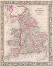
County
map
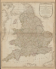
of England and Wales.
Map
of France, Spain, and Portugal
…, Sweden, and Norway ;
Map
of Denmark;
Map
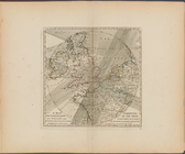
of Holland
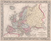
Map
of Europe, showing its gt. political
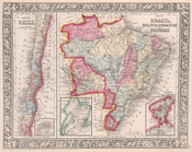
Map
of Brazil
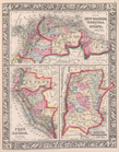
Map
of New Granada
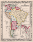
Map
of South
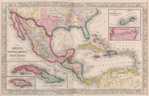
Map
of Mexico
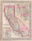
County
map
California;
Map
note:
…, Arizona - see
Map
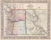
Map
of Oregon, Washington and part of Idaho.
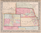
Map
of Kansas, Nebraska, and Colorado
1
2
3
4
5
6
7
8
Previous
Next
1
2
3
4
5
6
7
8
Previous
Next