Click to visit the main New York Public Library Homepage
The New York Public Library
Digital Collections
About Digital Collections
Browse
Search only public domain materials
Items
Collections
Divisions
Home
Search
Browse
About
Search only public domain materials
Items
Collections
Divisions
Digital Collections
Using Images
Using Data
Search
Filtered search
Show filters
Hide filters
Show Only Public Domain
topic
History
153
Real property
142
Geography
139
Landowners
115
Maps
115
More
Less
name
Faden, William, 1749-1836
106
Jomard, M. (Edme-François), 1777-1862
87
Napoleon I, Emperor of the French, 1769-1821
85
Carey, Mathew, 1760-1839
81
Burr, David H., 1803-1875
64
More
Less
collection
Bancker plans
893
Maps of North America
551
Lawrence H. Slaughter Collection of English maps, charts, globes, books and atlases
475
Maps of New York City and State
182
Atlases, gazetteers, guidebooks and other books
163
More
Less
place
United States
320
New York (State)
261
New York (N.Y.)
196
North America
151
Great Britain
146
More
Less
genre
Maps
3026
Surveys
911
land surveys
785
Prints
255
Documents
116
More
Less
publisher
Impr. impériale
85
publisher not identified
76
s.n
62
M. Carey
60
Published by Wm. Faden, geographer to His Majesty, and His R.H. the Prince of Wales
53
More
Less
division
Map Division
1597
Manuscripts and Archives Division
919
Rare Book Division
199
General Research Division
180
Wallach Division: Print Collection
52
More
Less
type
x
cartographic
text
200
still image
41
Date Range
to
3,100 results found
Filtering on:
x
Date
: 1747 - 1834
x
Type
: cartographic
Sort by:
Title
Date created
Date digitized
Sequence
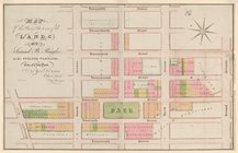
A map of Carolina, Florida an…
Plan of the town of Paramarib…
A map of Dutch settlements of…
Nieuwe kaart van Suriname : v…
Isothermal chart, or, View of…
m
Plano.: de la Ysla de Sn. Jua…
m
A chart of the discoveries of…
m
A New and Accurate Map of the…
A new map of Africa from the …
Map of Virginia, Maryland and…
A map of New Jersey : from th…
Colony of Liberia, on the Wes…
m
Carte trigonométrique des côt…
Chart of part of the Coast of…
Map of the Lower Division of …
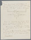
Memo showing plan of new stre…
Amerika ĕst nor Ashkharhagrak…
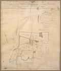
Survey of part of the Grange …
Map and survey of lands of up…
Great Falls of Columbia River
Plan of the town of York Haven
Plan of Conewago Canal
m
H.M.S. Aeolus and H.M.S. Norw…
Pennsylvania and Maryland map
Settlements of the Swiss past…
m
Township of Franklin situate …
m
Franklinville with privileges…
m
Carte d'une partie de l'Etat …
Map of the American Coast, fr…
Pennsylvania - Paoli, Chester…
A perspective view of Lake Ge…
Carte de l'Ancien Continent.
Carte du Nouveau Continent.
[La Carte]
Carte des deux Régions Polair…
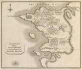
A map of the south part of th…
A chorographical map of the P…
Plan of the city and fortific…
East India Islands
A map of the world from the b…
A map of the icy sea in which…
Plan de Quito Capitale de la …
Plan de la ville Tartare de P…
Det gamle Norge
Ancient Italy
Countries adjacent to the Med…
A map of Barbary comprehendin…
m
Rough dr of Jn Devoor's farm
m
Nicholas Carmer and Mary Clar…
m
1800 October 29
1
2
3
4
5
6
7
8
9
10
…
12
13
Previous
Next
1
2
3
4
5
6
7
8
9
10
…
12
13
Previous
Next