Click to visit the main New York Public Library Homepage
The New York Public Library
Digital Collections
About Digital Collections
Browse
Search only public domain materials
Items
Collections
Divisions
Home
Search
Browse
About
Search only public domain materials
Items
Collections
Divisions
Digital Collections
Using Images
Using Data
Search
Filtered keyword search
Show filters
Hide filters
Show Only Public Domain
topic
Railroads
4
Altitudes
3
Roads
3
Administrative and political divisions
2
Parks
2
More
Less
name
Guyot, A. (Arnold), 1807-1884
3
Sandoz, Ernest
3
Schedler, J. (Joseph)
3
Bien, Julius, 1826-1909
2
Geological Survey (U.S.)
2
More
Less
collection
Atlases of New York City
40
Maps of North America
13
Maps of New York City and State
10
place
Staten Island (New York, N.Y.)
39
New York (State)
9
New York
4
Bronx (New York, N.Y.)
3
Catskill Mountains (N.Y.)
3
More
Less
genre
x
Topographic maps
Maps
63
Cadastral maps
1
Manuscript maps
1
publisher
C. Scribner's Sons
3
publisher not identified
3
Northern Transcontinental Survey?
2
Topographical Bureau
2
Department of Public Parks
1
More
Less
division
Map Division
63
type
cartographic
63
text
1
Date Range
to
63 results found for:
x
Roads
Filtering on:
x
Genre
: Topographic maps
Sort by:
Relevance
Title
Date created
Date digitized
Sequence
m
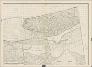
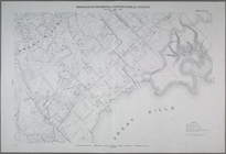
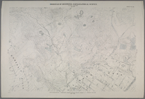
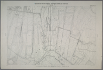
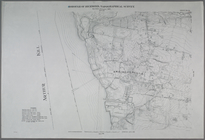
Map or plan of streets,
roads
, avenues
topic:
Roads
Topographical map of the stat…
note:
…,
roads
, drainage
Yellowstone National Park
abstract:
Shows continental watershed,
roads
, trails
Map of the White Mountains of…
note:
Shows cities and towns,
roads
, railroads
Topographical sketch of the g…
abstract:
Shows drainage,
roads
, etc. Relief shown
Map of the town of Roxbury
note:
Topographical map of the town showing
roads
Topographical map showing str…
note:
Shows existing and proposed
roads
in Forest
Map shewing position of 1st B…
note:
Topographic map showing
roads
, railroads
m
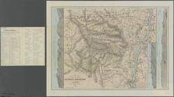
Topographical map of the Wyom…
abstract:
…, wagon
roads
, completed
m
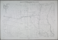
Topographical map of New York…
Map or plan of section 10 [Cr…
abstract:
…, and class of streets,
roads
Topographical map made from s…
note:
Shows cities and towns, streets,
roads
m
Lloyd's topographical map of …
note:
…,
roads
, buildings
Colorado : Aspen special map
abstract:
Shows townships, sections, railroads,
roads
m
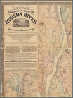
Map of the Catskill Mountains
note:
Shows
roads
and railroads.
Map of the Catskill Mountains
note:
Shows
roads
and railroads.
m
Map of the Catskill Mountains
note:
Shows
roads
and railroads.
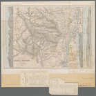
Map of Utah territory: repres…
abstract:
Shows railroads, wagon
roads
Preliminary agricultural map …
abstract:
Shows drainage,
roads
, land
Topographical map of the stat…
note:
Shows counties, cities and towns,
roads
m
Preliminary agricultural map …
abstract:
Shows drainage,
roads
, land
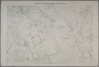
…. [Includes Richmond Hill
Road
, Forest Hill
Road
, Old
…. [Includes Port Richmond
Road
, Manor
Road
, Bradley
…
Road
, Midland
Road
, Great Kills
Road
…
Road
and Richmond
Road
.]
…, Forest Hill
Road
and port Richmond
Road
(Willow Brook).]
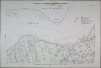
…. [Includes Fresh Kills
Road
(Arthur Kills
Road
) Green
…, (Arthur Kill
Road
) Fresh Kills
Road
and Olive
…. [Includes Annadale
Road
and Amboy
Road
in Annadale.]
…, Fresh Kills
Road
(Arthur Kill
Road
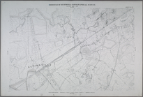
…, Amboy
Road
, Seguine Avenue, Fosters
Road
…, Manor
Road
, Egbert
…, Fingerboard
Road
, Richmond
Road
, Duncan Street
…. [Includes Fingerboard
Road
, Old Town
Road
…
Road
) Fresh Kills
Road
…
Road
, Wilson Avenue
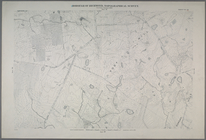
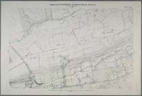
…. [Includes Clove
Road
…. [Includes Richmond
Road
…, (Elizabeth Grove
Road
… to Watchogue
Road
, and from
…, Signs
Road
in New
…, Todt Hill
Road
… Corners
road
, Liberty
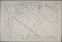
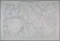
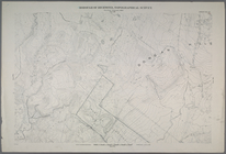
Sheet No. 54. [Includes Mill
Road
, Sea
…, Fresh Kills
Road
… and Annadale
Road
.]
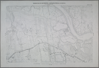
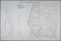
…
Road
and Southside
… Kills
Road
, Winant
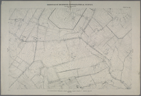
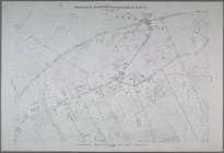
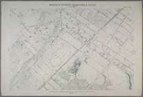
Sheet No. 81. [Includes Sharrotts
Road
Sheet No. 82. [Includes Sharrotts
Road