Click to visit the main New York Public Library Homepage
The New York Public Library
Digital Collections
About Digital Collections
Browse
Search only public domain materials
Items
Collections
Divisions
Home
Search
Browse
About
Search only public domain materials
Items
Collections
Divisions
Digital Collections
Using Images
Using Data
Search
Filtered search
Show filters
Hide filters
Show Only Public Domain
topic
Real property
10889
Fire insurance
5305
Cities & towns
5007
City planning
1087
Social conditions
942
More
Less
name
Sanborn Map Company
5108
G.W. Bromley & Co
2551
New York (N.Y.). City Planning Commission
980
M.I.T. Press
942
Bromley, George Washington
857
More
Less
collection
Atlases of New York City
11592
Atlases of the United States
3839
Maps of North America
3345
Maps of New York City and State
2057
Lawrence H. Slaughter Collection of English maps, charts, globes, books and atlases
1248
More
Less
place
New York (State)
13151
New York
4862
New York (N.Y.)
3351
Manhattan (New York, N.Y.)
2239
Brooklyn (New York, N.Y.)
1212
More
Less
genre
Maps
23265
Atlases
3762
Topographic maps
1050
Cadastral maps
594
Nautical charts
394
More
Less
publisher
Sanborn Map Company
5145
G.W. Bromley & Co
2371
MIT Press
942
E. Belcher Hyde
807
K.u.K. Militargeographisches Institut
774
More
Less
division
Map Division
23798
type
cartographic
22270
still image
1222
text
755
Date Range
to
23,798 results found
Filtering on:
x
Location
: Map Division
For more division details, visit the
Lionel Pincus and Princess Firyal Map Division division page
.
Sort by:
Title
Date created
Date digitized
Sequence
Results 3001 - 3050
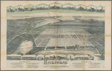
Riverhead, the home resort of…
Map of an exploring expeditio…
Chase's ice map, showing loca…
Map of Richland, Oswego Co. N…
Portions of 1st, 2nd, and 3rd…
Topographical map of New York…
m
Topographical map of Union Co…
m
Map of the counties of Bergen…
m
Topographical map of the Dist…
m
Northern New Jersey, showing …
m
Map of the Department of Dako…
m
Map of the Department of the …
m
Panoramic views
Map of the city of Concord, N…
Leavitt's map with views of t…
Map of Bar Harbor, Maine, 1896
Map of Somerset Co., Maine
m
Colton's map of the states an…
Penacook, N.H.: [bird's eye v…
A map of the White Mountains …
Railway map of the New Englan…
The province of Maine: from t…
Map of the city of Worcester …
Map of the city of Waltham, M…
Map of the territory of the […
Map of Boston in the state of…
Plan of Springfield: [Massach…
The North Shore and part of M…
Plan of the Neponset River an…
Plan of the harbour of Boston…
Map of Salem and surrounding …
Coastal chart of the Massachu…
Plan of the cemetery of Mount…
Preliminary chart of Ipswich …
Map of Boston for 1884: publi…
Plan of land & water lots of …
Map of the country about Bost…
Plan showing encroachments up…
Map showing horse rail roads …
Map of the Town of Milford an…
m
City of Washington, statistic…
Railroad and county map of Ar…
Arkansas : map of the Arkansa…
Arkansas
New township map of the state…
Pennsylvania : eastern part
The Matthews-Northrup up-to-d…
A new map of Arkansas
Map of the lands known as the…
A diagram of the State of Ala…
1
2
…
10
11
12
13
14
15
16
17
…
95
96
Previous
Next
1
2
…
10
11
12
13
14
15
16
17
…
95
96
Previous
Next