Click to visit the main New York Public Library Homepage
The New York Public Library
Digital Collections
About Digital Collections
Browse
Search only public domain materials
Items
Collections
Divisions
Home
Search
Browse
About
Search only public domain materials
Items
Collections
Divisions
Digital Collections
Using Images
Using Data
Search
Filtered search
Show filters
Hide filters
Show Only Public Domain
topic
Real property
10889
Fire insurance
5305
Cities & towns
5007
City planning
1087
Social conditions
942
More
Less
name
Sanborn Map Company
5108
G.W. Bromley & Co
2551
New York (N.Y.). City Planning Commission
980
M.I.T. Press
942
Bromley, George Washington
857
More
Less
collection
Atlases of New York City
11592
Atlases of the United States
3839
Maps of North America
3345
Maps of New York City and State
2057
Lawrence H. Slaughter Collection of English maps, charts, globes, books and atlases
1248
More
Less
place
New York (State)
13151
New York
4862
New York (N.Y.)
3351
Manhattan (New York, N.Y.)
2239
Brooklyn (New York, N.Y.)
1212
More
Less
genre
Maps
23265
Atlases
3762
Topographic maps
1050
Cadastral maps
594
Nautical charts
394
More
Less
publisher
Sanborn Map Company
5145
G.W. Bromley & Co
2371
MIT Press
942
E. Belcher Hyde
807
K.u.K. Militargeographisches Institut
774
More
Less
division
Map Division
23798
type
cartographic
22270
still image
1222
text
755
Date Range
to
23,798 results found
Filtering on:
x
Location
: Map Division
For more division details, visit the
Lionel Pincus and Princess Firyal Map Division division page
.
Sort by:
Title
Date created
Date digitized
Sequence
Results 3501 - 3550
The Courier Company's map of …
m
Map of Maine, New Hampshire, …
The Matthews-Northrup up-to-d…
The Matthews-Northrup Co.'s n…
Road map of the Albany-Troy d…
Smith's rail road, steam boat…
m
Watson's new county and railr…
m
Map of the United States and …
m
Map of the City of Utica, One…
Map of part of Orange County,…
m
Map of Ulster County, New York
m
Castle Ridge, Tarrytown, West…
m
Map of Mount Vernon and envir…
Map of Chenango County, New Y…
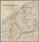
Map of Chautauqua County, N.Y…
Preliminary chart of Muskeget…
Magnus's county map of the Un…
m
Map of the states of Kansas a…
Map of the city of Boston and…
Muskeget Channel, Massachuset…
Plan of the town of Lowell an…
Map of Taunton: [Massachusett…
A plan of the salt marsh and …
Charles River embankment, sec…
Proposed plan of terminal gro…
Map of Boston for 1887: publi…
Map of Boston for 1888
Map of Boston for 1889: publi…
m
A map of the most inhabited p…
Plan of the town of Boston an…
Map of the town of Roxbury
Boston with its environs in 1…
An accurate map of the countr…
Reconnaissance of the western…
Reconnaissance of the western…
Reconnaissance of the western…
Map of Boston
Lines of proposed bridge to C…
Outline of revised plan for t…
Rapid Transit Commission, pla…
The harbor of New Bedford
Map of the township of Spring…
Map of the Town of Milford, M…
m
Map of the city of Springfiel…
Map of Somerville, Arlington …
Plan of proposed Muddy River …
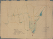
Map of Knollwood, Elmsford, W…
Driving chart of Hartford and…
m
Map of Connecticut
m
Map of northern parts of the …
1
2
…
12
13
14
15
16
17
18
19
…
95
96
Previous
Next
1
2
…
12
13
14
15
16
17
18
19
…
95
96
Previous
Next