Click to visit the main New York Public Library Homepage
The New York Public Library
Digital Collections
About Digital Collections
Browse
Search only public domain materials
Items
Collections
Divisions
Home
Search
Browse
About
Search only public domain materials
Items
Collections
Divisions
Digital Collections
Using Images
Using Data
Search
Filtered keyword search
Show filters
Hide filters
Show Only Public Domain
topic
Railroads
14
Rivers
14
Ferries
13
Canals
11
Real property
11
More
Less
name
A. Brown & Co
8
McCloskey, Henry
5
New York (N.Y.). Aqueduct Commission
4
Welcke, Robert A
4
Cook, Frederick S
3
More
Less
collection
x
Maps of New York City and State
place
New York (State)
49
New York
38
Brooklyn (New York, N.Y.)
23
New York (N.Y.)
14
Manhattan (New York, N.Y.)
7
More
Less
genre
Maps
60
Cadastral maps
5
Manuscript maps
4
Topographic maps
2
Aerial views
1
More
Less
publisher
publisher not identified
6
A. Brown & Co
5
A. Brown
3
Gaylord Watson
3
Aqueduct Commission
2
More
Less
division
Map Division
60
type
cartographic
60
text
3
Date Range
to
60 results found for:
x
East River (N.Y.)
Filtering on:
x
Rights
: Public Domain
x
Collection
: Maps of New York City and State
For more collection details, visit the
Maps of New York City and State collection page
.
Sort by:
Relevance
Title
Date created
Date digitized
Sequence
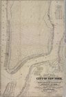
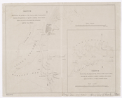
Opening Hell Gate at a cost o…
note:
Also inlcludes manuscript notation "
N.Y
Hell Gate and its approaches
m
Oyster Bay and Huntington, Hu…
… and bulkhead lines for the
east
note:
… and buildings along the
East
River
and the Hudson
Map of the
River
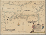
Niagara and vicinity
note:
… of the
East
Boston Timber Co."…
… by Pleasant Ave.,
East
117th Street,
East
River
note:
…ʺ--W 73°55ʹ43ʺ/
N
40°47ʹ50ʺ--
N
40°47ʹ37ʺ)…
Sketch of the Niagara
River
.
m
… into the
East
River
abstract:
…., and the
East
River
. Includes
East
River
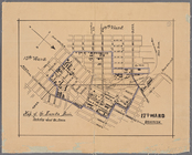
Heights, first ward borough
note:
Shows Astoria Park and taxlots
east
of the park.
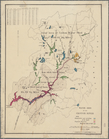
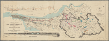
Water shed of the Croton
River
note:
…. Also shows dams,
rivers
New-York and vicinity as prop…
note:
… of the
East
River
, with a proposed New-
East-River
m
… & 35th Street on the
East
River
: showing
collection:
th Street on the
East
River
: showing
… the Glen Dale &
East
River
m
Watson's new map of New York …
note:
…", "Ferries
East
River
", and "Ferries North
River
."…
The course of the
River
St. Laurence
note:
… covers area
east
of the Mississippi
River
.
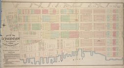
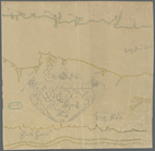
Map of the Rutger's Farm as i…
note:
… and the
East
River
on Manhattan's Lower
East
Side.
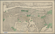
Map of the Eureka Basin, incl…
abstract:
… by
N
. 6th St.,
East
River
, Calyer St
…
River
pipe line also
note:
Covers an area
east
of the Hudson
River
, between
m
… and
East
177th Street
note:
… and
East
177th Street.
m
Watson's new map of New York …
note:
…", "Ferries
East
River
", "Ferries North
River
m
Map of New York City south of…
note:
…, and ferry lines on the
East
River
.
m
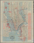
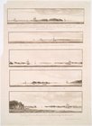
King's birds-eye view of Broo…
note:
Aerial view from
East
River
…, also the
East
River
Old New York, "The Bouwery": …
abstract:
… and landmarks and
East
River
East
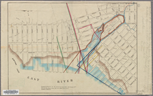
River
from the Battery to Blackwells
note:
… 74°01ʹ07ʺ--W 73°57ʹ30ʺ/
N
40°45ʹ27ʺ--
N
40°42ʹ00ʺ)…
Hammond's complete map of New…
note:
… to the
East
River
.
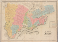
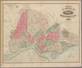
Map of the city of Brooklyn
abstract:
… and
East
River
; does
m
Map of the village of Astoria…
abstract:
… by the
East
River
, 24th Ave
…,
East
River
, New York
note:
… York,
N.Y
., Jan'
y
16
…
River
pipe line
note:
Covers an area
east
of the Hudson
River
, between
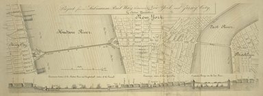
Project for a submarine rail …
note:
…
River
, New York City, and
East
River
.
m
Taunton new guide map and dir…
note:
… & Co., 54
East
Seventh
… and the
East
River
.
Map of property belonging to …
abstract:
….,
East
River
, and Union
m
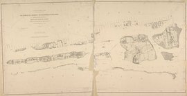
Map of Suffolk Co., L.I., New…
note:
… -- Patchogue --
East
Setauket --
River
Head -- Southold
m
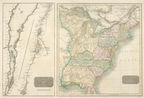
Map of Long Island and adjace…
collection:
… as far
east
as Wading
River
… and the
East
River
: devised
m
Map of the city of Williamsbu…
abstract:
… Clinton Avenue to
East
River
.
…, on the North or Hudsons
River
, and to Crown Point, on the
East
note:
… Water St.
N.Y
."…
Aqueduct Commissioners topogr…
note:
… and
east
from Croton
Aqueduct Commissioners topogr…
abstract:
… and
east
from Croton
… streets between
East
River
note:
40ʺ--W 73°56ʹ28ʺ/
N
40°46ʹ48ʺ--
N
40°45ʹ35ʺ)…
A mappe of Colonel Römers voy…
note:
… land from
east
of the Hudson
River
to Cadragqua
The heart of greater New York…
note:
… Park, New York (
N.Y
.); also the Hudson
River
Views of the entrance to New …
note:
… and
East
rivers
-- [4
… and adjacent shores of
East
and Harlem
Rivers
: from 51st
… in the city of Brooklyn,
N
.
Y
.
abstract:
… and
east
to the Cemetery
m
Higginson's plan of the city …
topic:
Rivers
m
Map of the city of Brooklyn
abstract:
… Street and
east
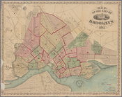
Map of the city of Brooklyn
abstract:
… Street and
east