Click to visit the main New York Public Library Homepage
The New York Public Library
Digital Collections
About Digital Collections
Browse
Search only public domain materials
Items
Collections
Divisions
Home
Search
Browse
About
Search only public domain materials
Items
Collections
Divisions
Digital Collections
Using Images
Using Data
Search
Filtered search
Show filters
Hide filters
Show Only Public Domain
topic
x
Real property
Fire insurance
291
Business enterprises
284
Landowners
273
Cities & towns
271
More
Less
name
Sanborn Map Company
288
Beers, F. W. (Frederick W.)
146
G.M. Hopkins & Co
116
G.W. Bromley & Co
113
Century Map Company
110
More
Less
collection
Atlases of the United States
997
Atlases of New York City
551
Maps of New York City and State
176
Maps of North America
175
Collection of broadside real estate maps announcing auctions of lots in early 19th century New York City
25
More
Less
place
New York (State)
1602
New York
348
Brooklyn (New York, N.Y.)
171
New Jersey
155
New York (N.Y.)
136
More
Less
genre
Maps
1791
Atlases
997
Cadastral maps
275
Title pages
79
Index maps
43
More
Less
publisher
Sanborn Map Company
273
Century Map Company
110
G.W. Bromley & Co
98
F. W. Beers & Co
70
E. Belcher Hyde
66
More
Less
division
Map Division
1906
Milstein Division
14
Schomburg Jean Blackwell Hutson Research and Reference Division
7
No Division
1
type
cartographic
1813
text
156
still image
20
Date Range
to
1,937 results found
Filtering on:
x
Title
: "Classified Business Directory of Erie County, New York (City of Buffalo)"
x
Topic
: Real property
Sort by:
Title
Date created
Date digitized
Sequence
m
Maps of property in the city …
m
Map of the Cedar Knolls, at B…
Schuylerville Business Direct…
References; Waterford [Villag…
Beechers Hollow [Village]; Be…
Map of Saratoga County
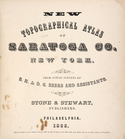
New topographical atlas of Sa…
Acres of Land, Population, Dw…
Table of Distances in Saratog…
Ballston Spa Business Directo…
Grangerville [Village]; Grang…
Corinth [Township]; Palmer Fa…
Clifton Park [Village]; Clift…
Day Corners Business Director…
Crescent [Village]; Crescent …
Galway [Township]; Yorks Corn…
Greenfield [Township]; Pages …
Bloodville [Village]; Bloodvi…
Hadley [Township]; Hadley Bus…
Factory Village [Village]; Fa…
Burnt Hills [Village]; Burnt …
Conklingville [Village]; Conk…
Providence [Township]; Hagedo…
References; Saratoga Springs …
Tracts and farms with street …
Map of Jamaica in the 4th war…
Map of property New York Dock…
Map of Kissena Park, third wa…
Block sketch 1679, New York C…
East River Heights, first war…
Map of 272 lots in the 30th w…
m
Map of the borough of Queens,…
m
Sea Gate, New York Harbor
Map of property in the 19th w…
m
Topographical map of New York…
m
Map of the City of Brooklyn a…
m
Driving road chart of the cou…
Map of portion of greater New…
m
Map of the southern part of W…
m
Map of Ulster County, New York
m
Map of Washington County, New…
Map showing locations of Dela…
Map of the city of San Jose
Harrison's map of Jersey City…
A map of the town of New-ark …
Map of the port & vicinity of…
Subdivision of Block 5 of the…
Map of the city of Detroit, 1…
m
To the honourable House of Re…
m
Map of Bates County, Missouri
1
2
3
4
5
6
7
8
Previous
Next
1
2
3
4
5
6
7
8
Previous
Next