Click to visit the main New York Public Library Homepage
The New York Public Library
Digital Collections
About Digital Collections
Browse
Search only public domain materials
Items
Collections
Divisions
Home
Search
Browse
About
Search only public domain materials
Items
Collections
Divisions
Digital Collections
Using Images
Using Data
Search
Filtered keyword search
Show filters
Hide filters
Show Only Public Domain
topic
Real property
386
Nautical charts
76
Railroads
67
Administrative and political divisions
46
Landowners
46
More
Less
name
Pidgeon, R. H. (Roger H.)
364
E. Robinson Co
312
Robinson, E. (Elisha)
263
United States Coast Survey
67
Bache, A. D. (Alexander Dallas), 1806-1867
61
More
Less
collection
Atlases of New York City
304
Atlases of the United States
223
Maps of New York City and State
196
Maps of North America
175
Lawrence H. Slaughter Collection of English maps, charts, globes, books and atlases
15
More
Less
place
New York (State)
465
New York (N.Y.)
313
New York
249
New Jersey
109
Brooklyn (New York, N.Y.)
72
More
Less
genre
Maps
936
Atlases
223
Nautical charts
60
Cadastral maps
33
Bathymetric maps
30
More
Less
publisher
E. Robinson Co
264
E. Robinson
49
J.M. Lathrop & Company
37
Bien, Joseph R
35
I.B. Culver & Co
32
More
Less
division
Map Division
923
Schomburg Jean Blackwell Hutson Research and Reference Division
6
Wallach Division: Print Collection
6
General Research Division
4
Milstein Division
2
More
Less
type
x
cartographic
text
13
still image
9
Date Range
to
945 results found for:
x
R. N
Filtering on:
x
Type
: cartographic
Sort by:
Relevance
Title
Date created
Date digitized
Sequence
m
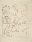
1900 census enumeration distr…
abstract:
… York : August
R
. Ohman
m
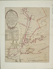
1905 Library map of Manhattan…
abstract:
… in 1902 by August
R
. Ohman
m
1906 Library map of Manhattan…
note:
… in 1902 by August
R
. Ohman
m
1907 Library map of Manhattan…
note:
… in 1906 by August
R
. Ohman
m
1907 Library map of Manhattan…
abstract:
… in 1902 by August
R
. Ohman
m
51 lots to be sold by
R
.
R
. Minturn & Co
collection:
51 lots to be sold by
R.R
. Minturn & Co
A general map of the southern…
note:
… 1:3,000,000 (W 94°--W 73°/
N
37°--
N
24°)…
A Generall chart for the West…
note:
Covers Atlantic Ocean between
N
550
A map of New England, New Yor…
note:
Also available on microfilm in: Sc Micro
R
A map of North America : with…
note:
R
.W. Seale, delin. et sculp.
A map of North America with t…
note:
…, translated by
N
. Tindal
A map of part of the land in …
A map of Philadelphia and par…
note:
By
N
. Scull and G. Heap.
m
A map of Schuylkill County, P…
note:
… 75°45'27"/
N
40°56'59"--
N
A map of the eastern part of …
A map of the eastern part of …
A map of the Genesee country:…
A map of the Genesee lands in…
A map of the Kingdom of Whidah
A map of the Manor Renselaerw…
note:
… (W 74°16ʹ--W 73°16ʹ/
N
42°50ʹ--
N
42°28ʹ).
m
A map of the province of Pens…
note:
…. 1:2,650,000] (W 81̕--W 74̕/
N
43̕--
N
39̕).
A map of the towns of Livings…
note:
… (townships) in
N
.Y. State
A map of ye English empire in…
collection:
I.
N
. Phelps Stokes Collection of American
… & Erie
R
.
R
. Co., 1844, exhibiting the line of the
N
collection:
… of the
N
.Y. & E.
R
. Road
A new & accurate plan of the …
note:
…"Copied from a map belonging to G.
R
. Jackson
A New & Accurate Plan of the …
note:
…. 120 Water Str.
N
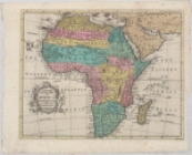
A new and accurate map of Afr…
note:
R
. W. Seale sculp.
A new and accurate map of the…
note:
… of Parliament Dec[embe]
r
1755
A new county map of the state…
A new map of Africa from the …
A new map of New England and …
note:
…., and covers
N
.Y. as far west
A new map of the Cherokee Nat…
note:
…. 1:1,000,000] (W 86°--W 82°/
N
36°--
N
34°)…
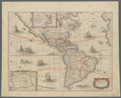
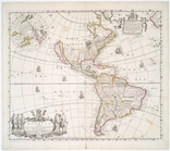
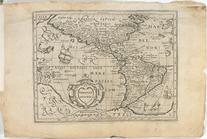
A new mapp of America: devid…
note:
Tooley,
R
.V. Mapping of America, p. 124
A new mapp of America Septent…
A plan of the town and harbou…
collection:
I.
N
. Phelps Stokes Collection of American
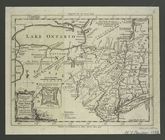
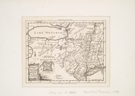
A topographical map of Lewis …
A topographical map of the north.
n
part of New York
note:
…
N
.Y."…
…, Holland,
N
.Y. ; Planing
collection:
…, Marilla, Erie Co.,
N
.Y.,
R
A.
R
. Roessler's latest map of the state
note:
… 92°30ʹ/
N
37°00ʹ--
N
25°45
Africa
Alaska Peninsula and Aleutian…
note:
…. S.
N
. hydrographic
Alaska Peninsula and Aleutian…
note:
…. S.
N
. hydrographic
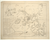
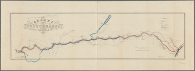
Albany and Susquehanna Railro…
note:
drawn by A. Fischer, A. & S.
R.R
. office
m
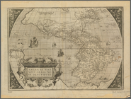
America noviter delineata
note:
…,
R
.V. The Mapping
America,
N
.W. Coast, Strait of Juan de Fuca
note:
… Henry Kellett,
R.N
Americae descrip.
collection:
…. Faithfully represented by
N.N
m
Americae sive novi orbis, nov…
note:
… 22°51ʹ00ʺ/
N
52°38ʹ00ʺ--S
Amerique septentrionale
note:
par
N
. Sanson d'Abbeville, geog. du Roy ; A
An accurate map of Staten Isl…
An accurate map of Staten Isl…
1
2
3
4
Previous
Next
1
2
3
4
Previous
Next