Click to visit the main New York Public Library Homepage
The New York Public Library
Digital Collections
About Digital Collections
Browse
Search only public domain materials
Items
Collections
Divisions
Home
Search
Browse
About
Search only public domain materials
Items
Collections
Divisions
Digital Collections
Using Images
Using Data
Search
Filtered keyword search
Show filters
Hide filters
Show Only Public Domain
topic
Real property
865
Administrative and political divisions
480
Railroads
439
Fire insurance
309
Cities & towns
274
More
Less
name
New York (N.Y.). Board of Estimate and Apportionment
334
Sanborn Map Company
292
G.W. Bromley & Co
153
M.B. Brown Printing and Binding Co
109
Ullitz, Hugo
93
More
Less
collection
Maps of New York City and State
1169
Atlases of New York City
1150
Maps of North America
1063
Atlases of the United States
464
Lawrence H. Slaughter Collection of English maps, charts, globes, books and atlases
304
More
Less
place
New York (State)
1809
New York
807
New York (N.Y.)
770
Manhattan (New York, N.Y.)
400
United States
392
More
Less
genre
Maps
4426
Atlases
452
Cadastral maps
132
Prints
78
Topographic maps
70
More
Less
publisher
Sanborn Map Company
276
New York (N.Y.). Board of Estimate and Apportionment
184
G.W. Bromley & Co
140
publisher not identified
113
M.B. Brown Printing & Binding Co.,
109
More
Less
division
Map Division
4286
Wallach Division: Print Collection
49
Manuscripts and Archives Division
44
Schomburg Jean Blackwell Hutson Research and Reference Division
32
Rare Book Division
21
More
Less
type
x
cartographic
text
103
still image
46
three dimensional object
1
Date Range
to
Looking for this collection?
Maps of New York City and State
2,059 items
4,471 results found for:
x
United States. Circuit Court (New York : Northern District)
Filtering on:
x
Type
: cartographic
Sort by:
Relevance
Title
Date created
Date digitized
Sequence
m
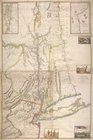
Maps of property in the city of
New
York
use:
… partner (e.g.,
New
York
m
… of the
United
States
use:
… partner (e.g.,
New
York
m
N.Y.C. & H.R.R.R. Electric Zone -
New
York
use:
… partner (e.g.,
New
York
m
1900 census enumeration
districts
use:
… partner (e.g.,
New
York
… the
states
of Guatemala
use:
… partner (e.g.,
New
York
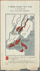
A Really Greater
New
York
as proposed
use:
… partner (e.g.,
New
York
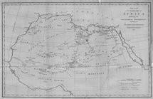
Sketch of the
Northern
Part of Africa
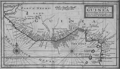
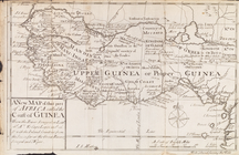
A
New
and Exact Map of Guinea Divided
use:
… partner (e.g.,
New
York
Map of free
states
, slave
states
use:
… partner (e.g.,
New
York
… of the
New
Colony.
use:
… partner (e.g.,
New
York
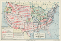
Status of slavery in the
United
States
, 1775-1865
use:
… partner (e.g.,
New
York
Map of the
United
States
and Canada shewing
use:
… partner (e.g.,
New
York
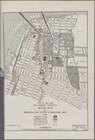
City of
New
York
City Planning
use:
… partner (e.g.,
New
York
A
new
map of North America from the latest
use:
… partner (e.g.,
New
York
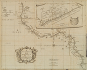
A
new
map of that part of Africa
use:
… partner (e.g.,
New
York
A
new
and correct map of the coast
use:
… partner (e.g.,
New
York
From
New
York
(1) to Stratford
use:
… partner (e.g.,
New
York
Map of the
new
line of defences
use:
… partner (e.g.,
New
York
New
York
City Map
use:
… partner (e.g.,
New
York
… population of
New
York
use:
… partner (e.g.,
New
York
Map of the
New
World
use:
… partner (e.g.,
New
York
…
new
discoveries
use:
… partner (e.g.,
New
York
m
A
New
and Accurate Map of the World
use:
… partner (e.g.,
New
York
Map of
New
York
City showing the spread
use:
… partner (e.g.,
New
York
… and
states
: also
use:
… partner (e.g.,
New
York
New
York
province. Map of the country
use:
… partner (e.g.,
New
York
m
A
new
map of Europe …
use:
… partner (e.g.,
New
York
New
-
York
.
use:
… partner (e.g.,
New
York
…, accompanying Atlas of
New
York
use:
… partner (e.g.,
New
York
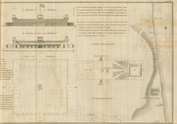
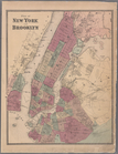
Plate 6: Plan of
New
York
and Brooklyn
use:
… partner (e.g.,
New
York
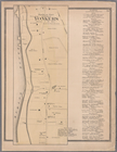
Plate 24:
Northern
part of Town of Yonkers
use:
… partner (e.g.,
New
York
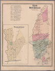
Plate 36: Town of
New
Rochelle
use:
… partner (e.g.,
New
York
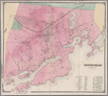
Plate 38:
New
Rochelle, Westchester Co. N
use:
… partner (e.g.,
New
York
Province de
New
-
York
: en 4 feuilles
use:
… partner (e.g.,
New
York
Plan of the town of
York
Haven
use:
… partner (e.g.,
New
York
… of
New
-
York
belonging
use:
… partner (e.g.,
New
York
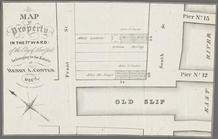
Memo showing plan of
new
street (Irving
use:
… partner (e.g.,
New
York
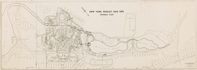
New
York
World's Fair 1939. General plan.
use:
… partner (e.g.,
New
York
New
-
York
.
use:
… partner (e.g.,
New
York
… Lawrence St.,
New
York
use:
… partner (e.g.,
New
York
…,
New
York
and Boston
use:
… partner (e.g.,
New
York
Bronx, Topographical Map Shee…
use:
… partner (e.g.,
New
York
… Washington Ave.,
New
York
use:
… partner (e.g.,
New
York
A
new
and accurat map of the world
use:
… partner (e.g.,
New
York
… of
New
-
York
in North
use:
… partner (e.g.,
New
York
… of the city of
New
York
use:
… partner (e.g.,
New
York
… of
New
York
use:
… partner (e.g.,
New
York
New
-
York
.
use:
… partner (e.g.,
New
York
Plan of the
State
of
New
York
use:
… partner (e.g.,
New
York
… of
New
York
and Brooklyn
use:
… partner (e.g.,
New
York
1
2
3
4
5
6
7
8
9
10
…
17
18
Previous
Next
1
2
3
4
5
6
7
8
9
10
…
17
18
Previous
Next