Click to visit the main New York Public Library Homepage
The New York Public Library
Digital Collections
About Digital Collections
Browse
Search only public domain materials
Items
Collections
Divisions
Home
Search
Browse
About
Search only public domain materials
Items
Collections
Divisions
Digital Collections
Using Images
Using Data
Search
Filtered keyword search
Show filters
Hide filters
Show Only Public Domain
topic
Real property
1490
Fire insurance
220
Cities & towns
185
Administrative and political divisions
137
Railroads
101
More
Less
name
Ullitz, Hugo
702
E.B. Hyde & Co
673
E. Belcher Hyde Map Company
458
Beers, F. W. (Frederick W.)
199
Sanborn Map Company
185
More
Less
collection
Atlases of New York City
1567
Atlases of the United States
922
Maps of North America
364
Maps of New York City and State
211
I. N. Phelps Stokes Collection of American Historical Prints
69
More
Less
place
New York (State)
1713
New York
836
Brooklyn (New York, N.Y.)
554
New York (N.Y.)
431
Maps
409
More
Less
genre
Maps
3333
Atlases
923
Prints
137
Illustrations
78
Cadastral maps
60
More
Less
publisher
E. Belcher Hyde
774
Sanborn Map Company
242
F. W. Beers & Co
148
E.B. Hyde & Co
116
E. Belcher-Hyde
112
More
Less
division
Map Division
3147
Wallach Division: Print Collection
74
Schomburg Manuscripts, Archives and Rare Books Division
54
Schomburg Jean Blackwell Hutson Research and Reference Division
49
General Research Division
46
More
Less
type
x
cartographic
text
53
still image
46
Date Range
to
3,425 results found for:
x
B
Filtering on:
x
Type
: cartographic
Sort by:
Relevance
Title
Date created
Date digitized
Sequence
Results 1501 - 1550
Preliminary chart of Monomoy …
parent:
bac116a0-
b
143-0132-83cb-58d385a7bbd0
Map of New Orleans and Jeffer…
parent:
a533ff30-221e-0135-88ea-23
b
2c52748ca
Map bounded by Atlantic Ocean…
parent:
e39976
b
0-c5fc-012f-adfb-58d385a7bc34
Map bounded by New York Bay, …
parent:
e39976
b
0-c5fc-012f-adfb-58d385a7bc34
Map bounded by Gravesend Bay,…
parent:
e39976
b
0-c5fc-012f-adfb-58d385a7bc34
Map bounded by Surf Ave., Nep…
parent:
e39976
b
0-c5fc-012f-adfb-58d385a7bc34
Map bounded by W. 28th St., N…
parent:
e39976
b
0-c5fc-012f-adfb-58d385a7bc34
Map bounded by Warehouse Ave.…
parent:
e39976
b
0-c5fc-012f-adfb-58d385a7bc34
Map bounded by Warehouse Ave.…
parent:
e39976
b
0-c5fc-012f-adfb-58d385a7bc34
Map bounded by W.16th St., W.…
parent:
e39976
b
0-c5fc-012f-adfb-58d385a7bc34
m
Smith's map of the city of Ph…
parent:
7
b
0a2650-c52
b
-012f-c914-3c075448cc4
b
m
Map of Otsego Co., New York: …
parent:
5ee48f80-c5aa-012f-0
b
70-58d385a7bc34
Reconnaissance of Catalina Ha…
parent:
eb12df00-0
b
6f-0136-dcab-5d133be4
b
85d
A Plan of the City and Enviro…
parent:
29dfb370-0f61-0132-1dfa-58d385a7
b
928
Reconnaissance of the western…
parent:
c3caa0
b
0-50fd-0134-6a48-00505686a51c
Map of Bennington County, Ver…
parent:
df0348f0-efc2-0134-5e42-47
b
2a39e5d54
m
A map of Schuylkill County, P…
parent:
69bfffd0-c52
b
-012f-6
b
53-3c075448cc4
b
Biloxi Bay, Mississippi : fro…
parent:
db28d080-
b
143-0132-f52a-58d385a7bbd0
Little Egg Harbor
parent:
60f75
b
40-c52
b
-012f-a360-3c075448cc4
b
Chart of the Atlantic Ocean.
parent:
c8228720-c5d4-012f-4
b
04-58d385a7bc34
Little Egg Harbor
parent:
61abca70-c52
b
-012f-2666-3c075448cc4
b
Plan of the city of New York …
first:
510d47dc-3
b
36-a3d9-e040-e00a18064a99
Preliminary chart of Tomales …
parent:
42cc38
b
0-c52
b
-012f-4adf-3c075448cc4
b
Reconnaissance of the western…
parent:
f58affb0-c52a-012f-56dd-3c075448cc4
b
Reconnaissance of the western…
parent:
63606
b
80-7396-0134-6412-00505686a51c
City of Spokane Falls, Washin…
parent:
24714d70-
b
145-0132-a6be-58d385a7bbd0
Preliminary chart of entrance…
parent:
45447440-13db-0135-66
b
3-6dae2d7fd847
A Draught of New York from th…
parent:
c4fda690-0f66-0132-bebc-58d385a7
b
928
New and improved map of the c…
parent:
7
b
0a2650-c52
b
-012f-c914-3c075448cc4
b
This plan of the city of Phil…
parent:
ba806530-bc01-0135-3361-0439
b
9d570d1
Preliminary chart of Bass Riv…
parent:
ad3ce6c0-529
b
-0134-643a-00505686a51c
A Plan of the City of New-Yor…
parent:
eb45da60-0f6a-0132-2581-58d385a7
b
928
Plan of the city of Philadelp…
parent:
7
b
0a2650-c52
b
-012f-c914-3c075448cc4
b
Map bounded by Atlantic Ocean…
parent:
e39976
b
0-c5fc-012f-adfb-58d385a7bc34
Map bounded by Highland Ave.,…
parent:
e39976
b
0-c5fc-012f-adfb-58d385a7bc34
Map bounded by Highland Ave.,…
parent:
e39976
b
0-c5fc-012f-adfb-58d385a7bc34
Map bounded by W.37th St., Ne…
parent:
e39976
b
0-c5fc-012f-adfb-58d385a7bc34
Map bounded by W.33rd St., Me…
parent:
e817
b
910-c5fc-012f-ef67-58d385a7bc34
Map bounded by W.16th St., Ne…
parent:
e39976
b
0-c5fc-012f-adfb-58d385a7bc34
1st Ward. [Map bounded by Sto…
parent:
02
b
2
b
6e0-bc6a-0132-6e72-58d385a7bbd0
Map bounded by Atlantic Ocean…
parent:
e39976
b
0-c5fc-012f-adfb-58d385a7bc34
m
[Tom Sawyer Abroad], "Map of …
parent:
ec018790-c6bf-012f-
b
36a-58d385a7bc34
Topographical map in ten-foot…
parent:
69bfffd0-c52
b
-012f-6
b
53-3c075448cc4
b
San Diego Bay, California
parent:
ea3d74a0-165e-0136-
b
71
b
-2dd0e1f2
b
21c
Map of the survey of Wissahic…
parent:
3c602960-bb49-0135-957f-0439435
b
3ae1
Preliminary chart of Beaufort…
parent:
ef6c89e0-3ff7-0135-dd26-0a1e3
b
7ef334
A map of the most inhabited p…
note:
…. 1966. p. [14], [1755?
b
]
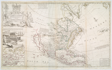
This map of North America acc…
note:
Herman Moll, geographer ;
B
. Lens delin
m
Nova tabula geographica compl…
parent:
ecc09360-c6f0-012f-ac05-3c075448cc4
b
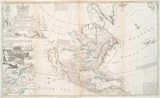
This map of North America acc…
parent:
64d8c240-c5d5-012f-6
b
0e-58d385a7bc34
1
2
…
4
5
6
7
8
9
10
11
…
13
14
Previous
Next
1
2
…
4
5
6
7
8
9
10
11
…
13
14
Previous
Next