Click to visit the main New York Public Library Homepage
The New York Public Library
Digital Collections
About Digital Collections
Browse
Search only public domain materials
Items
Collections
Divisions
Home
Search
Browse
About
Search only public domain materials
Items
Collections
Divisions
Digital Collections
Using Images
Using Data
Search
Filtered keyword search
Show filters
Hide filters
Show Only Public Domain
topic
Real property
10812
Fire insurance
5289
Cities & towns
5001
Administrative and political divisions
906
Railroads
784
More
Less
name
Sanborn Map Company
5093
G.W. Bromley & Co
2471
Bromley, George Washington
797
Bromley, Walter Scott
797
Austro-Hungarian Monarchy. Militärgeographisches Institut
773
More
Less
collection
Atlases of New York City
10577
Atlases of the United States
3749
Maps of North America
3345
Maps of New York City and State
2046
Lawrence H. Slaughter Collection of English maps, charts, globes, books and atlases
1101
More
Less
place
New York (State)
12155
New York
3979
New York (N.Y.)
2427
Manhattan (New York, N.Y.)
2373
Brooklyn (New York, N.Y.)
1166
More
Less
genre
Maps
24593
Atlases
3680
Topographic maps
1062
Surveys
1032
land surveys
849
More
Less
publisher
Sanborn Map Company
5129
G.W. Bromley & Co
2294
E. Belcher Hyde
780
K.u.K. Militargeographisches Institut
773
publisher not identified
452
More
Less
division
Map Division
22270
Manuscripts and Archives Division
1082
General Research Division
510
Rare Book Division
337
Schomburg Jean Blackwell Hutson Research and Reference Division
195
More
Less
type
x
cartographic
text
656
still image
329
three dimensional object
12
Date Range
to
Looking for one of these collections?
Atlases of New York City
11,722 items
Atlases of the United States
3,868 items
Maps of North America
3,345 items
Maps of New York City and State
2,059 items
Lawrence H. Slaughter Collection of English maps, charts, globes, books and atlases
1,252 items
Bancker plans
1,080 items
24,955 results found for:
x
Public libraries
Filtering on:
x
Type
: cartographic
Sort by:
Relevance
Title
Date created
Date digitized
Sequence
Results 24751 - 24800
Preliminary chart of St. Andr…
use:
… to the
public
)…
G. Woolworth Colton's new map…
use:
… to the
public
)…
G. Woolworth Colton's new map…
use:
… to the
public
)…
The harbor of Wood's Hole, Ma…
use:
… to the
public
)…
Triassic formation: including…
use:
… to the
public
)…
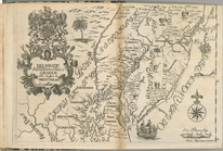
Delineatio Pennsilvaniae et C…
use:
… to the
public
)…
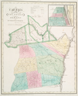
Map of the counties of Albany…
use:
… to the
public
)…
Map of the state of New-York …
use:
… to the
public
)…
Map of the county of Montgome…
use:
… to the
public
)…
Map of the counties of Ontari…
use:
… to the
public
)…
Map of the counties of Orange…
use:
… to the
public
)…
Map of the counties of Albany…
use:
… to the
public
)…
Map of the county of Montgome…
use:
… to the
public
)…
Map of the counties of Ontari…
use:
… to the
public
)…
Map of the counties of Orange…
use:
… to the
public
)…
A map of New England, New Yor…
use:
… to the
public
)…
Plan of the city of New York …
use:
… to the
public
)…
Second Geological Survey of P…
use:
… to the
public
)…
Map of the country thirty thr…
use:
… to the
public
)…
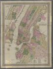
Queens, Vol. 1, Double Page P…
use:
… to the
public
)…
Map of the route of the new C…
use:
… to the
public
)…
m
Map of original grants and fa…
use:
….,
Library
Shop, CDs, DVDs
Map of the Harlem River and S…
use:
… to the
public
)…
m
Map of the hydrographical bas…
use:
… to the
public
)…
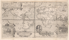
La herdike enterprinse faict …
use:
….,
Library
Shop, CDs, DVDs
Views of the entrance to New …
use:
… to the
public
)…
Map no. 2, from the mouth of …
use:
… to the
public
)…
Eastern part of St. George's …
use:
… to the
public
)…
North America west coast, Har…
use:
… to the
public
)…
Snyder's real estate map of t…
use:
… to the
public
)…
New Hampshire by recent survey
use:
… to the
public
)…
m
Map of Somerset County, Pa.
use:
… to the
public
)…
m
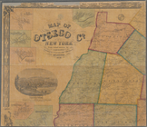
Map of Otsego Co., New York: …
use:
… to the
public
)…
Preliminary chart of Winyah B…
use:
… to the
public
)…
Second Geological Survey of P…
use:
… to the
public
)…
Preliminary chart no. 4 of th…
use:
… to the
public
)…
Reconnaissance of the western…
use:
… to the
public
)…
Preliminary chart of the sea …
use:
… to the
public
)…
Biloxi Bay, Mississippi : fro…
use:
… to the
public
)…
Topographical map showing the…
use:
… to the
public
)…
Preliminary chart of lower pa…
use:
… to the
public
)…
Little Egg Harbor
use:
… to the
public
)…
Little Egg Harbor
use:
… to the
public
)…
The harbor of Annapolis
use:
… to the
public
)…
Preliminary chart of St. John…
use:
… to the
public
)…
Harbor of Refuge, Dutch Islan…
use:
… to the
public
)…
Preliminary chart of North Ed…
use:
… to the
public
)…
America, N.W. Coast, Strait o…
use:
… to the
public
)…
Queens, Vol. 1, Double Page P…
use:
… to the
public
)…
Queens, Vol. 1, Double Page P…
use:
… to the
public
)…
1
2
…
91
92
93
94
95
96
97
98
99
100
Previous
Next
1
2
…
91
92
93
94
95
96
97
98
99
100
Previous
Next