Click to visit the main New York Public Library Homepage
The New York Public Library
Digital Collections
About Digital Collections
Browse
Search only public domain materials
Items
Collections
Divisions
Home
Search
Browse
About
Search only public domain materials
Items
Collections
Divisions
Digital Collections
Using Images
Using Data
Search
Keyword search
Show filters
Hide filters
Show Only Public Domain
topic
Real property
10996
Fire insurance
5198
Cities & towns
5007
Landowners
483
Business enterprises
468
More
Less
name
Sanborn Map Company
5103
G.W. Bromley & Co
2179
Ullitz, Hugo
735
E.B. Hyde & Co
545
E. Belcher Hyde Map Company
488
More
Less
collection
Atlases of New York City
8590
Atlases of the United States
1859
Maps of North America
360
Maps of New York City and State
348
Collection of broadside real estate maps announcing auctions of lots in early 19th century New York City
67
More
Less
place
New York (State)
10618
New York
3325
Manhattan (New York, N.Y.)
2023
New York (N.Y.)
824
Brooklyn (New York, N.Y.)
811
More
Less
genre
Maps
10919
Atlases
1856
Cadastral maps
516
Indexes
126
Title pages
80
More
Less
publisher
Sanborn Map Company
5009
G.W. Bromley & Co
2051
E. Belcher Hyde
554
E. Robinson Co
246
F. W. Beers & Co
148
More
Less
division
Map Division
11069
Milstein Division
29
Manuscripts and Archives Division
1
No Division
1
type
cartographic
10996
text
363
still image
34
Date Range
to
Looking for this collection?
Atlases of New York City
11,722 items
11,230 results found for:
Real property --New York (State) --Maps
Sort by:
Relevance
Title
Date created
Date digitized
Sequence
Results 9751 - 9800
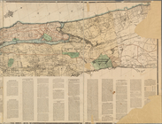
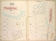
…, Section 21; [
Map
bounded
use:
… partner (e.g.,
New
York
…, Section 22; [
Map
bounded
use:
… partner (e.g.,
New
York
…, Section 22; [
Map
bounded
use:
… partner (e.g.,
New
York
m
Map
of Cook County, Illinois …
use:
… partner (e.g.,
New
York
m
Map
of Long Island
use:
… partner (e.g.,
New
York
m
…
York
use:
… partner (e.g.,
New
York
Plan of house lots in South F…
use:
… partner (e.g.,
New
York
Plan of Public Garden: showin…
use:
… partner (e.g.,
New
York
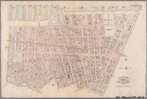
Plate 10: Bounded by West Str…
use:
… partner (e.g.,
New
York
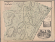
Plate 17:
Map
of the Woodlawn Cemetery
use:
… partner (e.g.,
New
York
m
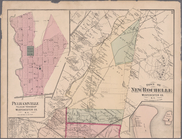
Plates 53 & 54: Town of
New
Rochelle
use:
… partner (e.g.,
New
York
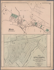
Plate 66: Rye, Town of Westchester Co. N.Y. -
Map
use:
… partner (e.g.,
New
York
Res. & Farm of Henry Ives, Ba…
use:
… partner (e.g.,
New
York
Full brothers, 4-5 years. Sir…
use:
… partner (e.g.,
New
York
Geo. H. Monroe, Portrait and …
use:
… partner (e.g.,
New
York
Genesee County Mills, J. G. C…
use:
… partner (e.g.,
New
York
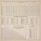
Acres of Land, Valuation, Pop…
use:
… partner (e.g.,
New
York
m
… (in Morris County,
New
use:
… partner (e.g.,
New
York
m
… near Allentown,
New
use:
… partner (e.g.,
New
York
m
…,
New
Jersey)…
use:
… partner (e.g.,
New
York
m
Coll. John Bryerly's draught …
use:
… partner (e.g.,
New
York
m
Jon. Biddle's draught on Assu…
use:
… partner (e.g.,
New
York
m
A plan of 8 acres land survey…
use:
… partner (e.g.,
New
York
m
Draughts of land in Amwell in…
use:
… partner (e.g.,
New
York
Map
of the county of Ulster
use:
… partner (e.g.,
New
York
m
Map
of Fulton Co., Pennsylvania …
use:
… partner (e.g.,
New
York
Private claims at Michilimack…
use:
… partner (e.g.,
New
York
…
New
York
Avenue, Troy
use:
… partner (e.g.,
New
York
[Bounded by Avenue H, E. 18th…
use:
… partner (e.g.,
New
York
Bounded by Avenue Q, E. 36th …
use:
… partner (e.g.,
New
York
Bounded by Flatbush Ave., Ave…
use:
… partner (e.g.,
New
York
Bounded by Avenue T, Kimball …
use:
… partner (e.g.,
New
York
Bounded by Flatlands Ave., Pa…
use:
… partner (e.g.,
New
York
Bounded by E. 57th St., Avenu…
use:
… partner (e.g.,
New
York
Bounded by W. 27th St., Canal…
use:
… partner (e.g.,
New
York
Bounded by Avenue B (Beverly …
use:
… partner (e.g.,
New
York
Bounded by (U.S. Government R…
use:
… partner (e.g.,
New
York
…
States
Navy Yard) Hudson
use:
… partner (e.g.,
New
York
Bounded by Marcy Ave., Metrop…
use:
… partner (e.g.,
New
York
Bounded by Manhattan Avenue, …
use:
… partner (e.g.,
New
York
Bounded by Meserole Avenue, F…
use:
… partner (e.g.,
New
York
Sub Plan from Plate 33 [Barre…
use:
… partner (e.g.,
New
York
Map
of the county of Herkimer
use:
… partner (e.g.,
New
York
m
… of the
state
of
New
York
: made
use:
… partner (e.g.,
New
York
Map
of the county of Westchester
use:
… partner (e.g.,
New
York
Map
of the County of St. Lawrence
use:
… partner (e.g.,
New
York
A compleat
map
of North-Carolina from
use:
… partner (e.g.,
New
York
m
Map
of Roanoke, Virginia …
use:
… partner (e.g.,
New
York
Map
of the "Hunter Fly Farm" in the 9th
use:
… partner (e.g.,
New
York
Plate 37:: [Bounded by New Yo…
use:
… partner (e.g.,
New
York
1
2
…
36
37
38
39
40
41
42
43
44
45
Previous
Next
1
2
…
36
37
38
39
40
41
42
43
44
45
Previous
Next