Click to visit the main New York Public Library Homepage
The New York Public Library
Digital Collections
About Digital Collections
Browse
Search only public domain materials
Items
Collections
Divisions
Home
Search
Browse
About
Search only public domain materials
Items
Collections
Divisions
Digital Collections
Using Images
Using Data
Search
Keyword search
Show filters
Hide filters
Show Only Public Domain
topic
Real property
10996
Fire insurance
5198
Cities & towns
5007
Landowners
483
Business enterprises
468
More
Less
name
Sanborn Map Company
5103
G.W. Bromley & Co
2179
Ullitz, Hugo
735
E.B. Hyde & Co
545
E. Belcher Hyde Map Company
488
More
Less
collection
Atlases of New York City
8590
Atlases of the United States
1859
Maps of North America
360
Maps of New York City and State
348
Collection of broadside real estate maps announcing auctions of lots in early 19th century New York City
67
More
Less
place
New York (State)
10618
New York
3325
Manhattan (New York, N.Y.)
2023
New York (N.Y.)
824
Brooklyn (New York, N.Y.)
811
More
Less
genre
Maps
10919
Atlases
1856
Cadastral maps
516
Indexes
126
Title pages
80
More
Less
publisher
Sanborn Map Company
5009
G.W. Bromley & Co
2051
E. Belcher Hyde
554
E. Robinson Co
246
F. W. Beers & Co
148
More
Less
division
Map Division
11069
Milstein Division
29
Manuscripts and Archives Division
1
No Division
1
type
cartographic
10996
text
363
still image
34
Date Range
to
Looking for this collection?
Atlases of New York City
11,722 items
11,230 results found for:
Real property --New York (State) --Maps
Sort by:
Relevance
Title
Date created
Date digitized
Sequence
Results 10751 - 10800
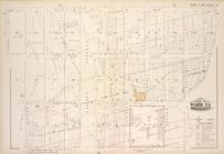
…, Section 25; [
Map
bounded
use:
… partner (e.g.,
New
York
…, Section 25; [
Map
bounded
use:
… partner (e.g.,
New
York
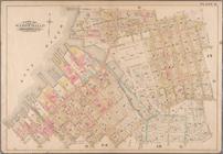
…, Sections 24 & 25; [
Map
use:
… partner (e.g.,
New
York
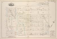
…, Section 24; [
Map
bounded
use:
… partner (e.g.,
New
York
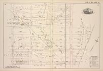
… & 25; [
Map
bounded
use:
… partner (e.g.,
New
York
Plan of Ohio City in the
state
of Missouri
use:
… partner (e.g.,
New
York
…., East
New
York
Ave
use:
… partner (e.g.,
New
York
Plate 19: [Bounded by 72nd St…
use:
… partner (e.g.,
New
York
Plate 27: [Bounded by Avenue …
use:
… partner (e.g.,
New
York
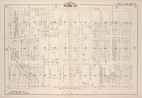
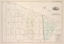
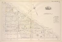
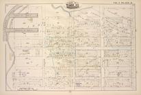
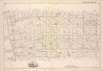
Plate 33, Part of Wards 2 & 3…
use:
… partner (e.g.,
New
York
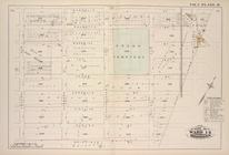
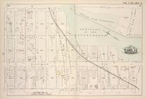
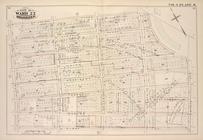
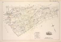
Plate 26, Part of Ward 5: [Ma…
use:
… partner (e.g.,
New
York
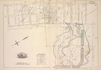
Bounded by W. 11th Street, W.…
use:
… partner (e.g.,
New
York
…., Brooklyn Ave.,
New
York
Ave
use:
… partner (e.g.,
New
York
…
York
Ave., Nostrand Ave
use:
… partner (e.g.,
New
York
Plate 11: [Bounded by Noble S…
use:
… partner (e.g.,
New
York
Map
bound by La Fayette Ave., Himrod St
use:
… partner (e.g.,
New
York
Map
bound by Stanhope St., Wyckoff Ave
use:
… partner (e.g.,
New
York
Map
bound by Central Ave., Schaeffer St
use:
… partner (e.g.,
New
York
Map
bound by Magnolia St., City Line
use:
… partner (e.g.,
New
York
Map
bound by City Line, Cemetery Lane
use:
… partner (e.g.,
New
York
Map
bound by Central Ave., Cemetery
use:
… partner (e.g.,
New
York
Map
bound by Atlantic Ave., Flatbush Ave
use:
… partner (e.g.,
New
York
Map
bound by St. Johns Place, PLaza
use:
… partner (e.g.,
New
York
Map
bound by Fifth Ave., Fifth St., Sixth
use:
… partner (e.g.,
New
York
Map
bound by Fifth St., Sixth St., Fifth
use:
… partner (e.g.,
New
York
Map
bound by First St., Ninth Ave
use:
… partner (e.g.,
New
York
Map
bound by Tenth St., Ninth Ave
use:
… partner (e.g.,
New
York
Map
bound by Thirteenth St., Fifth Ave
use:
… partner (e.g.,
New
York
Map
bound by Prospect Ave., Ninth Ave
use:
… partner (e.g.,
New
York
Map
bound by Ninth Ave., Prospect Park
use:
… partner (e.g.,
New
York
Map
bound by Twentieth St., Fifth Ave
use:
… partner (e.g.,
New
York
Map
bound by Thirty-Sixth, Fifth Ave., Forty
use:
… partner (e.g.,
New
York
Map
bound by Forty-Fourth St., City Line
use:
… partner (e.g.,
New
York
Map
bound by Harrison St., Henry St
use:
… partner (e.g.,
New
York
Map
bound by Butler St., Fourth Ave
use:
… partner (e.g.,
New
York
Map
bound by Hamilton Ave., Carroll St
use:
… partner (e.g.,
New
York
Map
bound by Atlantic Basin, Verona St
use:
… partner (e.g.,
New
York
Map
bound by Lorraine St., Hamilton Ave
use:
… partner (e.g.,
New
York
Detailed Estate and Old Farm …
use:
… partner (e.g.,
New
York
Map
bound by Huron St., Oakland St
use:
… partner (e.g.,
New
York
Map
bound by Manhattan Ave., Leonard St
use:
… partner (e.g.,
New
York
Map
bound by Whale Creek Canal, Green Point
use:
… partner (e.g.,
New
York
Map
bound by Conselyea St., Bushwick Ave
use:
… partner (e.g.,
New
York
Map
bound by Bushwick Inlet, N.14th St
use:
… partner (e.g.,
New
York
Map
bound by N.6th St., Sixth St., Grand
use:
… partner (e.g.,
New
York
Map
bound by Grand St., Seventh St
use:
… partner (e.g.,
New
York
Map
bound by S. Sixth St., Broadway
use:
… partner (e.g.,
New
York
Map
bound by Grand St., Eleventh St., S
use:
… partner (e.g.,
New
York
Map
bound by Ten Eyck St., Old Bushwick
use:
… partner (e.g.,
New
York
Map
bound by Broadway, Middleton St
use:
… partner (e.g.,
New
York
1
2
…
35
36
37
38
39
40
41
42
43
44
45
Previous
Next
1
2
…
35
36
37
38
39
40
41
42
43
44
45
Previous
Next