


![Plate 1: Map No. 441 [Bounded by Fourth Avenue, 138th Street, ... (Harlem River) Line of Water Grant, Bulkhead & Pier Line, Grove Street, Cottage Street, Old Boston Post Road or Morris Avenue.]](https://images.nypl.org/index.php?id=1524170&t=b)
![Plate 2: Map No. 419 [Bounded by 138th Street, Mill Brook, 131st Street, Morris Avenue, 130th Street, Harlem River High Water Line and Third Avenue.]](https://images.nypl.org/index.php?id=1524171&t=b)
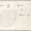
![Plate 3: Map No. 549 [Bounded by 4th Avenue (130th to 141st Sts.), River Avenue, 146th Street, College Rider Avenue, 138th Street, Third Avenueand 130th Street.]](https://images.nypl.org/index.php?id=1524172&t=b)
![Plate 4: Map No. 302 [Bounded by Harlem River, [149th Street] and Post Road from New York to Boston.]- Map No. 549 [Bounded by Grove St., Cottage St., Villa Place, Old Boston Road, 130th Street, 4th Avenue, Macomb Avenue and Walton Avenue.]](https://images.nypl.org/index.php?id=1524173&t=b)
![Plate 5: Map No. 375 [Bounded by Fourth Avenue, Riverside Avenue, Macomb Avenue, Cottage Street, Morris Avenue, 3rd Avenue and 129th Street.] - Map No. 213 [Bounded by Cherry Street, Old Harlem Bridge Post Road from New York to Boston, Harlem River and New bridge.]](https://images.nypl.org/index.php?id=1524174&t=b)
![Plate 6: Map No. 141 [Bounded by James Street, (Wm. Morris Farm), Rail Road Avenue, Prospect Street, Juliet Street, Gerard Street, Henry Street and River Avenue.]- Map No. 286 {Bounded by James WElls Land, Mill Brook, Henry Street and Morse Avenue or Old Boston Road.]](https://images.nypl.org/index.php?id=1524175&t=b)
![Plate 7: Map No. 148 [Bounded by Ella St., Rail Road Ave., Juliet St., and Morrisania Av.] - Map No. 509: [Bounded by (West Morrisania) Melrose Street, Morris St., Mott St. and Harlem River.] - Map No. 242: [Bounded by Cortland Ave., First St., Rail Road Ave. and William St.]](https://images.nypl.org/index.php?id=1524176&t=b)
![Plate 9: Map No. 641, old No. 143 [Bounded by Rail Road Ave., Fighth St., Franklin Ave., Jefferson St., Morse Ave. and Fordham Ave.] -Map No. 602: [Bounded by Jackson Ave., 156th St. and Westchester Ave.] -Map No. 207: [Bounded by Morse Ave., East Sixth St. and Union Ave.] -Map No. 249: [Bounded by Morse Ave., Sixth St. and Union Ave.]](https://images.nypl.org/index.php?id=1524178&t=b)
![Plate 10: Map No. 541 [Bounded by Wall St., (Woodstock) Grove Ave, (Grove Hill) Cliff St., Carr Ave.and Boston Road.] - Map No. 195: [Bounded by Village of Fairmount, Grove St., Oak St. znc Prospect Ave.] - Map No. 373: [Bounded by Wall St., Union Ave., New St. and Forest Ave.]](https://images.nypl.org/index.php?id=1524179&t=b)
![Plate 11: Map No. 165 [Bounded by 3 Rod Road, Coles Road and Southern Westchester Turnpike.] - Map No. 232: [Bounded by 6th St., Prospect Ave., Road leading from the Harlem Bridge to the Village of Westchester, Post Road and Railroad Avenue.]](https://images.nypl.org/index.php?id=1524180&t=b)
![Plate 12: Map No. 149 [Bounded by Harlem River (River Ave.), James St., Washington Ave. (Village of Morrisania) and Juliet St.] - Map No. 140: [Bounded by Harlem Rail Road, Upper Morrisania, and Morrisania Village.]](https://images.nypl.org/index.php?id=1524181&t=b)
- The Library Shop
- Privacy Policy
- Rules and Regulations
- Using the Internet
- Website Terms and Conditions
- Gifts of Materials to NYPL
-
© The New York Public Library, 2024
The New York Public Library is a 501(c)(3) | EIN 13-1887440
![Plate 29: Map No. 274 [Bounded by Kingsbridge Road, Fordham Ave., Irving St., and Madison Ave.] - Map No. 163: [Bounded by Williams Bridge Road, Third Ave., Williams St., Isaac St., West Farms Rd., Marian Ave. and Ridge St.] - Map No. 458:[Bounded by Kingsbridge Rd., New York & Harlem R.R. Depot, Sandford St., virginia St., Clark St. and Tiebout Ave.] - Map No. 224: [Bounded by Old Boston Rd., Lands of Mrs. Sarah Bussing, Pugsey's Lands, Lands of John B. Gillespie and Lands of James T. Adee Esq.]](https://images.nypl.org/index.php?id=1524198&t=b)
Lionel Pincus and Princess Firyal Map Division, The New York Public Library. "Plate 29: Map No. 274 [Bounded by Kingsbridge Road, Fordham Ave., Irving St., and Madison Ave.] - Map No. 163: [Bounded by Williams Bridge Road, Third Ave., Williams St., Isaac St., West Farms Rd., Marian Ave. and Ridge St.] - Map No. 458:[Bounded by Kingsbridge Rd., New York & Harlem R.R. Depot, Sandford St., virginia St., Clark St. and Tiebout Ave.] - Map No. 224: [Bounded by Old Boston Rd., Lands of Mrs. Sarah Bussing, Pugsey's Lands, Lands of John B. Gillespie and Lands of James T. Adee Esq.]" The New York Public Library Digital Collections. 1888 - 1897. https://digitalcollections.nypl.org/items/510d47e2-4ac9-a3d9-e040-e00a18064a99
Lionel Pincus and Princess Firyal Map Division, The New York Public Library. "Plate 29: Map No. 274 [Bounded by Kingsbridge Road, Fordham Ave., Irving St., and Madison Ave.] - Map No. 163: [Bounded by Williams Bridge Road, Third Ave., Williams St., Isaac St., West Farms Rd., Marian Ave. and Ridge St.] - Map No. 458:[Bounded by Kingsbridge Rd., New York & Harlem R.R. Depot, Sandford St., virginia St., Clark St. and Tiebout Ave.] - Map No. 224: [Bounded by Old Boston Rd., Lands of Mrs. Sarah Bussing, Pugsey's Lands, Lands of John B. Gillespie and Lands of James T. Adee Esq.]" New York Public Library Digital Collections. Accessed April 26, 2024. https://digitalcollections.nypl.org/items/510d47e2-4ac9-a3d9-e040-e00a18064a99
Lionel Pincus and Princess Firyal Map Division, The New York Public Library. (1888 - 1897). Plate 29: Map No. 274 [Bounded by Kingsbridge Road, Fordham Ave., Irving St., and Madison Ave.] - Map No. 163: [Bounded by Williams Bridge Road, Third Ave., Williams St., Isaac St., West Farms Rd., Marian Ave. and Ridge St.] - Map No. 458:[Bounded by Kingsbridge Rd., New York & Harlem R.R. Depot, Sandford St., virginia St., Clark St. and Tiebout Ave.] - Map No. 224: [Bounded by Old Boston Rd., Lands of Mrs. Sarah Bussing, Pugsey's Lands, Lands of John B. Gillespie and Lands of James T. Adee Esq.] Retrieved from https://digitalcollections.nypl.org/items/510d47e2-4ac9-a3d9-e040-e00a18064a99
<ref name=NYPL>{{cite web | url=https://digitalcollections.nypl.org/items/510d47e2-4ac9-a3d9-e040-e00a18064a99 | title=
(cartographic)
Plate 29: Map No. 274 [Bounded by Kingsbridge Road, Fordham Ave., Irving St., and Madison Ave.] - Map No. 163: [Bounded by Williams Bridge Road, Third Ave., Williams St., Isaac St., West Farms Rd., Marian Ave. and Ridge St.] - Map No. 458:[Bounded by Kingsbridge Rd., New York & Harlem R.R. Depot, Sandford St., virginia St., Clark St. and Tiebout Ave.] - Map No. 224: [Bounded by Old Boston Rd., Lands of Mrs. Sarah Bussing, Pugsey's Lands, Lands of John B. Gillespie and Lands of James T. Adee Esq.], (1888 - 1897)
|author=Digital Collections, The New York Public Library |accessdate=April 26, 2024 |publisher=The New York Public Library, Astor, Lenox, and Tilden Foundations}}</ref>
![Plate 29: Map No. 274 [Bounded by Kingsbridge Road, Fordham Ave., Irving St., and Madison Ave.] - Map No. 163: [Bounded by Williams Bridge Road, Third Ave., Williams St., Isaac St., West Farms Rd., Marian Ave. and Ridge St.] - Map No. 458:[Bounded by Kingsbridge Rd., New York & Harlem R.R. Depot, Sandford St., virginia St., Clark St. and Tiebout Ave.] - Map No. 224: [Bounded by Old Boston Rd., Lands of Mrs. Sarah Bussing, Pugsey's Lands, Lands of John B. Gillespie and Lands of James T. Adee Esq.]](https://images.nypl.org/index.php?id=1524198&t=t)