


- The Library Shop
- Privacy Policy
- Rules and Regulations
- Using the Internet
- Website Terms and Conditions
- Gifts of Materials to NYPL
-
© The New York Public Library, 2024
The New York Public Library is a 501(c)(3) | EIN 13-1887440
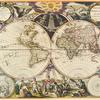
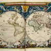
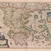
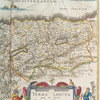
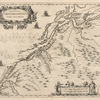
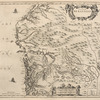
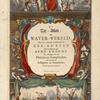
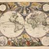
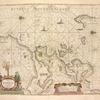
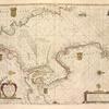
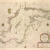
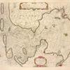
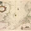
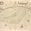
Lionel Pincus and Princess Firyal Map Division, The New York Public Library. "De zee-atlas ofte water-wereld, waer in vertoont werden alle de zee-kusten van het bekende des aerd-bodems" The New York Public Library Digital Collections. 1668. https://digitalcollections.nypl.org/items/b9732840-c602-012f-0fcd-58d385a7bc34
Lionel Pincus and Princess Firyal Map Division, The New York Public Library. "De zee-atlas ofte water-wereld, waer in vertoont werden alle de zee-kusten van het bekende des aerd-bodems" New York Public Library Digital Collections. Accessed April 26, 2024. https://digitalcollections.nypl.org/items/b9732840-c602-012f-0fcd-58d385a7bc34
Lionel Pincus and Princess Firyal Map Division, The New York Public Library. (1668). De zee-atlas ofte water-wereld, waer in vertoont werden alle de zee-kusten van het bekende des aerd-bodems Retrieved from https://digitalcollections.nypl.org/items/b9732840-c602-012f-0fcd-58d385a7bc34
<ref name=NYPL>{{cite web | url=https://digitalcollections.nypl.org/items/b9732840-c602-012f-0fcd-58d385a7bc34 | title=
(cartographic)
De zee-atlas ofte water-wereld, waer in vertoont werden alle de zee-kusten van het bekende des aerd-bodems, (1668)
|author=Digital Collections, The New York Public Library |accessdate=April 26, 2024 |publisher=The New York Public Library, Astor, Lenox, and Tilden Foundations}}</ref>
