


![Central Park : memorial of the Common Council of the City of New York to the Legislature, approved June 11th, 1853...[title page]](https://images.nypl.org/index.php?id=5190254&t=b)


- The Library Shop
- Privacy Policy
- Rules and Regulations
- Using the Internet
- Website Terms and Conditions
- Gifts of Materials to NYPL
-
© The New York Public Library, 2024
The New York Public Library is a 501(c)(3) | EIN 13-1887440
Lionel Pincus and Princess Firyal Map Division, The New York Public Library. "New map of that part of the city of New York south from 20th Street on the Hudson & 35th Street on the East River : showing the position of Greenwich, Washington and West Streets on the Hudson River, and Pearl, Water, Front, Cherry & Tompkins Sts. on the East River : also the Brooklyn shore from Bobine House to Red Hook Point : also the high & low water mark as developed from the original city grants : the ordinance lines of 1795, 1796 & 1808 and the lawful boundary of the city" The New York Public Library Digital Collections. 1862. https://digitalcollections.nypl.org/items/e5c889f0-c5aa-012f-8c5c-58d385a7bc34
Lionel Pincus and Princess Firyal Map Division, The New York Public Library. "New map of that part of the city of New York south from 20th Street on the Hudson & 35th Street on the East River : showing the position of Greenwich, Washington and West Streets on the Hudson River, and Pearl, Water, Front, Cherry & Tompkins Sts. on the East River : also the Brooklyn shore from Bobine House to Red Hook Point : also the high & low water mark as developed from the original city grants : the ordinance lines of 1795, 1796 & 1808 and the lawful boundary of the city" New York Public Library Digital Collections. Accessed April 26, 2024. https://digitalcollections.nypl.org/items/e5c889f0-c5aa-012f-8c5c-58d385a7bc34
Lionel Pincus and Princess Firyal Map Division, The New York Public Library. (1862). New map of that part of the city of New York south from 20th Street on the Hudson & 35th Street on the East River : showing the position of Greenwich, Washington and West Streets on the Hudson River, and Pearl, Water, Front, Cherry & Tompkins Sts. on the East River : also the Brooklyn shore from Bobine House to Red Hook Point : also the high & low water mark as developed from the original city grants : the ordinance lines of 1795, 1796 & 1808 and the lawful boundary of the city Retrieved from https://digitalcollections.nypl.org/items/e5c889f0-c5aa-012f-8c5c-58d385a7bc34
<ref name=NYPL>{{cite web | url=https://digitalcollections.nypl.org/items/e5c889f0-c5aa-012f-8c5c-58d385a7bc34 | title=
(cartographic)
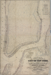
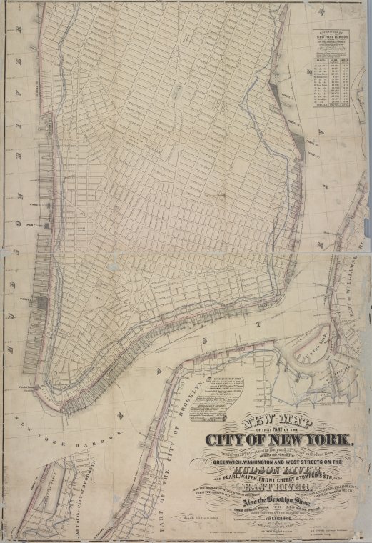
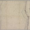
New map of that part of the city of New York south from 20th Street on the Hudson & 35th Street on the East River : showing the position of Greenwich, Washington and West Streets on the Hudson River, and Pearl, Water, Front, Cherry & Tompkins Sts. on the East River : also the Brooklyn shore from Bobine House to Red Hook Point : also the high & low water mark as developed from the original city grants : the ordinance lines of 1795, 1796 & 1808 and the lawful boundary of the city, (1862)
|author=Digital Collections, The New York Public Library |accessdate=April 26, 2024 |publisher=The New York Public Library, Astor, Lenox, and Tilden Foundations}}</ref>