Click to visit the main New York Public Library Homepage
The New York Public Library
Digital Collections
About Digital Collections
Browse
Search only public domain materials
Items
Collections
Divisions
Home
Search
Browse
About
Search only public domain materials
Items
Collections
Divisions
Digital Collections
Using Images
Using Data
Search
Filtered search
Show filters
Hide filters
Show Only Public Domain
topic
Geography
141
History
106
Maps
83
Historical geography
57
Nautical charts
57
More
Less
name
Faden, William, 1749-1836
101
Tiebout, Cornelius, 1777-1832
63
Sayer, Robert, 1725-1794
62
Stockdale, John, 1749?-1814
58
Colles, Christopher, 1738-1816
53
More
Less
collection
Bancker plans
726
Lawrence H. Slaughter Collection of English maps, charts, globes, books and atlases
365
Maps of North America
263
Atlases, gazetteers, guidebooks and other books
111
Maps of New York City and State
69
More
Less
place
United States
168
Great Britain
133
North America
103
England
87
Middle Atlantic States
78
More
Less
genre
x
Maps
Surveys
730
land surveys
628
Documents
103
Prints
42
More
Less
publisher
Published by Wm. Faden, geographer to His Majesty, and His R.H. the Prince of Wales
53
Printed for John Cary
47
Printed for Robert Sayer, No. 53, Fleet-Street
44
publisher not identified
39
s.n
37
More
Less
division
Map Division
861
Manuscripts and Archives Division
741
Rare Book Division
48
General Research Division
45
Wallach Division: Print Collection
40
More
Less
type
cartographic
1798
text
182
still image
15
Date Range
to
1,807 results found
Filtering on:
x
Date
: 1760 - 1800
x
Genre
: Maps
Sort by:
Title
Date created
Date digitized
Sequence
Results 501 - 550
m
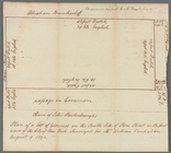
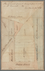
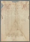
Lots between Delancey and Riv…
m
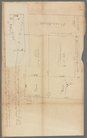
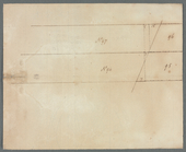
Thames Street to the North Ri…
m
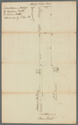
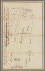
Widow Roosevelt at the Tea Wa…
m
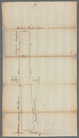
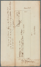
Adolph Waldron's lot in the s…
m
Lot on the south side of Ston…
m
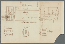
Stone Street
m
Benjamin Booth's lot north si…
m
Stone and Marketfield Street
m
Van Der Spiegel's lot in Ston…
m
Stone Street
m
Stone Street
m
Stone Street and Broad Street
m
A. Hammond's ground
m
Lots 24, 25, 26 in the square…
m
Columbia, North, and Stanton …
m
South Street between White Ha…
m
Skinner and Queen Street
m
Smith Street
m
Eight lots on Herring Farm
m
Queen and Skinner Street
m
Charlotte and Rutgers Streets
m
Rotten Row
m
Rose Street
m
John Robert Livingston's hous…
m
Pierre Depeyster's house next…
m
Dr. Stuart's purchase
m
Benjamin Peck's at Peck Slip
m
Queen Street and Skinner Stre…
m
Corner of Queen and Beekman S…
m
Queen Street near Fresh Water
m
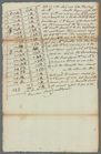
Lots in Princess Street
m
Lot in Princess Street
m
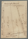
Princess Street
m
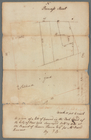
Pine Street drain
m
East side of Peck's Slip
m
Bowery Lane
m
Pell Street and Winne Street
m
Peck's Slip
m
Pearl and Pine Streets
m
Pearl and John Street
m
South side of Pearl Street
m
Pearl Street
m
Pearl Street
m
Pearl Street
m
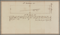
Pearl Street
m
Pearl Street near Rutgers and…
m
Pearl Street, formerly Hanove…
m
Old Slip
m
North, Pitt, Ridge and Stanto…
m
Kip Street
1
2
3
4
5
6
7
8
Previous
Next
1
2
3
4
5
6
7
8
Previous
Next