Click to visit the main New York Public Library Homepage
The New York Public Library
Digital Collections
About Digital Collections
Browse
Search only public domain materials
Items
Collections
Divisions
Home
Search
Browse
About
Search only public domain materials
Items
Collections
Divisions
Digital Collections
Using Images
Using Data
Search
Filtered search
Show filters
Hide filters
Show Only Public Domain
topic
Geography
141
History
106
Maps
83
Historical geography
57
Nautical charts
57
More
Less
name
Faden, William, 1749-1836
101
Tiebout, Cornelius, 1777-1832
63
Sayer, Robert, 1725-1794
62
Stockdale, John, 1749?-1814
58
Colles, Christopher, 1738-1816
53
More
Less
collection
Bancker plans
726
Lawrence H. Slaughter Collection of English maps, charts, globes, books and atlases
365
Maps of North America
263
Atlases, gazetteers, guidebooks and other books
111
Maps of New York City and State
69
More
Less
place
United States
168
Great Britain
133
North America
103
England
87
Middle Atlantic States
78
More
Less
genre
x
Maps
Surveys
730
land surveys
628
Documents
103
Prints
42
More
Less
publisher
Published by Wm. Faden, geographer to His Majesty, and His R.H. the Prince of Wales
53
Printed for John Cary
47
Printed for Robert Sayer, No. 53, Fleet-Street
44
publisher not identified
39
s.n
37
More
Less
division
Map Division
861
Manuscripts and Archives Division
741
Rare Book Division
48
General Research Division
45
Wallach Division: Print Collection
40
More
Less
type
cartographic
1798
text
182
still image
15
Date Range
to
1,807 results found
Filtering on:
x
Date
: 1760 - 1800
x
Genre
: Maps
Sort by:
Title
Date created
Date digitized
Sequence
Results 1001 - 1050
A map of the new governments …
A new and accurate map of eas…
A new and accurate map of eas…
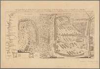
Plan of the action of Huberto…
A map of East and West Florid…
Map of New Haven and its envi…
Plan of the city of Washingto…
Map of Jersey City, [New Jers…
m
New York City directory , 179…
m
New York City directory, 1794…
Massachusetts, Connecticut an…
A map of the province of Mass…
Coastal chart of the Massachu…
An accurate map of Rhode Isla…
The state of Rhode-Island
Boston and the adjacent count…
Map of the east coast of the …
m
A plan of Boston: from actual…
Plan of part of the district …
An Accurate map of New Hampsh…
m
A map of the most inhabited p…
A new and accurate plan of th…
Plan of the town of Boston wi…
A plan of the battle, on Bunk…
The Province of Maine, from t…
A view of the rivers Kenebec …
Rhode - Island, 2e feuille
m
Piscataqua Harbour, Portsmout…
A map of the country between …
An exact map of the five grea…
m
A map of the most inhabited p…
An accurate map of the countr…
Pencil sketch of Rochester, N…
A new and accurate map of the…
m
New York City directory, 1791
m
New York City directory, 1790
m
Plans for a New York State pr…
m
New York City directory, 1789
m
New York City directory, 1796
Connecticut and parts adjacent
Birds' eye view of New London…
Operations after the evacuati…
A correct map of Connecticut:…
A new and accurate map of Con…
m
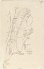
Map of the road to Presqu'Isle
m
Map of Long Island and adjace…
A new map of the Cherokee Nat…
Part of North America, contai…
m
Draft of the New Road from No…
A prospective view of the bat…
1
2
3
4
5
6
7
8
Previous
Next
1
2
3
4
5
6
7
8
Previous
Next