Click to visit the main New York Public Library Homepage
The New York Public Library
Digital Collections
About Digital Collections
Browse
Search only public domain materials
Items
Collections
Divisions
Home
Search
Browse
About
Search only public domain materials
Items
Collections
Divisions
Digital Collections
Using Images
Using Data
Search
Filtered search
Show filters
Hide filters
Show Only Public Domain
topic
Nautical charts
9
Coasts
2
History
2
Administrative and political divisions
1
Boundaries
1
More
Less
name
Zatta, Antonio, fl. 1757-1797
12
Des Barres, Joseph F. W. (Joseph Frederick Wallet), 1729-1824
5
Brion de la Tour, Louis, -1823
4
Kitchin, Thomas, 1718-1784
3
Sauthier, Claude Joseph
3
More
Less
collection
x
Lawrence H. Slaughter Collection of English maps, charts, globes, books and atlases
place
North America
20
New York (State)
10
New Jersey
8
Maps
6
Delaware
5
More
Less
genre
x
Maps
publisher
Presso Antonio Zatta
12
s.n
3
J.F.W. Des Barres
2
Published for the use of the Royal Navy of Great Britain by Joseph F. W. Des Barres
2
... published ... by J.F.W. Des Barres esqr
1
More
Less
division
Map Division
57
type
cartographic
56
text
1
Date Range
to
57 results found
Filtering on:
x
Date
: 1778 - 1782
x
Genre
: Maps
x
Collection
: Lawrence H. Slaughter Collection of English maps, charts, globes, books and atlases
For more collection details, visit the
Lawrence H. Slaughter Collection of English maps, charts, globes, books and atlases collection page
.
Sort by:
Title
Date created
Date digitized
Sequence
m
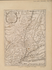
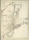
The southern part of the Prov…
Carte du theatre de la guerre…
A plan of Fort Montgomery & F…
Carte de la baye et riviere d…
[A chart of New York Island &…
Mappa geographica Provinciae …
Amerique septentrionale : sui…
Carte de la Virginie, du Mary…
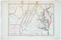
Il Maryland, il Jersey Meridi…
Carte du theatre de la guerre…
Carte du théatre de la guerre…
Carte du théatre de la guerre…
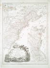
The coast of Nova Scotia, New…
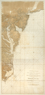
A chart of Delawar River from…
Amérique, ou, Indes occidenta…
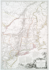
Carte de la Nouvelle York : y…
Carte de la Virginie, du Mary…
Carte de la Pensylvanie et du…
La Pensilvania, la Nuova York…
Il Maryland, il Jersey Meridi…
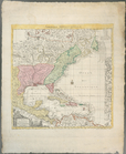
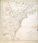
North America
Carte de l'Amérique septentri…
Carte de la route des lacs de…
Carte de la Nouvelle York : y…
Carte de la Virginie, du Mary…
Carte de la Pensylvanie et du…
Plan de la Bataille de Montmo…
A chart of Delawar Bay : with…
A chart of Delaware Bay and R…
A chart of Delaware Bay and R…
Map of New York I. : with the…
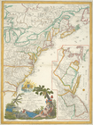
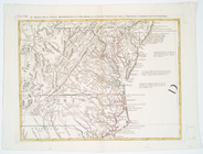
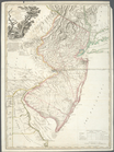
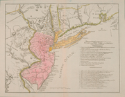
The Province of New Jersey, d…
A chart of the coast of New Y…
A new and accurate chart of t…
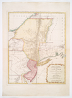
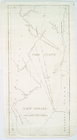
The State of New Jersey.
Carte de l'Amérique septentri…
Position der Königl; Grosbrit…
Carte nouvelle des posséssion…
Carte de la Louisiane et du c…
Bowles's new pocket map of th…
Carte de la partie nord, des …
Carte generale des treize Eta…
A chorographical map of the p…
Carte des troubles de l'Améri…
A chart of the coast of New Y…
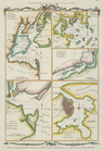
Various plans and draughts of…
A chart of New York Island & …
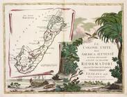
Le colonie unite dell' Americ…
Il paese de' Selvaggi Outauac…
La parte Occidentale della Nu…