Click to visit the main New York Public Library Homepage
The New York Public Library
Digital Collections
About Digital Collections
Browse
Search only public domain materials
Items
Collections
Divisions
Home
Search
Browse
About
Search only public domain materials
Items
Collections
Divisions
Digital Collections
Using Images
Using Data
Search
Filtered search
Show filters
Hide filters
Show Only Public Domain
topic
Real property
1097
Landowners
374
Administrative and political divisions
369
Railroads
266
Nautical charts
256
More
Less
name
Perris, William
308
United States Coast Survey
255
Bache, A. D. (Alexander Dallas), 1806-1867
205
Burr, David H., 1803-1875
195
Beers, F. W. (Frederick W.)
176
More
Less
collection
Maps of North America
1559
Maps of New York City and State
828
Atlases of the United States
703
Atlases of New York City
532
Bancker plans
465
More
Less
place
New York (State)
1423
New York
536
United States
455
New York (N.Y.)
451
Manhattan (New York, N.Y.)
426
More
Less
genre
Maps
5185
Atlases
677
Surveys
475
land surveys
412
Cadastral maps
304
More
Less
publisher
publisher not identified
275
William Perris
142
U.S. Coast Survey
128
Perris & Browne
124
Chapman and Hall
109
More
Less
division
Map Division
4080
Manuscripts and Archives Division
485
General Research Division
216
Rare Book Division
145
George Arents Collection
53
More
Less
type
x
cartographic
text
197
still image
131
Date Range
to
5,297 results found
Filtering on:
x
Date
: 1794 - 1870
x
Type
: cartographic
Sort by:
Title
Date created
Date digitized
Sequence
Results 2001 - 2050
Maine
Map of a section of the Cobbe…
A New map of Maine
New Hampshire by recent survey
Preliminary chart of Portland…
m
Map Of The State Of Maine
m
A topographical map of Lincol…
Preliminary chart of Portsmou…
Plan of Suffolk Street Distri…
Map of the seat of war to acc…
Boston Harbor, Massachusetts
Extract from a map entitled P…
Plan of Church St. district: …
Plan of Boston
Map of parts of Boston Harbor…
Plan of Boston: corrected und…
Plan of Boston: corrected und…
Plan of Boston: prepared unde…
m
Map of Monroe County, New York
Map of Rockland Co: [New York]
Railroad map of New England &…
Map of the County of St. Lawr…
Map of Orleans County, New Yo…
Map of the county of Herkimer
Sketch of the states of Massa…
Map of Orange County: [New Yo…
Map of the village at Little …
Map of Dobbs Ferry and Hastin…
Country-seat of Danl. P. Barn…
A map of the country between …
Map of New England
Telegraph and rail road map o…
m
Village of Buffalo
m
Schonberg's imperial map of t…
m
H.H. Lloyd & Co.'s new Union …
Map of the city of Buffalo
m
Map of the city of Albany: wi…
m
Map of the village & town of …
m
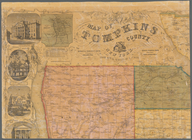
Map of Tompkins County, New Y…
m
Map of Maine, New Hampshire, …
Smith's rail road, steam boat…
m
Map of the City of Utica, One…
Map of part of Orange County,…
m
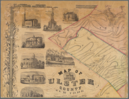
Map of Ulster County, New York
Map of Chenango County, New Y…
Preliminary chart of Muskeget…
Magnus's county map of the Un…
Muskeget Channel, Massachuset…
Plan of the town of Lowell an…
A plan of the salt marsh and …
1
2
…
6
7
8
9
10
11
12
13
…
21
22
Previous
Next
1
2
…
6
7
8
9
10
11
12
13
…
21
22
Previous
Next