Click to visit the main New York Public Library Homepage
The New York Public Library
Digital Collections
About Digital Collections
Browse
Search only public domain materials
Items
Collections
Divisions
Home
Search
Browse
About
Search only public domain materials
Items
Collections
Divisions
Digital Collections
Using Images
Using Data
Search
Filtered search
Show filters
Hide filters
Show Only Public Domain
topic
Real property
1097
Landowners
374
Administrative and political divisions
369
Railroads
266
Nautical charts
256
More
Less
name
Perris, William
308
United States Coast Survey
255
Bache, A. D. (Alexander Dallas), 1806-1867
205
Burr, David H., 1803-1875
195
Beers, F. W. (Frederick W.)
176
More
Less
collection
Maps of North America
1559
Maps of New York City and State
828
Atlases of the United States
703
Atlases of New York City
532
Bancker plans
465
More
Less
place
New York (State)
1423
New York
536
United States
455
New York (N.Y.)
451
Manhattan (New York, N.Y.)
426
More
Less
genre
Maps
5185
Atlases
677
Surveys
475
land surveys
412
Cadastral maps
304
More
Less
publisher
publisher not identified
275
William Perris
142
U.S. Coast Survey
128
Perris & Browne
124
Chapman and Hall
109
More
Less
division
Map Division
4080
Manuscripts and Archives Division
485
General Research Division
216
Rare Book Division
145
George Arents Collection
53
More
Less
type
x
cartographic
text
197
still image
131
Date Range
to
5,297 results found
Filtering on:
x
Date
: 1794 - 1870
x
Type
: cartographic
Sort by:
Title
Date created
Date digitized
Sequence
Results 1501 - 1550
m
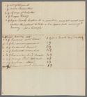
Survey of lot
m
Tract of land
m
Tract bordered by Maerschalk …
m
Tract of land
m
Stoughton's bitters and mixtu…
m
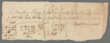
Settlement of dimensions
m
Samuel Pell's lots
m
Nicholas Depeyster
m
Description of Anne Depeyster…
m
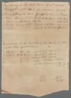
Mrs. Englehart's lots
m
Valuation of six lots
m
Englehart's given by Mr. Mill…
m
Waldron and Turner stone
m
Stephen Rich - his land at Ne…
m
Small tract of Bartow's at We…
Military topographical map of…
Military map of south-eastern…
Military map of south-eastern…
Patuxent River from Pt. Judit…
Military map of south-eastern…
Map of part of the Shenandoah…
Johnson's Virginia, Delaware,…
Colton's map of Virginia, Mar…
Geological and topographical …
A map of the state of Virgini…
Lloyd's official map of the s…
Preliminary sketch of Chincot…
Reconnaissance of the Pamunky…
Albemarle and Chesapeake Cana…
Preliminary sketch of Wachapr…
Reconnoissance of the entranc…
Map of eastern Virginia
Map of routes & distances to …
Cumberland coal region: shewi…
New sectional map of the stat…
Railway guide for Illinois : …
Long Island Sound (western sh…
Middle part of Long Island So…
New sectional map of the stat…
m
Topographical map of the Coun…
m
Map of Cook County, Illinois
Map of the town of Taunton: w…
Preliminary chart of Monomoy …
The harbor of Wood's Hole, Ma…
Preliminary chart of Plymouth…
Nashua River
Map of Marshfield, Mass.
Map of the town of Raynham, B…
Land given to the town of Qui…
Preliminary chart of Port Roy…
1
2
…
4
5
6
7
8
9
10
11
…
21
22
Previous
Next
1
2
…
4
5
6
7
8
9
10
11
…
21
22
Previous
Next