Click to visit the main New York Public Library Homepage
The New York Public Library
Digital Collections
About Digital Collections
Browse
Search only public domain materials
Items
Collections
Divisions
Home
Search
Browse
About
Search only public domain materials
Items
Collections
Divisions
Digital Collections
Using Images
Using Data
Search
Filtered search
Show filters
Hide filters
Show Only Public Domain
topic
History
118
Railroads
74
Real property
39
Landowners
38
Real propery auctions
32
More
Less
name
American Civil War (1861-1865)
29
United States. Army. Corps of Topographical Engineers
21
Breese, Samuel, 1802-1873
18
Morse, Sidney E. (Sidney Edwards), 1794-1871
18
Bien, Julius, 1826-1909
17
More
Less
collection
Maps of North America
335
Collection of broadside real estate maps announcing auctions of lots in early 19th century New York City
32
Atlases of the United States
31
Maps of New York City and State
23
The pictorial field-book of the War of 1812; or, Illustrations, by pen and pencil, of the history, biography, scenery, relics, and traditions of the last war for American independence
5
More
Less
place
x
United States
New York (State)
59
Virginia
46
New York
39
Manhattan (New York, N.Y.)
35
More
Less
genre
Maps
442
Cadastral maps
33
Illustrations
13
Topographic maps
13
Atlases
9
More
Less
publisher
S. E. Morse & co.,
18
publisher not identified
18
U.S. Geological Survey
11
Corps of Topographical Engineers
10
U.S. Light-House Board
10
More
Less
division
Map Division
421
Manuscripts and Archives Division
6
Rare Book Division
5
Schomburg Jean Blackwell Hutson Research and Reference Division
4
Schomburg Manuscripts, Archives and Rare Books Division
4
More
Less
type
x
cartographic
still image
10
text
8
Date Range
to
442 results found
Filtering on:
x
Date
: 1837 - 1924
x
Place
: United States
x
Type
: cartographic
Sort by:
Title
Date created
Date digitized
Sequence
Map of Camp Chase. Drawn on a…
Map illustrating the operatio…
Map and profile showing sourc…
Map of Proposed Belt Railways…
Preliminary Study for a Great…
Map showing relation of the I…
H4. Map (Scheme B) illustrati…
Siege of Fort Meigs
Detroit River and vicinity
Plan of the Tippecanoe camp a…
Plan of the Battle of Fallen …
Battle of the Thames
Map of the Gogebic Iron Range…
Map of the boundary line betw…
Phelps's national map of the …
m
United States
Skeleton map of the overland …
Map showing condition and pro…
Map of the frontiers of the n…
Map of free states, slave sta…
Map of the port & vicinity of…
Map of Texas and the countrie…
A.R. Roessler's latest map of…
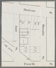
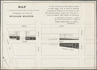
Horatio Street, Hudson Street…
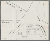
Gansevoort Street, 9th Avenue…
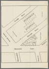
Jane Street, Eighth Avenue, T…
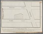
Thirteenth Street, Greenwich …
m
Hammond Street, Perry Street,…
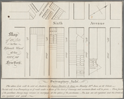
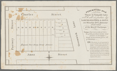
Peremptory sale these 15 valu…
Hudson Street, Horatio Street…
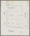
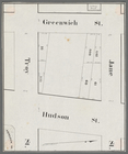
Greenwich Street, Troy Street…
m
Map of 19 lots in the fifteen…
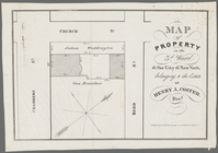
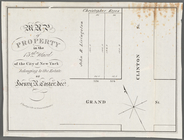
Map of property in the 9th wa…
13 lots of ground to be sold …
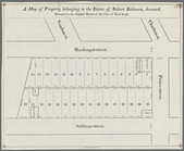
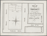
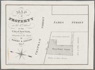
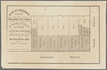
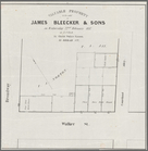
A map of property belonging t…
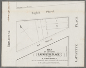
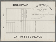
La Fayette Place map of lots …
Map of property in the eleven…
m
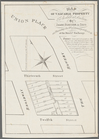
Map of valuable property to b…
m
Map of lots on Lafayette Plac…
m
Peremptory sale of lots, on T…
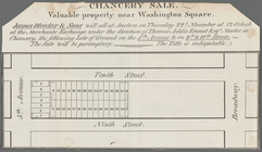
Chancery sale, valuable prope…
m
Map of a water grant between …
Map of property in the 7th Wa…
Map of property in the 4th Wa…
Map of property to be sold by…
Map of property in the 13th W…
Valuable property to be sold …
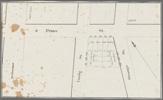
Broadway, Prince Street, Cros…
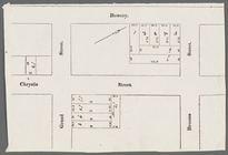
Bowery, Chrystie Street, Gran…
m
Map of property in the 3d War…
1
2
Previous
Next
1
2
Previous
Next