Click to visit the main New York Public Library Homepage
The New York Public Library
Digital Collections
About Digital Collections
Browse
Search only public domain materials
Items
Collections
Divisions
Home
Search
Browse
About
Search only public domain materials
Items
Collections
Divisions
Digital Collections
Using Images
Using Data
Search
Filtered search
Show filters
Hide filters
Show Only Public Domain
topic
Real property
4660
Fire insurance
3158
Cities & towns
3085
Administrative and political divisions
388
Railroads
341
More
Less
name
Sanborn Map Company
3085
Beers, F. W. (Frederick W.)
530
E. Robinson Co
238
Everts, Ensign & Everts
231
G.M. Hopkins & Co
223
More
Less
collection
Atlases of New York City
3757
Atlases of the United States
1826
Maps of North America
1016
Maps of New York City and State
479
Atlases, gazetteers, guidebooks and other books
27
More
Less
place
New York (State)
4888
New York
434
Brooklyn (New York, N.Y.)
307
New York (N.Y.)
274
New Jersey
205
More
Less
genre
Maps
7133
Atlases
1793
Cadastral maps
191
Prints
95
Plans
90
More
Less
publisher
Sanborn Map Company
3085
E. Robinson Co
191
F. W. Beers & Co
148
publisher not identified
136
G.M. Hopkins & Co
101
More
Less
division
Map Division
7124
Rare Book Division
22
General Research Division
19
Schomburg Jean Blackwell Hutson Research and Reference Division
17
Manuscripts and Archives Division
15
More
Less
type
x
cartographic
text
58
still image
55
Date Range
to
7,218 results found
Filtering on:
x
Date
: 1867 - 1889
x
Type
: cartographic
Sort by:
Title
Date created
Date digitized
Sequence
Results 1251 - 1300
Map of the reservoirs, feeder…
m
The Hudson by daylight: map s…
m
Map of New York and vicinity:…
Asher & Adams' new map of the…
m
Map of the Hudson River, show…
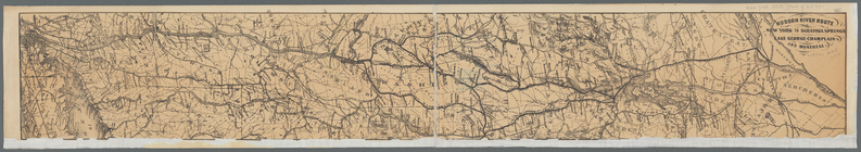
Hudson River route: New York …
[Map of the Hudson River] pre…
Route of the Albany & New Yor…
m
Preliminary post route map of…
m
Colton's railroad & commercia…
m
Map showing the locations of …
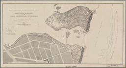
General plan for the improvem…
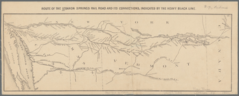
Route of the Lebanon Springs …
Rand McNally & Co.'s new rail…
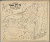
Map of the rail roads of the …
N.Y State Survey: triangulati…
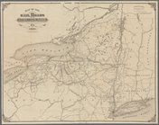
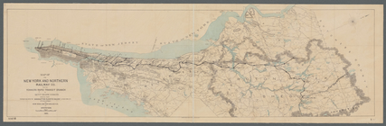
Map of the New York and North…
Coltons map of the New York w…
Colton's railroad & township …
Plan showing route of Rochest…
Map of the Adirondack wildern…
Map of the New York wildernes…
Map of the Adirondack wildern…
Map of the Adirondack wildern…
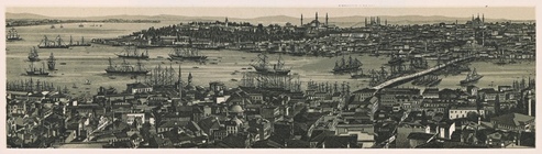
Constantinople, 1874.
Map of the United States and …
Map of the New York Wildernes…
Map of the New York Wildernes…
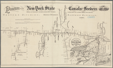
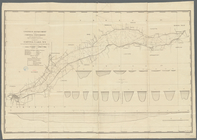
Profiles of the New York Stat…
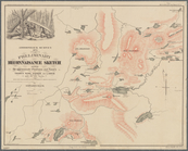
Specimen of preliminary recon…
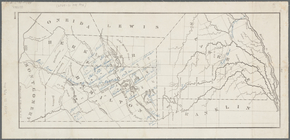
Map of Hamilton, St. Lawrence…
Asher & Adams' new map of the…
Cayuga Lake, N.Y. surveyed by…
Map of the New York wildernes…
Colton's map of the New York …
Map of the United States and …
Colton's Map of the New York …
Sketch showing contour lines …
Map of the New York wildernes…
Adirondack survey, sketch sho…
Adirondack survey, Sketch in …
Adirondack Survey, 1873, seco…
Map of the Catskill Mountains…
Map of the Catskill Mountains
m
Post route map of the State o…
Sketch of the triangulation o…
Sketch of the triangulation o…
Sketch of the triangulation o…
Revised map of the rail roads…
Map showing the Adirondack La…
1
2
3
4
5
6
7
8
9
10
…
28
29
Previous
Next
1
2
3
4
5
6
7
8
9
10
…
28
29
Previous
Next