Click to visit the main New York Public Library Homepage
The New York Public Library
Digital Collections
About Digital Collections
Browse
Search only public domain materials
Items
Collections
Divisions
Home
Search
Browse
About
Search only public domain materials
Items
Collections
Divisions
Digital Collections
Using Images
Using Data
Search
Filtered search
Show filters
Hide filters
Show Only Public Domain
topic
Real property
1377
Fire insurance
580
Cities & towns
578
History
121
Description and travel
112
More
Less
name
Sanborn Map Company
580
Ullitz, Hugo
341
E.B. Hyde & Co
278
E. Belcher Hyde Map Company
230
Bromley, George Washington
196
More
Less
collection
Atlases of New York City
1417
Atlases of the United States
414
Maps of North America
315
Maps of New York City and State
307
Spezialkarte der Osterreichisch-Ungarischen Monarchie
152
More
Less
place
New York (State)
1533
New York
661
Brooklyn (New York, N.Y.)
320
Manhattan (New York, N.Y.)
238
Bronx (New York, N.Y.)
217
More
Less
genre
x
Maps
Atlases
414
Topographic maps
205
Cadastral maps
65
Geological maps
25
More
Less
publisher
Sanborn Map Company
708
E. Belcher Hyde
230
G.W. Bromley & Co
195
K.u.K. Militargeographisches Institut
152
Century Map Company
111
More
Less
division
Map Division
2622
General Research Division
110
Manuscripts and Archives Division
44
Milstein Division
29
Schomburg Jean Blackwell Hutson Research and Reference Division
20
More
Less
type
x
cartographic
text
35
still image
16
Date Range
to
2,836 results found
Filtering on:
x
Date
: 1894 - 1905
x
Genre
: Maps
x
Type
: cartographic
Sort by:
Title
Date created
Date digitized
Sequence
m
Mapah derekh emet : Mapa Dere…
Zoological chart of the world…
m
Chart of the world exhibiting…
Records of searches in relati…
Map of the borough of Brookly…
m
Map of property belonging to …
Map of lots belonging to the …
Map of Brooklyn Manor
m
The Blanchard Press correctly…
Rand, McNally & Co.'s new aut…
Map and profile showing sourc…
Brooklyn
Rosedale Square, Rosedale : 4…
m
Rand, McNally & Co.'s complet…
m
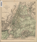
New York City and vicinity
Erie Railroad suburban lines
King's bird's-eye view of Bro…
Rand McNally standard map of …
Guide map to the Brooklyn and…
Map of the borough of Brookly…
Map of 272 lots in the 30th w…
The Brooklyn of the future : …
Map showing proposed extensio…
Map of Jamaica Fells : fourth…
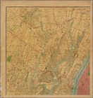
Map of the borough of Brookly…
m
King's birds-eye view of Broo…
Rand, McNally & Co.'s new han…
Map of New York City region a…
Rand McNally standard map of …
m
Map of New York City : showin…
Map of the City of New York :…
m
Sea Gate, New York Harbor
Map of Elmhurst Square : situ…
Center of New York, first cit…
m
Manhattan borough and part of…
m
Rand-McNally standard map of …
m
Map of New York : showing Leh…
The Matthews-Northrup up-to-d…
m
Map of the borough of Brookly…
Plan of Bay Ridge Parkway
Map of the enlarged city of B…
Map of the 23rd and 24th ward…
m
Map of the underground railwa…
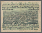
Jamaica, Long Island, N.Y
Bridgman's new map of the Cit…
m
Rand McNally & Co.'s road map…
Map showing the proposed area…
m
Map of the metropolitan distr…
Map of portion of greater New…
Map of the borough of Manhatt…
1
2
3
4
5
6
7
8
9
10
11
12
Previous
Next
1
2
3
4
5
6
7
8
9
10
11
12
Previous
Next