Click to visit the main New York Public Library Homepage
The New York Public Library
Digital Collections
About Digital Collections
Browse
Search only public domain materials
Items
Collections
Divisions
Home
Search
Browse
About
Search only public domain materials
Items
Collections
Divisions
Digital Collections
Using Images
Using Data
Search
Filtered keyword search
Show filters
Hide filters
Show Only Public Domain
topic
Landowners
24
Real property
18
Administrative and political divisions
13
Nautical charts
9
Railroads
8
More
Less
name
Smith, Robert Pearsall, 1827-1898
11
Gavit, John E., 1817-1874
10
French, J. H. (John Homer), 1824-1888
8
United States Coast Survey
7
Gillette, John E
6
More
Less
collection
x
Maps of New York City and State
place
New York (State)
61
New York (N.Y.)
16
Long Island (N.Y.)
7
Manhattan (New York, N.Y.)
7
Albany
5
More
Less
genre
x
Maps
Cadastral maps
15
Topographic maps
4
Nautical charts
3
Tourist maps
3
publisher
publisher not identified
8
J.H. French
3
Robert Pearsall Smith
3
U.S. Coast Survey office
3
Aqueduct Commission?
2
More
Less
division
Map Division
78
type
cartographic
77
still image
2
Date Range
to
78 results found for:
x
J. E
Filtering on:
x
Genre
: Maps
x
Collection
: Maps of New York City and State
For more collection details, visit the
Maps of New York City and State collection page
.
Sort by:
Relevance
Title
Date created
Date digitized
Sequence
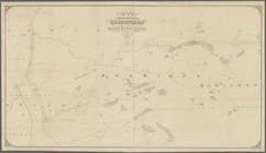
Map showing location of reser…
use:
Release Source File for Free (i.
e
., high-res
Northern coast of Long Island…
parent:
83
e
4b4b0-3010-0134-dc98-00505686a51c
m
… for
J
. Augustus Page, Esq. by William
E
parent:
6cea9
e
80-c5aa-012f-63d6-58d385a7bc34
Map of the flats above Albany
parent:
20
e
063d0-0968-0134-69c1-00505686a51c
Map of property belonging to Mrs. Caroline
E
use:
Release Source File for Free (i.
e
., high-res
Map of the Albany Rural Cemet…
use:
Release Source File for Free (i.
e
., high-res
Map of the Albany Rural Cemet…
use:
Release Source File for Free (i.
e
., high-res
Fort la Présentation anno 174…
use:
Release Source File for Free (i.
e
., high-res
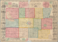
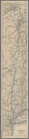
Map of the State of New-York:…
parent:
2f9bfc10-801d-0133-c6
e
4-00505686a51c
m
Map of Dutchess County, New-Y…
use:
Release Source File for Free (i.
e
., high-res
Long Island Sound from New Yo…
use:
Release Source File for Free (i.
e
., high-res
m
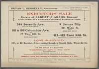
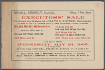
Executor's Sale Estate of Albert
J
. Adams
parent:
120ee310-132
e
-0131-ba85-58d385a7bbd0
m
… and Charles
J
. Snyder
parent:
c5
e
77850-32c0-0131-7038-58d385a7bbd0
Topographical map of Seneca C…
parent:
7cd226
e
0-
e
3
e
9-0133-1bf6-00505686a51c
m
Map of Genesee County, New Yo…
use:
Release Source File for Free (i.
e
., high-res
Map of Genesee County, New Yo…
use:
Release Source File for Free (i.
e
., high-res
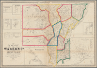
Map of Warren Co., New York
parent:
8863fea0-f05d-0133-8
e
9f-00505686a51c
[Map of the Hudson River] pre…
use:
Release Source File for Free (i.
e
., high-res
m
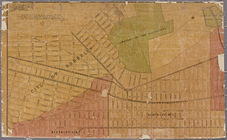
Map of the village of East Ne…
parent:
6cea9
e
80-c5aa-012f-63d6-58d385a7bc34
m
Gillette's map of Oneida Co.,…
parent:
c95b7480-04
e
8-0134-a412-00505686a51c
Map & profile of the Lake Ont…
use:
Release Source File for Free (i.
e
., high-res
Map of the Rutger's Farm as i…
parent:
6cea9
e
80-c5aa-012f-63d6-58d385a7bc34
Aqueduct Commissioners topogr…
parent:
41
e
8f680-b8ae-0133-32c6-00505686a51c
Aqueduct Commissioners topogr…
use:
Release Source File for Free (i.
e
., high-res
Survey for a ship canal aroun…
parent:
9f511b00-bedd-0133-3
e
87-00505686a51c
Western part of the southern …
parent:
f7188db0-d341-0133-92
e
4-00505686a51c
m
Eastern part of Long Island S…
parent:
45ed47
e
0-793c-0135-6bfd-47d71542dbac
Map of Richland, Oswego Co. N…
parent:
609
e
85
e
0-1601-0134-b00f-00505686a51c
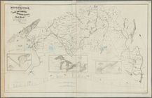
Land classification map, New …
parent:
f67242a0-bd63-0133-1f93-00505686d14
e
New York Harbor and entrance …
parent:
6cea9
e
80-c5aa-012f-63d6-58d385a7bc34
m
… & Tompkins Sts. on the
E
parent:
e
5c889f0-c5aa-012f-8c5c-58d385a7bc34
Long Island Sound (western sh…
use:
Release Source File for Free (i.
e
., high-res
Middle part of Long Island So…
use:
Release Source File for Free (i.
e
., high-res
Map of Essex Co., New York
parent:
ad3f69a0-
e
551-0133-c95c-00505686a51c
… / compiled by James
E
parent:
6cea9
e
80-c5aa-012f-63d6-58d385a7bc34
Atherton, St. Lawrence County…
parent:
afbcb460-1536-0134-9d8
e
-00505686a51c
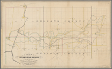
Map of Tonawanda Swamp in the…
use:
Release Source File for Free (i.
e
., high-res
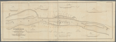
Map of the Hudson River near …
use:
Release Source File for Free (i.
e
., high-res
m
Map of Cayuga and Seneca Coun…
use:
Release Source File for Free (i.
e
., high-res
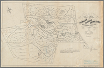
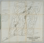
Albany Rural Cemetery
use:
Release Source File for Free (i.
e
., high-res
Map of the Genesee Valley Can…
parent:
9da00260-a298-0133-
e
45c-00505686d14
e
Map of New-York Bay and Harbo…
parent:
6cea9
e
80-c5aa-012f-63d6-58d385a7bc34
…. Perris, C.
E
. & Surveyor.
parent:
6cea9
e
80-c5aa-012f-63d6-58d385a7bc34
m
Map of Ontario County, New Yo…
use:
Release Source File for Free (i.
e
., high-res
Map of the head waters of the…
parent:
cbda2300-b956-0133-c1a1-00505686d14
e
m
Map of upper New York City an…
parent:
028b98b0-
e
54c-0133-2d90-00505686a51c
Map of the head waters of the…
parent:
ff3ad580-b954-0133-04a6-00505686d14
e
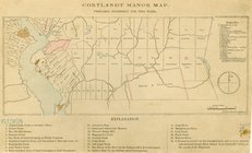
Cortlandt Manor map : prepare…
use:
Release Source File for Free (i.
e
., high-res
A map of a tract of land in t…
parent:
39bb7140-becc-0133-48c0-00505686d14
e
Map of the manors erected wit…
parent:
fb276800-1b8
e
-0134-951f-00505686a51c