Click to visit the main New York Public Library Homepage
The New York Public Library
Digital Collections
About Digital Collections
Browse
Search only public domain materials
Items
Collections
Divisions
Home
Search
Browse
About
Search only public domain materials
Items
Collections
Divisions
Digital Collections
Using Images
Using Data
Search
Filtered keyword search
Show filters
Hide filters
Show Only Public Domain
topic
History
199
Railroads
83
Real property
75
Landowners
73
Real propery auctions
67
More
Less
name
Colles, Christopher, 1738-1816
53
Tiebout, Cornelius, 1777-1832
53
Siegel, Michael
49
James Bleecker & Sons
34
American Civil War (1861-1865)
29
More
Less
collection
Maps of North America
455
Lawrence H. Slaughter Collection of English maps, charts, globes, books and atlases
144
Collection of broadside real estate maps announcing auctions of lots in early 19th century New York City
67
In motion : the African-American migration experience: Maps by Michael Siegel
49
Maps of New York City and State
34
More
Less
place
x
United States
New York (State)
110
New York
78
Middle Atlantic States
73
Manhattan (New York, N.Y.)
70
More
Less
genre
Maps
845
Illustrations
72
Cadastral maps
69
Charts
52
Graphs
49
More
Less
publisher
Rutgers Cartography
48
publisher not identified
28
Printed for J. Stockdale
26
S. E. Morse & co.,
18
M. Carey
17
More
Less
division
Map Division
740
Schomburg Jean Blackwell Hutson Research and Reference Division
56
Wallach Division: Picture Collection
22
Rare Book Division
20
Wallach Division: Print Collection
14
More
Less
type
cartographic
825
still image
59
text
25
notated music
1
Date Range
to
Looking for one of these collections?
Maps of North America
3,345 items
Lawrence H. Slaughter Collection of English maps, charts, globes, books and atlases
1,252 items
875 results found for:
x
map
Filtering on:
x
Place
: United States
Sort by:
Relevance
Title
Date created
Date digitized
Sequence
13 lots of ground to be sold …
collection:
Collection of broadside real estate
maps
1841, showing the dates of th…
note:
… to Early
Maps
of the Middle
m
3 three story brick houses in…
collection:
Collection of broadside real estate
maps
m
51 lots to be sold by R.R. Mi…
collection:
Collection of broadside real estate
maps
7th
map
to accompany Willard's History
note:
Inset
maps
: Charleston and vicinity
m
A chart of the harbour of Rho…
note:
NYPL
Map
Div. copy is divided into 2 sheets, 54
A description of part of the …
collection:
…. Also the
maps
A general
map
of North America : from
note:
Copy in
Map
Div. 97-6459: Lawrence H
A general
map
of the southern British colonies
note:
Mapping
the Nation (NEH grant, 2015-2018)…
m
A
map
of Cabotia
note:
Map
borders Include "longitude west of Greenwich."…
A
Map
of Carolana and of the River Meschacebe &c.
note:
Inset:
Map
of the mouth of the River
A
map
of Connecticut.
note:
… to Early
Maps
of the Middle
A
map
of Kentucky, drawn from actual
note:
… to Early
Maps
of the Middle
A
map
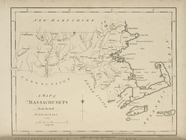
of Massachusets [sic] from
note:
… to Early
Maps
of the Middle
A
map
of Mexico, Louisiana, and the Missouri
note:
Mapping
the Nation (NEH grant, 2015-2018)…
A
map
of New England, New York, New
note:
… to Early
Maps
of the Middle
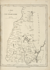
A
map
of New Hampshire.
note:
… to Early
Maps
of the Middle
A
map
of New Jersey …
note:
… to Early
Maps
of the Middle
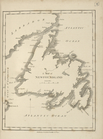
A
map
of Newfoundland.
note:
… to Early
Maps
of the Middle
A
map
of North Carolina, from the best
note:
… to Early
Maps
of the Middle
A
map
of part of Rhode Island shewing
note:
… of George Washington,
maps
A
map
of part of the N. W. Territory
note:
… top center of
map
indicates
map
meant
A
map
of Pennsylvania, from the best
note:
… to Early
Maps
of the Middle
A
map
of property belonging to the estate
A
map
of Rhode Island.
note:
… to Early
Maps
of the Middle
A
map
of South America and the adjacent
note:
… to Early
Maps
of the Middle
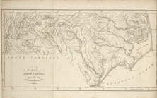
A
map
of South Carolina, from the best
note:
… to Early
Maps
of the Middle
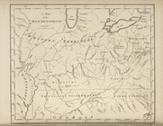
A
map
of the Back Settlements.
note:
… to Early
Maps
of the Middle
A
map
of the confluence of the Hudson
note:
Mapping
the Nation (NEH grant, 2015-2018)…
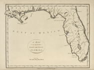
A
map
of the East and West Florida.
note:
… to Early
Maps
of the Middle
A
map
of the northern and middle states
note:
… to Early
Maps
of the Middle
A
map
of the State of New York.
note:
… to Early
Maps
of the Middle
A
map
of the states of Virginia, North Carolina
note:
… to Early
Maps
of the Middle
A
map
of the Tennessee Government, 1794.
note:
… to Early
Maps
of the Middle
A
map
of the United
A
map
of the United States and British
note:
… States, this
map
A
map
of the United States including
note:
Phillips.
Maps
of America, p. 879
A
Map
of the United States of America, 1830
note:
… to Early
Maps
of the Middle
A
map
of the United States of America
note:
… to Early
Maps
of the Middle
A
map
of the United States of America
note:
… to Early
Maps
of the Middle
A
map
of the United States of America
note:
Jolly, D.C.
Maps
of America in periodicals
A
map
of the United States of North America
note:
… to Early
Maps
of the Middle
A
map
of the United States.
note:
Phillips.
Maps
of America, p. 871
A
map
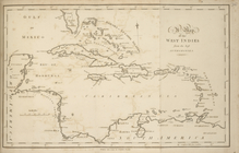
of the West Indies, from the best
note:
… to Early
Maps
of the Middle
A
map
of the White Mountains of New Hampshire
note:
Mapping
the Nation (NEH grant, 2015-2018)…
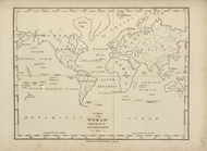
A
map
of the world, exhibiting all the new
note:
… to Early
Maps
of the Middle
A
map
of Vermont.
note:
… to Early
Maps
of the Middle
A new and accurate
map
of east and west
note:
NYPL
Map
Div. copy is pasted on sheet 31 x 36
A new and accurate
map
of the present
note:
Mapping
the Nation (NEH grant, 2015-2018)…
A new and accurate
map
of the present war
note:
Mapping
the Nation (NEH grant, 2015-2018)…
1
2
3
4
Previous
Next
1
2
3
4
Previous
Next