Click to visit the main New York Public Library Homepage
The New York Public Library
Digital Collections
About Digital Collections
Browse
Search only public domain materials
Items
Collections
Divisions
Home
Search
Browse
About
Search only public domain materials
Items
Collections
Divisions
Digital Collections
Using Images
Using Data
Collections
Charting America: Maps from the Lawrence H. Slaughter Collection and Others
Charting America: Maps from the Lawrence H. Slaughter Collection and Others
Navigation
Filters
Charting America: Maps from the Lawrence H. Slaughter Collection and Others
Previous
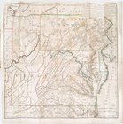
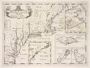
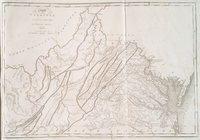
The south part of Virginia, now the north part of Carolina
0
Atlases, gazetteers, guidebooks and other books
377
Maps of the World
16
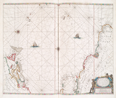
Maps of the Oceans
24
Maps of North and South America
23
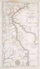
Maps of North America.
551
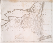
Maps of New York City and State
1340
Lawrence H. Slaughter Collection of English maps, charts, globes, books and atlases
1020
John H. Levine Collection
60
More
Show filters
Hide filters
Show Only Public Domain
topic
History
129
Road maps
53
Geography
42
Nautical charts
36
Colonies
21
More
Less
name
Montanus, Arnoldus, 1625?-1683
117
Ogilby, John, 1600-1676
116
Tiebout, Cornelius, 1777-1832
54
Colles, Christopher, 1738-1816
53
Morse, Jedidiah, 1761-1826
29
More
Less
collection
x
Lawrence H. Slaughter Collection of English maps, charts, globes, books and atlases
place
America
178
West Indies, British
116
North America
114
United States
109
Middle Atlantic States
62
More
Less
genre
Maps
536
Title pages
2
Facsimiles
1
Nautical charts
1
publisher
Printed by the author, and are to be had at his house
116
Printed for J. Stockdale
26
Presso Antonio Zatta
12
s.n
11
s.n.,
11
More
Less
division
Map Division
536
type
cartographic
435
still image
99
text
7
Date Range
to
538 results found for:
x
America?tab=filter
Filtering on:
x
Collection
: Lawrence H. Slaughter Collection of English maps, charts, globes, books and atlases
Sort by:
Relevance
Title
Date created
Date digitized
Sequence
The generall historie of Virg…
topic:
Indians of North
America
…
America
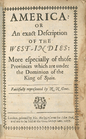
: from the first
…
America
, according
… of the United States of
America
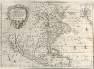
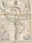
A new mapp of
America
Septentrionale
note:
Tooley. The mapping of
America
, p. 119
A new map of Virginia from th…
note:
Jolly, D.C. Maps of
America
in periodicals
America
: …
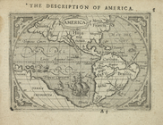
Americae
descrip.
America
North
America
: …
abstract:
Covers continent of North
America
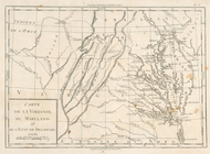
Carte de la Virginie, du Mary…
note:
Research catalog of maps of
America
to 1860
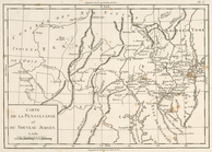
Carte de la Pensylvanie et du…
note:
Research catalog of maps of
America
to 1860
Carte de la Nouvelle York : y…
America
.
A map of Florida and ye Great…
note:
Covers eastern North
America
from
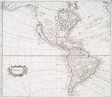
North
America
Part of North
America
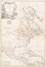
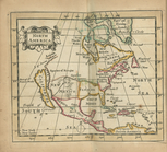
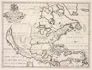
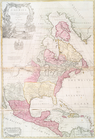
A new map of North
America
shewing its
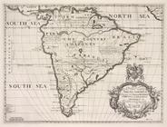
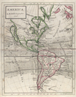
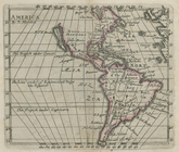
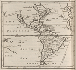
A new map of South Ameerica, …
collection:
South
America
.
… in
America
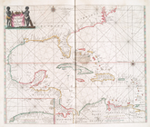
A general chart of the West I…
note:
… coast of South
America
.
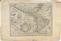
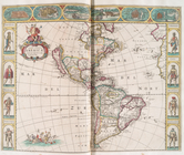
Nova totivs
Americæ
descriptio.
A chart of the West Indies fr…
m
North
America
: …
abstract:
… of North
America
m
North
America
divided into its
note:
…
America
is humbly
America
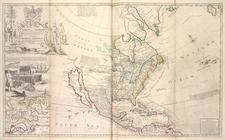
This map of North
America
, according to ye
m
… continent of North
America
note:
… part of North
America
m
A new map of the north parts of
America
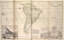
Map of South
America
...
A new & exact map of the coas…
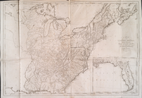
A map of the United States : …
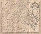
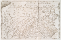
The state of Pennsylvania
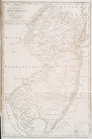
The state of New Jersey : com…
The state of New York : compi…
Delaware, from the best autho…
The state of Virginia : from …
Pascaerte vande Vlaemsche, So…
Pascaerte van Westindien : de…
note:
Covers coast of North
America
as far
America
.
note:
In upper right corner:
Tab
. 46.
m
A chart of the West Indias fr…
m
A chart of the West Indias fr…
America
The north west part of
America
note:
Covers northeastern North
America
, from
America
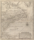
The English empire in
America
, Newfound-land
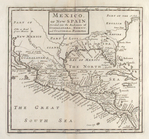
Mexico, or, New Spain : divid…
note:
Covers North
America
as far north
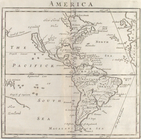
The United States of
America
America
.
note:
… description of
America
m
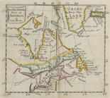
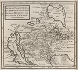
The isle of California, New M…
note:
Covers most of North
America
, but does
1
2
3
Previous
Next
1
2
3
Previous
Next