Click to visit the main New York Public Library Homepage
The New York Public Library
Digital Collections
About Digital Collections
Browse
Search only public domain materials
Items
Collections
Divisions
Home
Search
Browse
About
Search only public domain materials
Items
Collections
Divisions
Digital Collections
Using Images
Using Data
Search
Filtered keyword search
Show filters
Hide filters
Show Only Public Domain
topic
Real property
298
Administrative and political divisions
178
Nautical charts
127
History
121
Railroads
112
More
Less
name
E.B. Hyde & Co
204
United States Coast Survey
139
Bache, A. D. (Alexander Dallas), 1806-1867
121
Hyde, Merritt B
118
Ullitz, Hugo
86
More
Less
collection
Maps of North America
846
Atlases of New York City
247
Atlases of the United States
177
Maps of New York City and State
70
Lawrence H. Slaughter Collection of English maps, charts, globes, books and atlases
40
More
Less
place
New York (State)
270
New York
159
Virginia
142
Pennsylvania
139
Suffolk County (N.Y.)
121
More
Less
genre
Maps
1454
Atlases
177
Nautical charts
117
Bathymetric maps
90
Cadastral maps
86
More
Less
publisher
E. Belcher Hyde
191
publisher not identified
92
U.S. Coast Survey
76
Sanborn Map Company
51
U.S. Coast Survey Office
42
More
Less
division
Map Division
1399
Manuscripts and Archives Division
24
Rare Book Division
10
Wallach Division: Print Collection
7
Schomburg Jean Blackwell Hutson Research and Reference Division
5
More
Less
type
x
cartographic
still image
44
text
33
Date Range
to
1,456 results found for:
x
17
Filtering on:
x
Type
: cartographic
Sort by:
Relevance
Title
Date created
Date digitized
Sequence
Results 751 - 800
Woods' new map of Pittsburgh,…
Eastern United States, No. 6
m
A map of the Richmond & Alleg…
County and township map of Ut…
m
A New description of Carolina
A plan of Charles town
Map of Oneida County, Wiscons…
Lands of the Tremont Petroleu…
Map of Virginia and West Virg…
Sketch of the coast of North …
Washington Territory
South-Carolina and parts adja…
Map of North Carolina and Sou…
Plan of York Town in Virginia…
Pennsylvania : eastern part
A new map of Carolina
Map of the states of North & …
Albemarle and Chesapeake Cana…
Cincinnati : with Covington, …
County & township map of the …
m
A new description of Carolina
Map of eastern Virginia
Preliminary agricultural map …
abstract:
… Region [Map Div.
17
-5515].
Map of New York and vicinity
note:
Scale approximately 1:
17
,300.
Audience de Guadalajara, Nouv…
note:
Scale [ca. 1:
17
,500,000] (W 125°--W 97°/N
m
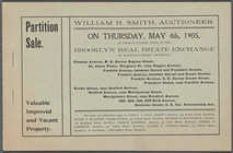
Partition Sale
Trans-Flat-Top Land Associati…
Wisconsin, a sectional map wi…
A new and accurate map of Nor…
Railroad map of Ohio
Reconnaissance of Hatteras In…
Map of eastern Virginia : com…
Geological map of Ohio, showi…
Sketch of the battle ground a…
Rand McNally & Co.'s North Da…
State of Arkansas
Sketch of the Atlantic coast …
State of Florida
Road map of the island of Rho…
City of Philadelphia
Map of Baker City, Oregon
m
A sketch of the operations be…
Brattleboro and vicinity : co…
State of Indiana
Map of the country upon the B…
Map of the city of Washington…
Map of the Rhode Island state…
Sketch F, showing the progres…
Sketch exhibiting the approac…
Map showing the Lehigh Valley…
1
2
3
4
5
6
Previous
Next
1
2
3
4
5
6
Previous
Next