Click to visit the main New York Public Library Homepage
The New York Public Library
Digital Collections
About Digital Collections
Browse
Search only public domain materials
Items
Collections
Divisions
Home
Search
Browse
About
Search only public domain materials
Items
Collections
Divisions
Digital Collections
Using Images
Using Data
Search
Filtered keyword search
Show filters
Hide filters
Show Only Public Domain
topic
Real property
298
Administrative and political divisions
178
Nautical charts
127
History
121
Railroads
112
More
Less
name
E.B. Hyde & Co
204
United States Coast Survey
139
Bache, A. D. (Alexander Dallas), 1806-1867
121
Hyde, Merritt B
118
Ullitz, Hugo
86
More
Less
collection
Maps of North America
846
Atlases of New York City
247
Atlases of the United States
177
Maps of New York City and State
70
Lawrence H. Slaughter Collection of English maps, charts, globes, books and atlases
40
More
Less
place
New York (State)
270
New York
159
Virginia
142
Pennsylvania
139
Suffolk County (N.Y.)
121
More
Less
genre
Maps
1454
Atlases
177
Nautical charts
117
Bathymetric maps
90
Cadastral maps
86
More
Less
publisher
E. Belcher Hyde
191
publisher not identified
92
U.S. Coast Survey
76
Sanborn Map Company
51
U.S. Coast Survey Office
42
More
Less
division
Map Division
1399
Manuscripts and Archives Division
24
Rare Book Division
10
Wallach Division: Print Collection
7
Schomburg Jean Blackwell Hutson Research and Reference Division
5
More
Less
type
x
cartographic
still image
44
text
33
Date Range
to
1,456 results found for:
x
17
Filtering on:
x
Type
: cartographic
Sort by:
Relevance
Title
Date created
Date digitized
Sequence
Results 251 - 300
…
17
provinces
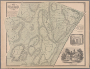
A map of the roads leading to…
Carte de la Nouvelle York : y…
A map of the Congo regions pu…
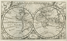
A new map of ye world
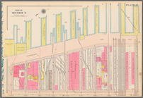
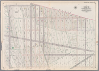
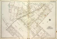
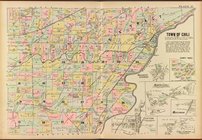
Plate 7: Bounded by Avenue A,…
collection:
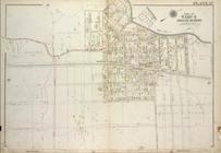
Part of Wards 11,
17
& 18, New York
Plate
17
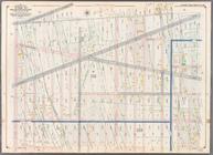
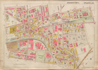
: Bounded by W. 64th Street
Plate 13: [Bounded by Calyer …
collection:
Plate 13: Part of Wards
17
& 18. Brooklyn
Plate
17
: Bounded by Bowery Bay Road, Shore
Plate
17
: Map of the Woodlawn Cemetery
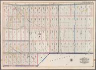
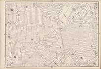
Bounded by Twelfth Avenue, 45…
collection:
….
17
. Volume 2
Bounded by Seventh Avenue, 60…
collection:
…. 3,
17
& 18, Volume 2
Bounded by Fifth Avenue, Stew…
collection:
….
17
, 18 & 19. Volume 2
Bounded by Eighteenth Avenue,…
parent:
48963a80-c5f9-012f-4b
17
-58d385a7bc34
Plate
17
: Map No. 314 [Bounded by St
Plate
17
: [Bounded by E. 149th St
Double Page Plate No.
17
, Part of Ward
m
Plate
17
, Part of Section 3: [Bounded
…., Nos. 15 and
17
Court
Plate
17
, Part of Ward 1 [Map bound
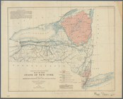
A sketch of the operations of…
note:
….
17
, 1777, by J. F. W
Plate
17
, Part of Ward 4 [Map bound
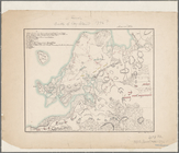
Map of Livingston Manor, 1714
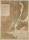
[Map of the Hudson River] pre…
… of Brooklyn. Sections
17
, 18
…, Section
17
; [Map bounded
…, Section
17
; [Map bounded
…, Section
17
; [Map bounded
…, Section
17
; [Map bounded
…, Section
17
; [Map bounded
…, Sections
17
, 18 & 19; [Map
…, Sections
17
& 19; [Map
…, Sections
17
& 19; [Map
Brooklyn, Vol. 7, Double Page Plate No.
17
… No.
17
[Map bounded
… No.
17
[Map bounded
Monroe County, Double Page Plate No.
17
Jersey City, V. 1, Double Page Plate No.
17
Height Zoning Map Section No.
17
Plan of the town of Boston an…
note:
…," vol.
17
, front. & p
Map of Brooklyn during the Ba…
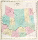
Map of the county of Montgome…
Map of the county of Montgome…
m
James H. Kelly's business map…
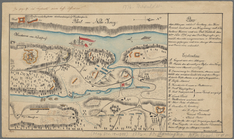
Plan der Attaque, welche Sr. …
To accompany Willard's histor…
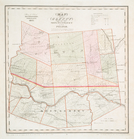
Map of the State of New York:…
note:
….
17
of series.
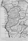
A new map of Virginia : from …
Regni Mexicani seu Novae Hisp…
note:
…, 96, plate
17
A map of that part of America…
1
2
3
4
5
6
Previous
Next
1
2
3
4
5
6
Previous
Next