


![Central Park : memorial of the Common Council of the City of New York to the Legislature, approved June 11th, 1853...[title page]](https://images.nypl.org/index.php?id=5190254&t=b)


- The Library Shop
- Privacy Policy
- Rules and Regulations
- Using the Internet
- Website Terms and Conditions
- Gifts of Materials to NYPL
-
© The New York Public Library, 2024
The New York Public Library is a 501(c)(3) | EIN 13-1887440
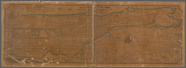
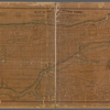
Lionel Pincus and Princess Firyal Map Division, The New York Public Library. "Map of the City of New York : north of 55th Street, showing on the "West Side" the streets, roads, avenues and public places established, widened and retained, and the pier and bulkhead lines &c. as laid out by the commsnrs of Central Park / compiled and drawn by Hamilton Ewen, City Surveyor." The New York Public Library Digital Collections. 1869. https://digitalcollections.nypl.org/items/d98aa1a0-084f-0131-1da7-58d385a7b928
Lionel Pincus and Princess Firyal Map Division, The New York Public Library. "Map of the City of New York : north of 55th Street, showing on the "West Side" the streets, roads, avenues and public places established, widened and retained, and the pier and bulkhead lines &c. as laid out by the commsnrs of Central Park / compiled and drawn by Hamilton Ewen, City Surveyor." New York Public Library Digital Collections. Accessed April 26, 2024. https://digitalcollections.nypl.org/items/d98aa1a0-084f-0131-1da7-58d385a7b928
Lionel Pincus and Princess Firyal Map Division, The New York Public Library. (1869). Map of the City of New York : north of 55th Street, showing on the "West Side" the streets, roads, avenues and public places established, widened and retained, and the pier and bulkhead lines &c. as laid out by the commsnrs of Central Park / compiled and drawn by Hamilton Ewen, City Surveyor. Retrieved from https://digitalcollections.nypl.org/items/d98aa1a0-084f-0131-1da7-58d385a7b928
<ref name=NYPL>{{cite web | url=https://digitalcollections.nypl.org/items/d98aa1a0-084f-0131-1da7-58d385a7b928 | title=
(cartographic)
Map of the City of New York : north of 55th Street, showing on the "West Side" the streets, roads, avenues and public places established, widened and retained, and the pier and bulkhead lines &c. as laid out by the commsnrs of Central Park / compiled and drawn by Hamilton Ewen, City Surveyor., (1869)|author=Digital Collections, The New York Public Library |accessdate=April 26, 2024 |publisher=The New York Public Library, Astor, Lenox, and Tilden Foundations}}</ref>