Click to visit the main New York Public Library Homepage
The New York Public Library
Digital Collections
About Digital Collections
Browse
Search only public domain materials
Items
Collections
Divisions
Home
Search
Browse
About
Search only public domain materials
Items
Collections
Divisions
Digital Collections
Using Images
Using Data
Search
Filtered search
Show filters
Hide filters
Show Only Public Domain
topic
Real property
8500
Fire insurance
5103
Cities & towns
4998
Maps
361
Railroads
274
More
Less
name
Sanborn Map Company
5093
G.W. Bromley & Co
2391
Bromley, George Washington
797
Bromley, Walter Scott
797
Austro-Hungarian Monarchy. Militärgeographisches Institut
763
More
Less
collection
Atlases of New York City
9621
Atlases of the United States
1621
Maps of New York City and State
847
Spezialkarte der Osterreichisch-Ungarischen Monarchie
763
Maps of North America
702
More
Less
place
New York (State)
9290
New York
3095
Manhattan (New York, N.Y.)
1853
New York (N.Y.)
1740
Brooklyn (New York, N.Y.)
733
More
Less
genre
Maps
13974
Atlases
1607
Topographic maps
977
Cadastral maps
197
Plans
111
More
Less
publisher
Sanborn Map Company
5129
G.W. Bromley & Co
2294
E. Belcher Hyde
780
K.u.K. Militargeographisches Institut
763
E. Robinson Co
249
More
Less
division
Map Division
13622
General Research Division
184
Manuscripts and Archives Division
82
Schomburg Jean Blackwell Hutson Research and Reference Division
71
George Arents Collection
51
More
Less
type
x
cartographic
text
281
still image
121
Date Range
to
14,082 results found
Filtering on:
x
Date
: 1887 - 1975
x
Type
: cartographic
Sort by:
Title
Date created
Date digitized
Sequence
Results 1501 - 1550
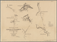
Plate III : Sketches of villa…
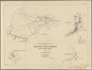
Plate II. Sketches of village…
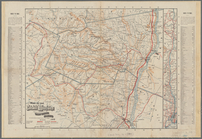
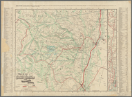
Map of the Catskill Mountains…
Map of the Catskill Mountains…
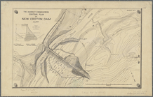
The Aqueduct Commissioners, N…
The Aqueduct Commissioners, c…
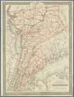
Colton's map of the county of…
Mineral spring resorts of the…
United States base map
Territorial groups of the Uni…
m
Map of lands belonging to the…
Map of historic Niagara: show…
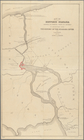
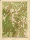
Aqueduct Commissioners topogr…
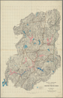
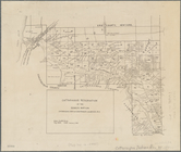
Land classification map, New …
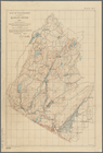
Map of watershed of Ramapo Ri…
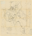
Map of Shelter Island showin…
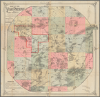
Lake Pleasant, - C.H. formerl…
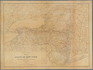
Map of the State of New York …
L.A.W. road maps of New York …
Geological map of a part of s…
Rand, McNally & Co.'s New York
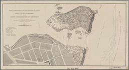
General plan for the improvem…
m
Colton's road map of Long Isl…
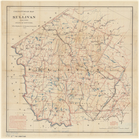
Colton's Road map of Sullivan…
m
Weather map, January 9, 1886:…
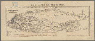
Long Island for the summer
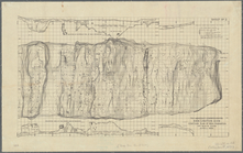
The second section of the sur…
m
Niagara 1819
Cattaraugus Reservation of th…
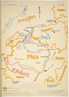
Map of Pfalz
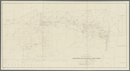
N.Y State Survey: triangulati…
m
Map of the Adirondack Forest …
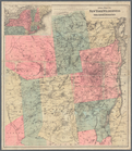
Colton's map of the New York …
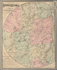
Map of the Adirondack wildern…
Map of the Vilas Preserve and…
Map no. I, New Netherland
m
Atlas of the illustrated buil…
m
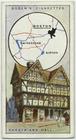
Shodfriars Hall.
m
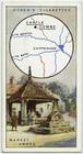
Market cross & stocks, Bottes…
m
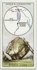
Bowderstone.
m
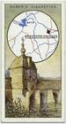
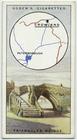
Old bridge & chapel.
m
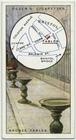
Bronze tables.
m
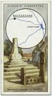
Market cross.
m
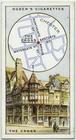
The cross.
m
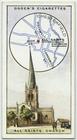
All Saints Church.
m
Wool market.
m
Triangular bridge.
m
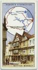
Butter market.
m
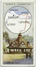
Yarn market.
m
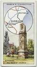
Buttress, All Saints Church.
1
2
…
4
5
6
7
8
9
10
11
…
56
57
Previous
Next
1
2
…
4
5
6
7
8
9
10
11
…
56
57
Previous
Next