Click to visit the main New York Public Library Homepage
The New York Public Library
Digital Collections
About Digital Collections
Browse
Search only public domain materials
Items
Collections
Divisions
Home
Search
Browse
About
Search only public domain materials
Items
Collections
Divisions
Digital Collections
Using Images
Using Data
Search
Filtered keyword search
Show filters
Hide filters
Show Only Public Domain
topic
History
199
Railroads
83
Real property
75
Landowners
73
Real propery auctions
67
More
Less
name
Colles, Christopher, 1738-1816
53
Tiebout, Cornelius, 1777-1832
53
Siegel, Michael
49
James Bleecker & Sons
34
American Civil War (1861-1865)
29
More
Less
collection
Maps of North America
455
Lawrence H. Slaughter Collection of English maps, charts, globes, books and atlases
144
Collection of broadside real estate maps announcing auctions of lots in early 19th century New York City
67
In motion : the African-American migration experience: Maps by Michael Siegel
49
Maps of New York City and State
34
More
Less
place
x
United States
New York (State)
110
New York
78
Middle Atlantic States
73
Manhattan (New York, N.Y.)
70
More
Less
genre
Maps
845
Illustrations
72
Cadastral maps
69
Charts
52
Graphs
49
More
Less
publisher
Rutgers Cartography
48
publisher not identified
28
Printed for J. Stockdale
26
S. E. Morse & co.,
18
M. Carey
17
More
Less
division
Map Division
740
Schomburg Jean Blackwell Hutson Research and Reference Division
56
Wallach Division: Picture Collection
22
Rare Book Division
20
Wallach Division: Print Collection
14
More
Less
type
cartographic
825
still image
59
text
25
notated music
1
Date Range
to
Looking for one of these collections?
Maps of North America
3,345 items
Lawrence H. Slaughter Collection of English maps, charts, globes, books and atlases
1,252 items
875 results found for:
x
map
Filtering on:
x
Place
: United States
Sort by:
Relevance
Title
Date created
Date digitized
Sequence
Map
of Camp Chase. Drawn on a scale of 120
Map
illustrating the operations of the U.S
note:
Key to
map
symbols for branch supply depots
Map
and profile showing sources of
Map
of Virginia, Maryland and Delaware …
note:
… to Early
Maps
of the Middle
A
map
of New Jersey …
note:
… to Early
Maps
of the Middle
Carson and Godey returning fr…
note:
… ; ... with
maps
and colored plates.
On the Road: map, itinerary, …
Hitch-hiking trip July - Oct.…
Map
of the American Coast, from Lynhaven Bay
Pennsylvania - Paoli, Chester…
note:
…]. Title from back of
map
.
Proposed Metropolitan Freight…
Map
of Proposed Belt Railways
Preliminary Study for a Great…
Map
showing relation of the Inter
collection:
Map
showing relation
H4.
Map
(Scheme B) illustrating freight situation
Siege of Fort Meigs
Detroit River and vicinity
Plan of the Tippecanoe camp a…
Plan of the Battle of Fallen …
Battle of the Thames
m
Afro American travel
map
A new
map
of North America from the latest
A plan of Captain Carvers tra…
British possessions in North …
topic:
Maps
in education
m
Smith's tourist guide of nece…
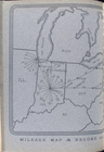
Mileage
map
& record of [the Premier
Map
of the Gogebic Iron Range …
note:
… catalog of the
Map
Map
of the boundary line between the states
note:
Mapping
the Nation (NEH grant, 2015-2018)…
Map
of the boundary lines between the United
note:
NYPL
Map
Div. copy
Phelps's national
map
of the United
note:
… of Florida --
Map
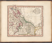
of Oregon
Map
of the western states to illustrate
note:
Mapping
the Nation (NEH grant, 2015-2018
To accompany Willard's histor…
note:
NYPL
Map
Div. copy has accession no
m
United States
note:
Mapping
the Nation (NEH grant, 2015-2018)…
Skeleton
map
of the overland mail route
note:
Mapping
the Nation (NEH grant, 2015-2018)…
Map
showing condition and progress
note:
Mapping
the Nation (NEH grant, 2015-2018)…
Map
of the frontiers of the northern
note:
…"Corrected and improved from Evans
map
Sketch of the action on the h…
note:
Map
of Charlestown peninsula showing
Map
of free states, slave states
m
With the 114th in the ETO: A …
m
United States of Nth. America
note:
… to Early
Maps
of the Middle
Map
of the port & vicinity of New York
Map
of Texas and the countries adjacent
note:
Wheat, C.I.
Mapping
the transmississippi West. vol. 2, no
A.R. Roessler's latest
map
of the state
note:
… catalog of the
Map
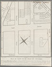
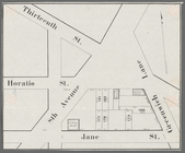
Horatio Street, Hudson Street…
collection:
Collection of broadside real estate
maps
These lots will positively be…
collection:
Collection of broadside real estate
maps
Gansevoort Street, 9th Avenue…
collection:
Collection of broadside real estate
maps
Jane Street, Eighth Avenue, T…
collection:
Collection of broadside real estate
maps
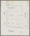
Thirteenth Street, Greenwich …
collection:
Collection of broadside real estate
maps
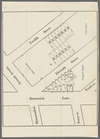
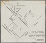
m
Map
of lots to be sold at auction
m
Hammond Street, Perry Street,…
collection:
Collection of broadside real estate
maps
1
2
3
4
Previous
Next
1
2
3
4
Previous
Next