Click to visit the main New York Public Library Homepage
The New York Public Library
Digital Collections
About Digital Collections
Browse
Search only public domain materials
Items
Collections
Divisions
Home
Search
Browse
About
Search only public domain materials
Items
Collections
Divisions
Digital Collections
Using Images
Using Data
Search
Filtered keyword search
Show filters
Hide filters
Show Only Public Domain
topic
History
199
Railroads
83
Real property
75
Landowners
73
Real propery auctions
67
More
Less
name
Colles, Christopher, 1738-1816
53
Tiebout, Cornelius, 1777-1832
53
Siegel, Michael
49
James Bleecker & Sons
34
American Civil War (1861-1865)
29
More
Less
collection
Maps of North America
455
Lawrence H. Slaughter Collection of English maps, charts, globes, books and atlases
144
Collection of broadside real estate maps announcing auctions of lots in early 19th century New York City
67
In motion : the African-American migration experience: Maps by Michael Siegel
49
Maps of New York City and State
34
More
Less
place
x
United States
New York (State)
110
New York
78
Middle Atlantic States
73
Manhattan (New York, N.Y.)
70
More
Less
genre
Maps
845
Illustrations
72
Cadastral maps
69
Charts
52
Graphs
49
More
Less
publisher
Rutgers Cartography
48
publisher not identified
28
Printed for J. Stockdale
26
S. E. Morse & co.,
18
M. Carey
17
More
Less
division
Map Division
740
Schomburg Jean Blackwell Hutson Research and Reference Division
56
Wallach Division: Picture Collection
22
Rare Book Division
20
Wallach Division: Print Collection
14
More
Less
type
cartographic
825
still image
59
text
25
notated music
1
Date Range
to
Looking for one of these collections?
Maps of North America
3,345 items
Lawrence H. Slaughter Collection of English maps, charts, globes, books and atlases
1,252 items
875 results found for:
x
map
Filtering on:
x
Place
: United States
Sort by:
Relevance
Title
Date created
Date digitized
Sequence
m
Voyage to a thousand cares: m…
m
Atlas of the illustrated buil…
m
With the 114th in the ETO: A …
m
Smith's tourist guide of nece…
Title page
collection:
…. Also the
maps
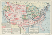
Map
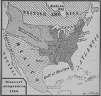
of free states, slave states
Diagr. V ; Missouri compromis…
Status of slavery in the Unit…
Pennsylvania - Paoli, Chester…
note:
…]. Title from back of
map
.
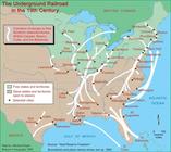
Map
of the United States and Canada shewing
Underground Railroad 19th Cen…
collection:
… experience:
Maps
by Michael
A new
map
of North America from the latest
Map
of the American Coast, from Lynhaven Bay
Carson and Godey returning fr…
note:
… ; ... with
maps
and colored plates.
Plan of the Battle of Fallen …
Florida.
image:
ps_
map
_174
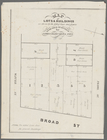
Map
of lots & buildings as shewn
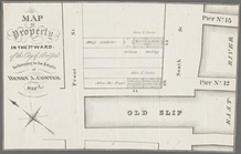
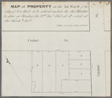
Map
of property in the 1st ward of the city
m
…. Grant reading
map
over
m
…. Grant reading
map
over
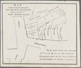
Map
of three lots of land in the first ward
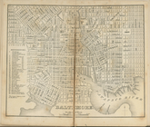
Baltimore.
note:
… to Early
Maps
of the Middle
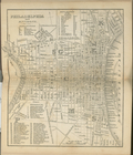
Philadelphia and environs.
note:
… to Early
Maps
of the Middle
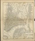
New-York.
note:
… to Early
Maps
of the Middle
Map
of property in the 1st ward of the city
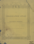
The cerographic atlas of the …
note:
Issued in parts;
maps
dated 1841-1845.
verso title page
note:
Issued in parts;
maps
dated 1841-1845.
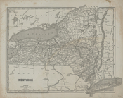
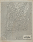
New York
note:
Issued in parts;
maps
dated 1841-1845.
City of New York, 1843.
note:
Issued in parts;
maps
dated 1841-1845.
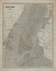
New York and vicinity.
note:
Issued in parts;
maps
dated 1841-1845.
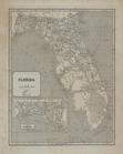
Florida.
note:
Issued in parts;
maps
dated 1841-1845.
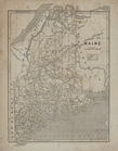
Maine.
note:
Issued in parts;
maps
dated 1841-1845.
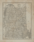
Vermont and New Hampshire.
note:
Issued in parts;
maps
dated 1841-1845.
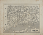
Connecticut.
note:
Issued in parts;
maps
dated 1841-1845.
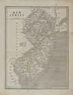
New Jersey.
note:
Issued in parts;
maps
dated 1841-1845.
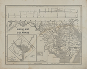
Maryland and Delaware.
note:
Issued in parts;
maps
dated 1841-1845.
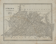
Virginia
note:
Issued in parts;
maps
dated 1841-1845.
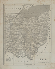
Ohio.
note:
Issued in parts;
maps
dated 1841-1845.
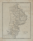
Iowa.
note:
Issued in parts;
maps
dated 1841-1845.
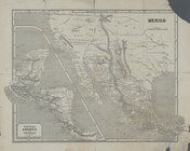
Map
of the Indian Territory, Northern Texas
note:
Issued in parts;
maps
dated 1841-1845.
Central America and Yucatan (…
note:
Issued in parts;
maps
dated 1841-1845.
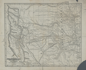
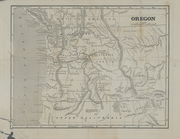
Oregon.
note:
Issued in parts;
maps
dated 1841-1845.
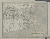
Massachusetts and Rhode Islan…
note:
Issued in parts;
maps
dated 1841-1845.
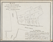
Map
of five lots of land in the first ward
Map
of property in the 2nd ward of the city
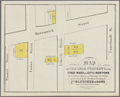
Map
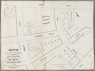
of valuable property in the First Ward
Valuable property to be sold …
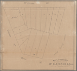
collection:
Collection of broadside real estate
maps
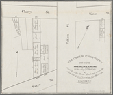
Map
of property to be sold at auction by Jas
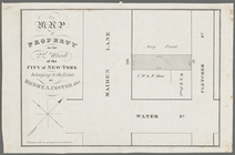
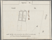
Lot no. 78 to be sold at the …
collection:
Collection of broadside real estate
maps
Map
of valuable property in the 1st Ward
1
2
3
4
Previous
Next
1
2
3
4
Previous
Next