Click to visit the main New York Public Library Homepage
The New York Public Library
Digital Collections
About Digital Collections
Browse
Search only public domain materials
Items
Collections
Divisions
Home
Search
Browse
About
Search only public domain materials
Items
Collections
Divisions
Digital Collections
Using Images
Using Data
Search
Filtered keyword search
Show filters
Hide filters
Show Only Public Domain
topic
Real property
10812
Fire insurance
5289
Cities & towns
5001
Administrative and political divisions
906
Railroads
784
More
Less
name
Sanborn Map Company
5093
G.W. Bromley & Co
2471
Bromley, George Washington
797
Bromley, Walter Scott
797
Austro-Hungarian Monarchy. Militärgeographisches Institut
773
More
Less
collection
Atlases of New York City
10577
Atlases of the United States
3749
Maps of North America
3345
Maps of New York City and State
2046
Lawrence H. Slaughter Collection of English maps, charts, globes, books and atlases
1101
More
Less
place
New York (State)
12155
New York
3979
New York (N.Y.)
2427
Manhattan (New York, N.Y.)
2373
Brooklyn (New York, N.Y.)
1166
More
Less
genre
Maps
24593
Atlases
3680
Topographic maps
1062
Surveys
1032
land surveys
849
More
Less
publisher
Sanborn Map Company
5129
G.W. Bromley & Co
2294
E. Belcher Hyde
780
K.u.K. Militargeographisches Institut
773
publisher not identified
452
More
Less
division
Map Division
22270
Manuscripts and Archives Division
1082
General Research Division
510
Rare Book Division
337
Schomburg Jean Blackwell Hutson Research and Reference Division
195
More
Less
type
x
cartographic
text
656
still image
329
three dimensional object
12
Date Range
to
Looking for one of these collections?
Atlases of New York City
11,722 items
Atlases of the United States
3,868 items
Maps of North America
3,345 items
Maps of New York City and State
2,059 items
Lawrence H. Slaughter Collection of English maps, charts, globes, books and atlases
1,252 items
Bancker plans
1,080 items
24,955 results found for:
x
New York
Filtering on:
x
Type
: cartographic
Sort by:
Relevance
Title
Date created
Date digitized
Sequence
Rand McNally Map of Brooklyn
use:
… partner (e.g.,
New
York
m
Map of the borough of Brooklyn,
New
York
…
use:
… partner (e.g.,
New
York
m
Hammond's complete map of Bro…
use:
… partner (e.g.,
New
York
… History,
New
York
City
use:
… partner (e.g.,
New
York
Map of the borough of Brookly…
use:
… partner (e.g.,
New
York
Hagstrom's map of ...
New
York
house-number
use:
… partner (e.g.,
New
York
Street guide of Brooklyn : wi…
use:
… partner (e.g.,
New
York
… population of
New
York
use:
… partner (e.g.,
New
York
…,
New
York
City
use:
… partner (e.g.,
New
York
…,
New
York
City
use:
… partner (e.g.,
New
York
m
Topographical map of
New
York
City, county
use:
… partner (e.g.,
New
York
Map of Brooklyn
use:
… partner (e.g.,
New
York
m
Hammond's complete map of Bro…
use:
… partner (e.g.,
New
York
m
Map of the borough of Brooklyn, City of
New
York
use:
… partner (e.g.,
New
York
Map of the City of
New
York
/ prepared
use:
… partner (e.g.,
New
York
Guide map to the Brooklyn and…
use:
… partner (e.g.,
New
York
Rand, McNally & Co.'s
new
handy map
use:
… partner (e.g.,
New
York
m
New
quick reference street indexed map
use:
… partner (e.g.,
New
York
Map of property
New
York
Dock Company
use:
… partner (e.g.,
New
York
Rand McNally & Co.'s
new
handy map
use:
… partner (e.g.,
New
York
m
Guide-map of
New
York
City
use:
… partner (e.g.,
New
York
m
Higginson's plan of the city …
use:
… partner (e.g.,
New
York
Map showing proposed extensio…
use:
… partner (e.g.,
New
York
m
Hagstrom's map of Brooklyn (
New
York
City) …
use:
… partner (e.g.,
New
York
m
Map of the borough of Brooklyn,
New
York
…
use:
… partner (e.g.,
New
York
Broadway, Prince Street, Cros…
use:
… partner (e.g.,
New
York
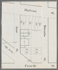
Hudson Street, Horatio Street…
use:
… partner (e.g.,
New
York
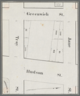
Greenwich Street, Troy Street…
use:
… partner (e.g.,
New
York
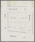
Horatio Street, Hudson Street…
use:
… partner (e.g.,
New
York
Gansevoort Street, 9th Avenue…
use:
… partner (e.g.,
New
York
Jane Street, Eighth Avenue, T…
use:
… partner (e.g.,
New
York
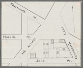
Thirteenth Street, Greenwich …
use:
… partner (e.g.,
New
York
Brooklyn
use:
… partner (e.g.,
New
York
Map of the borough of Brooklyn, City of
New
York
use:
… partner (e.g.,
New
York
Industrial map of
New
York
City
use:
… partner (e.g.,
New
York
Bowery, Chrystie Street, Gran…
use:
… partner (e.g.,
New
York
… of the city of
New
York
use:
… partner (e.g.,
New
York
Map of
New
York
City
use:
… partner (e.g.,
New
York
… of
New
York
City
use:
… partner (e.g.,
New
York
m
Map of the borough of Queens, City of
New
York
…
use:
… partner (e.g.,
New
York
Map of the City of
New
York
and vicinity
use:
… partner (e.g.,
New
York
The Brooklyn of the future : …
use:
… partner (e.g.,
New
York
Maps of the city of
New
-
York
use:
… partner (e.g.,
New
York
….'s
new
handy map of
New
York
City
use:
… partner (e.g.,
New
York
m
Map of
New
York
City : showing portions
use:
… partner (e.g.,
New
York
m
Map of
New
York
City : showing portions
use:
… partner (e.g.,
New
York
Map of Flatbush Meadows : sit…
use:
… partner (e.g.,
New
York
m
…, to and from the City of
New
York
: and adjacent
use:
… partner (e.g.,
New
York
m
The Wanamaker diary map of
New
York
use:
… partner (e.g.,
New
York
Map of
New
York
City
use:
… partner (e.g.,
New
York
1
2
3
4
5
6
7
8
9
10
…
99
100
Previous
Next
1
2
3
4
5
6
7
8
9
10
…
99
100
Previous
Next